
Indonesia Volcano Eruptions Disrupt More Than 300,000 Passengers as Five Mountains Remain on Alert Amid Natural Disasters
Mount Anak Krakatau in Indonesia erupted this week, sending volcanic ash high into the sky, forcing the temporary closure of eight airports including Jakarta's Soekarno-Hatta, and disrupting more than 300,000 passengers on flights amid natural disasters. [1]
Current Eruption of Anak Krakatau
The main hazard from the current eruption is via airborne ash, which is made of tiny, abrasive fragments of volcanic rock. [1] It is hazardous to inhale and can irritate eyes and skin. [1] It can also scratch the windshields of aircraft, rendering it difficult for pilots to see. [1] It can cause aircraft engines to stall. [1] Anak Krakatau, meaning “child of Krakatau” in Indonesian, has erupted on and off for almost a hundred years. [1] This volcano emerged from the devastation caused when its predecessor, Krakatau, famously erupted between May and August in 1883. [1] The Volcanology and Geological Hazard Mitigation Center recorded a new Strombolian eruption at 7:49 a.m. Tuesday, with a maximum amplitude of 48 millimeters and duration of 19 seconds. [4] Indonesia’s Mount Anak Krakatau has erupted again this week, sending plumes of volcanic ash high into the sky. [1] According to Indonesia’s National Disaster Management Agency, it does not currently have the potential to collapse on a scale that could trigger a tsunami. [1] In 2018 a large eruption caused collapse of most of the existing around 300 metre high edifice and produced a deadly tsunami that killed more than 400 people. [1] Since then, the volcano has remained relatively small. [1] The Meteorology, Climatology and Geophysics Agency has urged anyone affected to remain calm and seek information from government authorities. [1]
Impact on Air Travel
Indonesia's Meteorology, Climatology, and Geophysics Agency confirmed that eight airports earlier closed due to the Anak Krakatau eruption are now safe from volcanic ash. [5] The paper test results at 6 a.m. showed negative results for volcanic ash exposure at the eight airports that were previously closed. [5] As the airports were found safe from volcanic ash, air traffic operator AirNav Indonesia issued a Notice to Airmen announcing the gradual reopening of the airports on Tuesday morning. [5] Soekarno Hatta International Airport in Tangerang resumed operation at 12:30 a.m. local time, while Halim Perdanakusuma Airport in Jakarta reopened at 12:40 a.m., and Husein Sastranegara Airport in Bandung commenced service at 12:42 a.m. [5] Meanwhile, Budiarto Airport in Tangerang reopened at 1:25 a.m., and Pondok Cabe Airport in South Tangerang resumed operation at 1:28 a.m. [5] In the southern part of Sumatra, Taufiq Kiemas Airport in Pesisir Barat District was reopened at 9:31 a.m., and Radin Inten II Airport in Lampung resumed operation at 9:45 a.m. [5] The airport closest to Anak Krakatau, Salakanegara Airport in Banten's Tanjung Lesung region, was declared safe and was reopened at 9:50 a.m. [5] Some Hong Kong employment and travel companies have warned that air traffic in Jakarta could continue to face disruptions even after the Indonesian capital’s international airport reopened following a volcanic eruption that spewed ash into the sky, as airlines work through a backlog. [3] GLC (Manado) Employment Service founder and director Chu Shek-yin told the South China Morning Post that he would not rush to book an air ticket for his client’s helper despite the resumption of operations at all eight airports in Indonesia on Tuesday. [3]

Mount Anak Krakatau erupts sending ash plume into the sky as one of five Indonesian volcanoes on alert. — Source: gdelt
Status of Other Active Volcanoes
Five Indonesian volcanoes are currently at alert level with ongoing eruptions or activity: Anak Krakatau, Semeru, Lewotobi Laki-laki, Sinabung and Merapi, each generating earthquakes and prompting exclusion zones ranging from 3 km to 13 km. [2] For Anak Krakatau the mountain was covered in fog with no crater smoke observed. [2] Weather was cloudy, wind weak to moderate toward the northwest. [2] Air temperature around 26-26.3°C. [2] Humidity 82-84%. [2] One eruption earthquake, one low frequency earthquake, one hybrid earthquake and continuous tremor were recorded. [2] Residents and visitors are advised not to approach Anak Krakatau or conduct activities within a 3 km radius of the active crater. [2] For Lewotobi Laki-laki the mountain was covered in fog with no crater smoke observed. [2] Weather was cloudy to rainy, wind weak toward the west and northwest. [2] Air temperature around 21-23°C. [2] One blast earthquake, three non-harmonic tremor earthquakes and 15 distant tectonic earthquakes were recorded. [2] Residents around Lewotobi Laki-laki and visitors are advised not to conduct any activities within a 5 km radius from the center of the eruption. [2] For Merapi the mountain was covered in fog with no crater smoke observed. [2] Weather was overcast, wind calm toward the east. [2] Air temperature around 16.3-18.5°C. [2] Humidity 98.9-100%. [2] Sixteen collapse earthquakes and 14 hybrid earthquakes were recorded. [2] Potential hazards include lava avalanches and hot clouds on the south-southwest sector up to 7 km and on the southeast sector up to 5 km. [2] For Semeru the mountain was covered in fog with no crater smoke observed. [2] Weather was cloudy to overcast, wind weak toward the north and northeast. [2] Air temperature around 20-21°C. [2] Twenty-nine eruption earthquakes and four collapse earthquakes were recorded. [2] Residents are advised not to conduct activities in the southeast sector along Besuk Kobokan up to 13 km from the peak. [2] For Sinabung the mountain was visible to covered in fog. [2] White crater smoke with moderate to thick intensity around 200-300 meters from the peak was observed. [2] One blast earthquake and two deep volcanic earthquakes were recorded. [2] Residents and visitors are advised not to conduct activities in relocated villages and within a 3 km radial radius from the peak. [2]
Tsunami Risk Assessment
The Meteorology, Climatology and Geophysics Agency said on Tuesday that Mount Anak Krakatau’s eruption had not caused sea-level anomalies or indicated a tsunami in the Sunda Strait. [4] Twenty tsunami gauges and HF radar arrays in Carita and Tanjung Lesung indicated a tsunami probability below 50 percent. [4] Monitoring had detected no abnormal sea-level rise or significant changes in surface-current patterns that could indicate a tsunami. [4] Wave heights in the Sunda Strait remained stable at 0.5 to three meters. [4] Weather was expected to be sunny to partly cloudy through Sept. 13. [4]
Historical Context of Krakatau
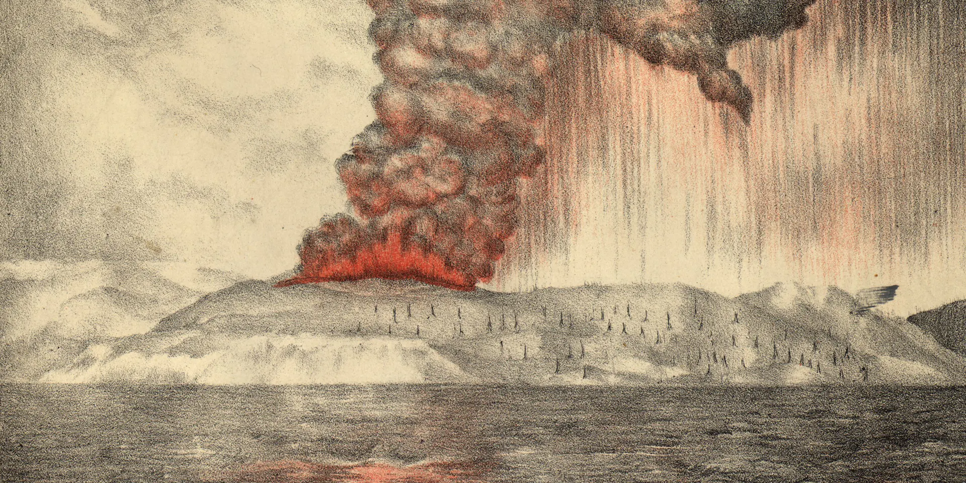
The 1883 Krakatau eruption was one of history's largest, killing around 35,000 mostly through tsunamis, producing the loudest sound ever recorded, and causing global effects including blue moons, green sunsets and a 0.3°C temperature drop for years. [1] Most volcanoes sit at the edges of Earth’s tectonic plates. [1] Krakatau sits above what’s called a subduction zone, where the Indo-Australian plate is forced beneath the Eurasian plate. [1] This produces molten rock with a lot of gas dissolved in it, which helps explain why Indonesian volcanoes can erupt so explosively. [1] In Australia, strange rumbling sounds were reported in August in Western Australia and the Northern Territory, around 3,000 kilometres from Krakatau. [1] Tsunamis generated by the eruption reached coastlines around Australia and New Zealand around the same time, with wave heights of more than two metres reported at several Australian locations. [1] Vast quantities of pumice floated along Australia’s coastlines for almost a year. [1] Volcanic gases and fine particles were injected high into the atmosphere, where they remained suspended for months. [1] These tiny particles scattered the red light in the spectrum, while allowing blue light to pass through, making the Moon appear blue. [1] The large amount of sulphur dioxide gas released was oxidised in the atmosphere to form sulphate aerosols. [1] These reduced the amount of sunlight that reached Earth’s surface, causing near-surface temperatures to drop by around 0.3°C for several years following the eruption. [1]
Government Mitigation Efforts
The Meteorology, Climatology and Geophysics Agency is also conducting weather modification operations to help disperse volcanic ash from the atmosphere. [4] BMKG, the National Disaster Management Agency and Transportation Ministry deployed five weather-modification flight sorties using two Cessna Caravan aircraft from Pondok Cabe and Halim Perdanakusuma. [4] BMKG conducted one sortie dispersing sodium chloride powder and another using calcium chloride liquid as a cloud-condensation agent, plus three sorties spraying water mist into the atmosphere. [4] The agency has been performing post-eruption weather modification operations to remove ash from the atmosphere. [1] This includes spraying water mist from planes in an attempt to make it rain. [1] Ardhasena advised people in areas affected by volcanic ash to limit outdoor activities and wear masks and protective eyewear to reduce potential health risks. [4] The agency is coordinating with aviation authorities and airport operators to ensure the airspace is safe for commercial flights and disaster mitigation operations. [5] The weather observation around Anak Krakatau and the Sunda Strait is relatively clear to partly cloudy from the morning until the evening. [5]
What to watch next: BMKG will continue regular paper tests at the airports along with satellite imagery and aviation meteorology to monitor volcanic ash movement at altitudes up to 7,000 feet in a south-southwestern direction.