Tropical Cyclone Monitor
Hurricane tracker 2026: live storm map, paths, and alerts
Monitor active hurricanes, tropical storms, and cyclones across all ocean basins. This page aggregates severe weather data from global meteorological networks, highlighting tropical cyclone activity with real-time position updates, intensity classifications, and storm tracking information.
Data·NOAA·NHC·NASA·EONET
Active tropical cyclones
Active storms right now
4 named storms are active worldwide, strongest first — live positions and intensities from the US National Hurricane Center and NASA EONET.
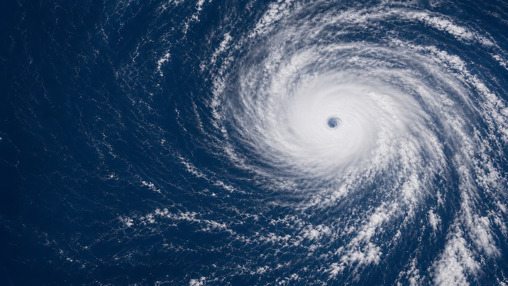
Dolphin· Major Typhoon
161mph
Noul· Typhoon
98mph
Genevieve· Hurricane
92mph
973 mb
Fausto· Tropical Depression
35mph
Live surface
Live storm positions
Every active named tropical cyclone plotted at its latest position — click a storm marker for its intensity and details.
By ocean basin
Storms by basin
Every tropical cyclone basin, with the storms active in each right now. Basins stay listed year-round so you can see which are in and out of season.
North Atlantic
QuietAtlantic, Caribbean, and Gulf of Mexico — the basin that threatens the US East and Gulf coasts.
No active storms. Season: Jun 1 – Nov 30 · peaks Sep 10.
Eastern Pacific
2 activeOff western Mexico and Central America, extending into the Central Pacific toward Hawaii.
- CAT 1Genevieve92 mph
- TDFausto35 mph
Western Pacific
2 activeThe most active basin on Earth — typhoons threatening the Philippines, Japan, China, and Taiwan.
- CAT 5Dolphin161 mph
- CAT 2Noul98 mph
North Indian
QuietBay of Bengal and Arabian Sea cyclones affecting India, Bangladesh, and the Arabian Peninsula.
No active storms. Season: Apr – Dec · peaks May & Nov.
South Pacific
QuietSouthern Hemisphere cyclones near Australia, Fiji, and the Pacific islands.
No active storms. Season: Nov – Apr.
South Indian
QuietSouthwest Indian Ocean cyclones affecting Madagascar, Mozambique, and the Mascarene islands.
No active storms. Season: Nov – Apr.
By coastline
Storms by threatened coastline
Impact view — the storms currently active off major hurricane-, typhoon-, and cyclone-exposed coastlines.
US Gulf Coast
QuietTexas to the Florida Panhandle — surge-prone shallow shelf.
No active storms.
US East Coast
QuietFlorida to New England along the Atlantic seaboard.
No active storms.
Caribbean
QuietGreater and Lesser Antilles, including Puerto Rico and Hispaniola.
No active storms.
Mexico
QuietPacific and Gulf coasts — struck from two basins.
No active storms.
Central America
QuietBelize to Panama — heavy rainfall and flooding risk.
No active storms.
Philippines
QuietThe most typhoon-exposed nation on Earth.
No active storms.
Japan & Korea
QuietRecurving typhoons across the Ryukyus, Honshu, and the peninsula.
No active storms.
China & Taiwan
1 activeSouth and East China Sea landfalls, incl. Hong Kong and Taiwan.
- CAT 2Noul98 mph
India & Bangladesh
QuietBay of Bengal and Arabian Sea cyclone landfalls.
No active storms.
Australia
QuietNorthern and Coral Sea coasts during the Southern Hemisphere season.
No active storms.
Severe weather events
All severe weather events in the past 7 days, including hurricanes, tropical storms, and other extreme weather.
| Event | Severity |
|---|---|
🌪️ Flood Alert Flash Flood Warning issued July 29 at 3:40AM EDT until July 29 at 6:45AM EDT by NWS Albany NY | HIGH |
🌪️ Severe Thunderstorm Warning Severe Thunderstorm Warning issued July 27 at 8:35PM EDT until July 27 at 9:30PM EDT by NWS Albany NY | HIGH |
🌪️ Germany Heat Wave Deaths Nearly 10,000 heat-related deaths recorded in Germany so far this year, exceeding previous annual totals | HIGH |
🌪️ Clooney Evacuates Home in France Actor George Clooney and his wife were forced to evacuate their home in southern France due to an emergency, likely a wildfire. | MEDIUM |
🌪️ Severe Thunderstorm Warning Severe Thunderstorm Warning issued July 29 at 2:45PM CDT until July 29 at 3:30PM CDT by NWS Tallahassee FL | HIGH |
🌪️ Germany heatwave deaths reach 10k Heatwave-related deaths in Germany have risen to nearly 10,000 according to the German public health institute. | HIGH |
🌪️ Flood Alert Flash Flood Warning issued July 29 at 10:21AM MST until July 29 at 2:30PM MST by NWS Flagstaff AZ | HIGH |
🌪️ Heatwave slows Swedish trains Intense heat in southern, western and southeastern Sweden leads to reduced train speeds on multiple railway sections. | MEDIUM |
🌪️ Fire Weather Alert Fire Weather Watch issued July 30 at 12:37AM MDT until August 2 at 9:00PM MDT by NWS Great Falls MT | HIGH |
🌪️ Kazakhstan heatwaves intensify health risks Kazakhstan is experiencing rising temperatures at twice the global average, leading to more frequent and intense heatwaves that are increasing public health risks and requiring a national Heat-Health Action Plan. | MEDIUM |
Storm hotspots
Where severe weather is clustering
United States
79
Active severe weather cluster in the current tracking window.
Germany
2
Active severe weather cluster in the current tracking window.
France
2
Active severe weather cluster in the current tracking window.
Africa
1
Active severe weather cluster in the current tracking window.
Pakistan
1
Active severe weather cluster in the current tracking window.
Sweden
1
Active severe weather cluster in the current tracking window.
Related coverage
Germany Logs Nearly 10,000 Heat-Related Deaths So Far This Year
Germany has already recorded nearly 10,000 heat-related deaths in 2025, topping any prior full year, as severe heat returns, wildfires force evacuations including George and Amal Clooney from their French home, and flooding warnings continue in New York and Florida.
Severe Thunderstorms Bring Damaging 60 mph Winds to Utah and South Dakota
Breaking severe weather: Damaging wind gusts threaten Utah and South Dakota communities while flash flooding hits southern Utah and major flooding persists along the Nueces River in Texas, per National Weather Service alerts.
Severe Thunderstorms and Flash Floods Trigger Warnings Across Southern Utah
Breaking weather alerts: Severe thunderstorms with damaging winds and hail hit Kane County, Utah, while flash flooding threatens Zion National Park and burn scars; excessive rainfall causes road closures and rising streams in eastern New York.
Flash Flooding Hits Eastern New York as Deventer Shuts Harbour Over Low River Levels
Severe weather updates: Flash flood and flood warnings issued across multiple New York counties after 2-4 inches of rain; Deventer, Netherlands, closes harbour due to record-low River IJssel levels; Red Flag Warning for lightning in southern Idaho.
Related trackers
Tornado Tracker
Live tornado warnings, watches, and severe weather alerts.
Global Disaster Tracker
Earthquakes, floods, wildfires, and severe weather in one view.
Tsunami Warnings
Current tsunami alerts and coastal threat advisories.
Earthquakes Near Me
Location-based earthquake proximity tracker.
Live World Map
All global events — conflicts, disasters, and more — on one map.
Global Risk Index
Composite risk score including disaster and conflict signals.
About this tracker
How Hurricane Tracking Works
Satellite reconnaissance forms the first layer of modern hurricane tracking. Geostationary satellites sit 35,000 km above the equator and provide continuous visible and infrared imagery of the same ocean region, letting forecasters watch a storm's cloud structure evolve in near-real time. Polar-orbiting satellites pass closer to the surface and carry microwave sensors that penetrate cloud tops to measure eye structure, eyewall temperature, and precipitation intensity — data that geostationary sensors cannot capture.
Hurricane Hunters add ground truth that satellites alone cannot provide. NOAA P-3 Orions and Air Force C-130J aircraft fly directly into the eye of active storms, releasing GPS dropsondes — instrument packages that parachute through the storm, transmitting wind, pressure, temperature, and humidity readings every second. A single storm penetration mission can generate hundreds of soundings that tighten forecast models dramatically.
Those models produce the famous spaghetti diagrams: overlapping track lines from different global and regional models, each driven by slightly different initial conditions. When models agree, confidence is high. When they diverge sharply, forecasters communicate uncertainty through the official cone of uncertainty — a graphic showing where the storm's center has roughly a 60-70% probability of tracking, not the maximum extent of damaging winds. Reading the cone correctly is essential: the storm's dangerous winds and storm surge extend far outside the cone's edges.
Track forecast accuracy has improved roughly 50% over the past 25 years, with 3-day track errors now comparable to what 1-day errors were in the 1990s. Intensity forecasting — predicting changes in wind speed, especially rapid intensification — remains the hardest challenge, as small-scale ocean and atmospheric features that models struggle to resolve can cause a storm to gain 50 mph in a single day.
Storm Surge: The Hidden Killer
Storm surge kills more people in hurricanes than any other hazard, accounting for roughly half of all hurricane fatalities — yet it consistently receives less public attention than wind speed. Surge is not waves on top of existing water. It is an abnormal rise of ocean water pushed ashore by a storm's wind and low pressure, arriving like a rapid tide that does not recede for hours.
How high the surge climbs depends on four factors working together: the storm's forward speed (slower storms pile up more water), the angle of approach to the coast (a perpendicular approach maximizes surge), the shape of the seafloor and coastline (gently sloping continental shelves and funnel-shaped bays amplify surge dramatically), and tidal timing (a surge arriving at high tide can be several feet higher than one arriving at low tide).
The most destructive surge in recorded U.S. hurricane history struck the Mississippi Gulf Coast when Hurricane Katrina (2005) made landfall as a Category 3. Despite weakening from its Category 5 peak, the surge measured up to 28 feet along the Mississippi shoreline — enough to obliterate entire communities like Bay St. Louis and Pass Christian that had stood for over a century. Most of Katrina's 1,392 deaths were drownings, not wind injuries.
Surge is so lethal for three reasons: people habitually underestimate it because they conflate category with water threat, it arrives and fills structures faster than people can escape, and in flat coastal terrain it can push miles inland along rivers and bays. Every county's surge risk map and evacuation zone is the single most important document for coastal residents to understand before hurricane season. The global disaster tracker documents post-landfall flooding events as they unfold.
Hurricane Season 2026 Outlook
The Atlantic hurricane season runs June 1 through November 30. Peak activity concentrates in a six-week window from mid-August through late September, when sea surface temperatures across the main development region (MDR) between Africa and the Caribbean reach their annual maximum. The statistical peak of the season falls on September 10.
Forecasters weight several factors when projecting overall season activity. The state of the El Niño-Southern Oscillation (ENSO) is the most reliable seasonal signal: La Niña conditions reduce upper-level wind shear across the Atlantic, allowing storms to organize more easily, while El Niño years typically suppress Atlantic activity. Sea surface temperatures in the MDR and Gulf of Mexico set a ceiling on how intense storms can become — anomalously warm waters in 2023 and 2024 contributed to rapid intensification events that surprised forecasters. African easterly wave activity, the source of most Atlantic tropical disturbances, varies year to year based on Saharan dust outbreaks and jet stream positioning.
Above-average seasons produce more named storms but are disproportionately dangerous when a higher fraction of those storms reach major (Category 3+) status. Below-average seasons can still produce catastrophic landfalling hurricanes if even one active storm tracks toward a populated coast. The Eastern Pacific season runs May 15 through November 30; the Western Pacific typhoon season operates year-round with a summer-fall peak, and its storms — called typhoons — follow the same physics as Atlantic hurricanes under a different name. See our tornado tracker and tsunami warnings pages for companion severe weather monitoring.
The Saffir-Simpson Scale Explained
The Saffir-Simpson Hurricane Wind Scale rates storms from Category 1 to Category 5 based on maximum sustained wind speed. Understanding what each category means in practical damage terms — not just numbers — is what makes the scale actionable for evacuation decisions.
Category 1 (74–95 mph): Some damage to roofs, gutters, vinyl siding, and large tree branches. Well-built frame homes withstand Category 1 winds reasonably well, but power outages lasting several days are common as lines go down.
Category 2 (96–110 mph): Major roof and siding damage to well-built homes. Shallow-rooted trees are uprooted, blocking roads. Near-total power loss is likely, with outages lasting days to weeks before restoration crews can reach all areas.
Category 3 (111–129 mph): Devastating damage. This is the major hurricane threshold. Well-built homes sustain significant structural damage. Electricity and water are unavailable for days to weeks. Areas may be uninhabitable during repairs.
Category 4 (130–156 mph): Catastrophic damage. Most of the roof structure and some exterior walls collapse on well-built homes. Power poles snap. Most trees are felled. Large areas become uninhabitable for weeks to months.
Category 5 (157+ mph): Total destruction of frame homes. Power infrastructure is destroyed rather than damaged. Areas can remain uninhabitable for months. Only a handful of Atlantic storms have made U.S. landfall at Category 5: Camille (1969), Andrew (1992), and the Labor Day Hurricane (1935).
A critical limitation: the scale measures wind only. Storm surge, rainfall, tornadoes embedded in spiral bands, and inland flooding — which together cause the majority of hurricane deaths — are invisible in the category number. A Category 1 hurricane stalling over a city can produce more flooding deaths than a fast-moving Category 4.
Historic Hurricanes
Hurricane Katrina (2005) made landfall near the Louisiana-Mississippi border as a Category 3, but its storm surge — generated when it was still a Category 5 over the Gulf — obliterated the Mississippi coastline with walls of water up to 28 feet high. Levee failures flooded 80% of New Orleans. The official death toll reached 1,392, and $125 billion in damage reshaped U.S. emergency management, leading to the complete reorganization of FEMA's disaster response doctrine.
Hurricane Harvey (2017) made landfall in Texas as a Category 4, then stalled over the Houston metropolitan area for four days, dropping more than 60 inches of rain — the highest tropical cyclone rainfall total ever recorded on U.S. soil. Harvey demonstrated a fundamental limitation of wind-speed categories: the storm's winds were long gone when tens of thousands of homes flooded. It became the costliest tropical cyclone in U.S. history at the time, with $125 billion in damage.
Hurricane Maria (2017) struck Puerto Rico as a Category 4, knocking out the entire power grid and destroying nearly 80% of the island's crop value. The official death toll, initially reported as 64, was revised by a Harvard study to approximately 2,975 — most deaths resulting from disrupted medical care, contaminated water, and generator failures in the months after the storm. Maria exposed how existing infrastructure vulnerability multiplies a hurricane's human cost long after winds subside.
Hurricane Ian (2022) rapid-intensified from a Category 1 to a Category 4 in roughly 24 hours before striking Fort Myers, Florida, with a storm surge reaching 18 feet in some areas. With $113 billion in insured losses, Ian ranked among the costliest Atlantic hurricanes on record and renewed urgent debate about whether official forecast models adequately communicate rapid-intensification risk to communities with less than 24 hours to prepare. For aggregated disaster context, see the global disaster tracker.
Frequently Asked Questions
When is hurricane season?
The Atlantic hurricane season officially runs June 1 through November 30, with the statistical peak on September 10. August, September, and October account for the majority of all named storms and virtually all major hurricanes. The Eastern Pacific season runs May 15 through November 30. The Western Pacific typhoon season operates year-round, peaking July through November. Pre-season storms forming in May or June have become more common in recent years.
What is the difference between a hurricane watch and warning?
A hurricane watch means hurricane conditions — sustained winds of 74 mph or higher — are possible within your area within 48 hours. Begin preparations immediately: board windows, fill fuel tanks, gather supplies, and review your evacuation plan. A hurricane warning means hurricane conditions are expected within 36 hours. If you are in an evacuation zone, leave now. Do not wait for the storm to approach — roads become impassable once wind and rain intensify, and surge arrives before the worst winds.
How far inland can a hurricane reach?
Damaging winds diminish rapidly after landfall but can extend 100 to 200 miles inland, especially from major hurricanes. Rain bands carrying heavy rainfall and embedded tornadoes can reach 300 miles or more from the center. Storm surge penetrates furthest in flat coastal terrain — in some cases pushing miles inland along rivers and bays. Inland flooding from stalled storms (like Harvey in 2017) has killed people hundreds of miles from the coast.
What makes a hurricane a major hurricane?
A major hurricane is defined as Category 3 or higher on the Saffir-Simpson scale, meaning maximum sustained winds of 111 mph or greater. Historically, only about 20% of all Atlantic named storms reach major hurricane status, yet these storms account for roughly 80% of all hurricane-related damage in the United States. The jump from Category 2 to Category 3 is significant: structural damage shifts from repairable to potentially catastrophic for frame homes.
Can hurricanes be predicted?
Track forecasting has become quite reliable: 3-day track forecasts today are as accurate as 1-day forecasts were in the 1990s, and 5-day forecasts are broadly useful for evacuation planning. Intensity forecasting — predicting how strong a storm will become — remains much harder, especially for rapid intensification events where a storm gains 35+ mph in 24 hours. Sea surface temperature anomalies and upper-ocean heat content are the key variables that models still struggle to capture at sufficient resolution.
Should I evacuate during a hurricane?
Follow orders from local emergency management officials — they have storm surge maps and shelter capacity data that forecasts alone cannot convey. If you are in a designated surge evacuation zone and a warning is issued, evacuate. Surge is the leading cause of hurricane deaths, and it is not survivable in a single-story structure. If you are inland and in a well-built structure with no mandatory evacuation order, sheltering in place is often safer than gridlocked evacuation routes. Never drive through floodwater — six inches of moving water can knock a person down; two feet can sweep a vehicle away.
Explore next
Related intelligence surfaces
Last updated 7/30/2026, 10:19:15 AM