
WW3 Map Updates Show Gaza Restricted to 35 Percent of Territory Under Yellow Line
Over 100 NGOs state that the Gaza ceasefire exists only on paper, with Israeli forces killing more than 1,400 Palestinians since the agreement while aid restrictions hinder recovery and the Yellow Line restricts Palestinians to 35 percent of the territory, as shown in ww3 map assessments. [3][5]
Ceasefire Violations and Casualties
Israeli attacks have killed or wounded a Palestinian in Gaza every 90 minutes on average since the ceasefire, with at least 1,454 killed and more than 5,000 wounded according to Islamic Relief, including 320 children. [5] Gaza’s Health Ministry reported that 1,471 Palestinians have been killed and 5,189 wounded since the ceasefire. [5] Islamic Relief said Israel has used the so-called Yellow Line, which marks the area under Israeli military control, to push Palestinians out of 65 percent of Gaza, crowding its nearly 2.1 million people into the remaining 35 percent. [5] An Islamic Relief aid worker in Gaza stated: “There is no ceasefire in reality. They target displacement camps and crowded areas, so there is still a lot of fear.” [5] On Thursday, Israeli forces killed a Palestinian southeast of Deir el-Balah, in central Gaza, and an Israeli air strike on a house in central Khan Younis wounded several people. [5]
The Yellow Line and Territorial Shrinkage in ww3 map
The Israeli-controlled or restricted area in Gaza increased from 53 percent in October 2025 to 65-70 percent by August 2026, according to a Palestinian Centre for Policy Studies paper, shrinking usable space for housing, agriculture and movement. [4] The "Yellow Line" marks Israeli military deployment inside Gaza, not an official border but a line separating Israeli-restricted areas from Palestinian zones. [4] Salwa Qudeih, a Khan Younis resident, has lost her house in the yellow area of the city's western part and now faces an uncertain return home. [4] She said: “Before the war, the land, the houses and the roads were familiar to us. Today, the landscape has changed, and there are places nearby that we cannot reach. Even when we think about returning to our homes, we do not know if the area has ended up behind 'the line' or not.” [4] In northern Gaza, Mahmoud Abu Rayash, a resident of Beit Lahia, told The New Arab that the Yellow Line has become a physical danger rather than simply a mark on a map. [4] He said: “For us, the Yellow Line is not merely something on a map. It is a place you cannot approach; land that used to be reachable in minutes has now become a danger zone.” [4]
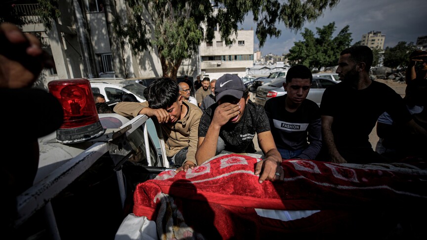
Over 100 NGOs declare Gaza ceasefire exists only on paper amid ongoing Israeli attacks and Yellow Line restrictions. — Source: anadolu
Physical Destruction and Landscape Changes
Around 82 percent of Gaza’s structures have been damaged or destroyed. [4][5] A United Nations assessment based on images captured in June 2026 found that around 200,000 buildings, or roughly 82 per cent of the Strip's structures, had sustained damage, with more than 134,000 classified as destroyed. [4] The transformation of Gaza’s landscape includes new military roads, earth berms, observation posts and the Yellow Line, which residents describe as a physical danger zone preventing return to homes and farmland. [4] In northern Gaza, Beit Hanoun, Beit Lahia, and Jabalia have changed drastically, with densely populated areas turned to rubble and vacant land, and new military roads, earth berms, and structures emerging. [4] In Gaza City, neighborhoods like Shuja'iyya, Zeitoun, and Tuffah are heavily damaged. [4] Across central Gaza, farmland and open spaces have become displacement areas, and families have lost access to land that once provided homes, livelihoods, and food. [4]
Humanitarian Conditions and Aid Blockages
More than half of health services have shut down, and more than 20,000 severely ill patients are denied permission to leave for treatment. [5] Israel continues to block shelter materials, fuel and medical supplies, the group said. [5] The charity urged world leaders to increase pressure to protect civilians and uphold international law. [5] “A ceasefire in name only cannot be an excuse for international inaction,” it said. [5] Islamic Relief calls for international action as Gaza endures deadly Israeli attacks and worsening humanitarian conditions. [5]
{IMAGE_3}
West Bank Attacks
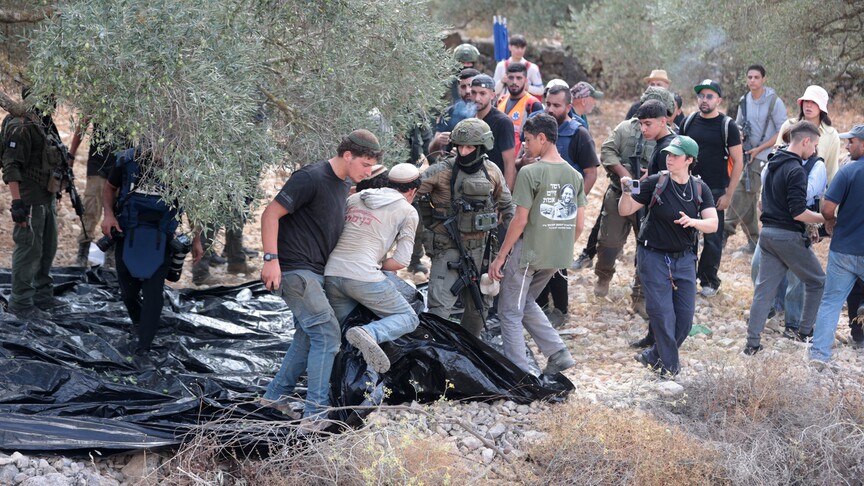
Israeli occupiers carried out 19 attacks on Palestinians and olive farmers across the West Bank in a matter of hours, including burning trees, stealing crops and livestock, and assaults on farmers and vehicles. [1] Palestinian commission says the attacks include burning trees, stealing crops and livestock, assaults on farmers, vehicles. [1]
Historical Context and Future Implications
Gaza's shrinking usable space did not begin with Israel's current genocidal war, and has been ongoing since 1948. [4] Before the 1948 Nakba, the Gaza District was larger, including many Palestinian villages and towns that Zionist armed groups occupied and absorbed into their newly enforced state. [4] Under the 1949 Egyptian-Israeli Armistice Agreement, signed in Rhodes, the Gaza Strip's boundaries were set at about 365 sq km under Egyptian control until Israel occupied Gaza in 1967. [4] Gaza-based political analyst Mustafa Ibrahim argued that the significance of the Yellow Line cannot be separated from the changes taking place around it. [4] He said: “The issue is not merely about the Yellow Line as a military demarcation; it is about the changes unfolding behind it, affecting the land, the population and freedom of movement.” [4] Ibrahim believed that controlling territory could be part of a post-war deal, limiting movement and reducing land for housing and agriculture. [4] “When land beyond the line becomes inaccessible, and reconstruction is tied to areas where access is permitted, geography begins to shape demography,” he added. [4] The question now is whether the so-called "Yellow Line" will remain a temporary ceasefire arrangement or become a lasting geographical reality. [4]
What to watch next: Analysts will monitor whether the Yellow Line remains a temporary security arrangement or hardens into a permanent partition that further restricts Palestinian access to land for housing, agriculture and movement.