
Two New Island Formations Appear Near Indonesia’s Anak Krakatau After September Eruption in Natural Disasters
Two new island-like formations have appeared near Indonesia’s Anak Krakatau volcano following its early-September eruption that disrupted air travel across the country amid natural disasters. Satellite imagery from the European Space Agency’s Sentinel satellites shows two formations less than one kilometre from Anak Krakatau, one 760 metres northwest and the other 495 metres southwest. [1] Indonesian volcanology officials state it is too early to confirm whether the formations are new eruptive centres or simply accumulations of volcanic material, and field verification has not yet occurred. [3]
New Island Formations Detected
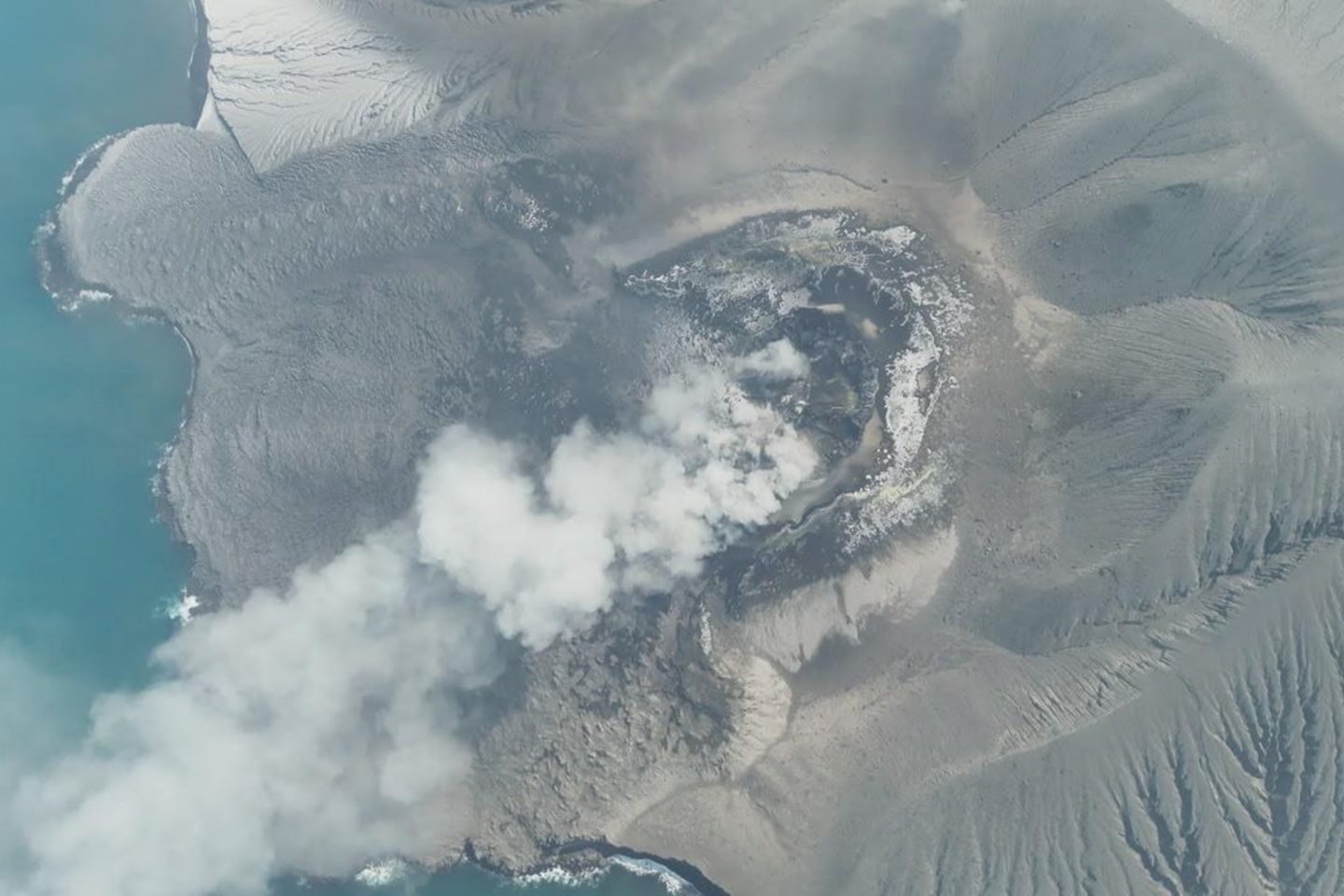
Satellite imagery from the European Space Agency’s Sentinel satellites shows two formations less than one kilometre from Anak Krakatau, one 760 metres northwest and the other 495 metres southwest. [1] These features were identified through analysis of Sentinel photographs, as stated by volcanology service representative Rita Susilawati. [1] The two formations resemble small islands according to the satellite data reviewed by Indonesian officials. [3] One lies 760 metres northwest of the volcano while the second sits 495 metres to the southwest. [1] Such detections rely entirely on remote sensing because authorities have not yet conducted on-site examinations. [3] The imagery analysis forms the sole basis for current knowledge of the features' locations and approximate sizes. [1]
Official Caution on Classification
Indonesian volcanology officials state it is too early to confirm whether the formations are new eruptive centres or simply accumulations of volcanic material, and field verification has not yet occurred. [3] Rita Susilawati of the PVMBG emphasised that officials cannot yet label the features as new islands or eruptive centres. [1] She noted that insufficient data exists on their origin and formation process. [3] Officials have not performed field research to determine the material composition of the two new formations. [3] Susilawati stated that confirmation must await further information before any classification can occur. [1] The current assessment remains limited to satellite observations alone. [3]

Satellite image shows two new island-like formations near Indonesia’s Anak Krakatau volcano after September eruption. — Source: gdelt
Historical Context of Similar Formations
Similar temporary land masses have appeared near Anak Krakatau since 1927, many of which later disappeared due to wave erosion; a permanent island formed only in 1930. [3] Beginning in 1927, several instances of land emerging briefly from the sea were recorded in the area, only to be removed later by erosion. [3] A permanent island finally formed in 1930 after repeated temporary appearances. [3] Susilawati warned that the two new formations may not last long because waves could erode them and submerge them again. [3] Historical patterns show that similar features have repeatedly proven temporary in this location. [3] The 1930 permanent formation stands as the sole lasting example amid earlier short-lived events. [3]
September Eruption and Air Travel Disruption
The September eruption forced the temporary closure of eight Indonesian airports, including Jakarta’s main international airport, stranding hundreds of thousands of travellers. [1] The volcano erupted at the beginning of September, ejecting a cloud of ash and lava. [1] This activity led to the closure of eight airports across Indonesia for several days. [1] Jakarta’s main international airport was among those halted, resulting in hundreds of thousands of travellers being stranded. [1] The eruption and volcanic ash disrupted air traffic in multiple parts of Indonesia. [3] Several hundred flights were cancelled because of the ash cloud effects. [3] The early-September event produced widespread operational halts at airports nationwide. [1]

Satellite image shows two new formations near Indonesia’s Anak Krakatau volcano after September eruption. — Source: gdelt
Current Alert Status and Safety Measures
Authorities maintain a raised alert level (Level 2 on a four-level scale) and prohibit approach within three kilometres of the volcano. [1] Anak Krakatau remains at the second danger level on the four-stage warning scale. [3] Officials continue to advise residents and visitors against approaching closer than three kilometres. [3] The raised alert status persists following the recent eruptive activity. [1] Safety measures focus on maintaining distance from the volcano to reduce exposure risks. [3] The exclusion zone of three kilometres stays in force as part of ongoing precautions. [1]
Geological Background
Anak Krakatau, whose name means “Child of Krakatoa,” lies in the Sunda Strait between Java and Sumatra, about 150 km east of Jakarta, in a geologically active zone linked to the catastrophic 1883 Krakatoa eruption. [3] The volcano sits in the Sunda Strait between Java and Sumatra roughly 150 kilometres east of Jakarta. [3] Its name translates as “Child of Krakatoa” in Indonesian. [3] The area belongs to the site of the former Krakatoa volcano whose 1883 eruption ranks among history’s most destructive events. [3] Anak Krakatau began emerging from the sea decades after the 1883 catastrophe. [3] Volcanic activity occurs frequently in this geologically active region. [3] The permanent land formation in the area dates to 1930, after which the volcano has erupted multiple times. [3]
What to watch next: Officials will continue satellite monitoring of the two formations while the Level 2 alert and three-kilometre exclusion zone remain in place around Anak Krakatau.







