
Severe Thunderstorm With Damaging Winds and Hail Moves Toward Lander County Nevada
The National Weather Service has issued a Severe Thunderstorm Warning for parts of north central and south central Nevada, while Flood Warnings remain in effect for portions of Texas and Red Flag Warnings cover large areas of eastern Washington state amid expected thunderstorms.
Active Severe Thunderstorm Warning in Nevada
The National Weather Service in Elko Nevada has issued a Severe Thunderstorm Warning for south central Lander County in north central Nevada and northwestern Nye County in south central Nevada. [1] This warning remains in effect until 9:45 PM PDT. [1] At 9:19 PM PDT a severe thunderstorm was located 19 miles west of Kingston and is moving north at 30 mph. [1] The hazard associated with this storm includes 60 mph wind gusts and half dollar size hail according to radar indicated sources. [1] Impacts from the storm are expected to include hail damage to vehicles along with wind damage to roofs and siding. [1] The severe thunderstorm capable of these conditions was positioned in a location that places south central Lander County and northwestern Nye County directly in its path as it advances northward. [1] Radar data confirmed the presence of the storm at the reported time and position while the movement speed indicates a relatively rapid progression across the affected counties. [1] Residents in the warned areas face the possibility of vehicle damage from hail and structural damage from strong winds as the thunderstorm continues its northward track. [1]
Ongoing Flooding Along Cibolo Creek in Texas
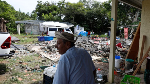
Minor flooding is occurring on Cibolo Creek at Selma with major flooding forecast to continue until tomorrow evening. [2] The forecast flooding on Cibolo Creek at Selma affecting Bexar and Guadalupe Counties changed from moderate to major severity and increased in duration. [2] At 22.0 feet major flooding severely floods a trailer park in Schertz while major lowland flooding damages crop and pasture land below Bulverde to below Falls City. [2] The current conditions show minor flooding already taking place along the creek with the escalation to major levels expected to persist through the evening hours of the following day. [2] Impacts include severe flooding of the trailer park in Schertz along with damage to agricultural areas in the lowland regions extending from below Bulverde toward below Falls City. [2] The National Weather Service has updated the severity assessment for this location based on the ongoing and projected river levels. [2]
Red Flag Warnings Issued Across Eastern Washington
Red Flag Warnings are in effect for the Eastern Columbia Basin, Palouse, Spokane Area, Lower Palouse, Snake River, Okanogan Highlands and Kettle Mountains. [3] [4] [5] These warnings address isolated to scattered thunderstorms from Wednesday night through Thursday evening. [3] [4] [5] Two rounds of showers and thunderstorms will impact Central and Eastern Washington between Wednesday night and Thursday evening. [3] [4] [5] The alerts cover multiple specific regions including the Eastern Columbia Basin, Palouse and Spokane Area as well as the Lower Palouse and Snake River zones along with the Okanogan Highlands and Kettle Mountains. [3] [4] [5] Fire weather concerns prompted the issuance of these warnings due to the anticipated thunderstorm activity across the listed areas. [3] [4] [5]
Forecast Details for Washington Thunderstorms
The first round of storms will track south to north through Central Washington Wednesday night into Thursday morning. [3] [4] [5] This round will consist of a mix of wet and dry thunderstorms with scattered lightning strikes. [3] [4] [5] Rainfall amounts will generally range from a trace to a tenth of an inch though amounts may be higher in some locations. [3] [4] [5] The thunderstorms in Washington are expected to produce a mix of wet and dry storms with scattered lightning strikes and generally light rainfall amounts from a trace to a tenth of an inch. [3] [4] [5] The second round of activity will follow later in the period through Thursday evening contributing to the overall thunderstorm coverage across the warned regions. [3] [4] [5] Scattered lightning strikes remain a key concern alongside the potential for dry thunderstorm conditions that align with the Red Flag Warning criteria. [3] [4] [5]
Broader Weather Context
The National Weather Service has issued a Severe Thunderstorm Warning for parts of north central and south central Nevada while Flood Warnings remain in effect for portions of Texas and Red Flag Warnings cover large areas of eastern Washington state amid expected thunderstorms. [1] [2] [3] [4] [5] These varied severe weather products were issued across different U.S. regions within the past day reflecting simultaneous monitoring of thunderstorm threats hail and wind risks flooding along rivers and fire weather conditions tied to lightning. [1] [2] [3] [4] [5] The Severe Thunderstorm Warning details radar confirmed hazards in Nevada the Flood Warning tracks river level changes in Texas and the Red Flag Warnings address thunderstorm rounds in Washington all based on the respective source alerts. [1] [2] [3] [4] [5]
What to watch next includes continued northward movement of the Nevada thunderstorm until the warning expires at 9:45 PM PDT along with major flooding on Cibolo Creek persisting until tomorrow evening and the two rounds of showers and thunderstorms in Washington extending through Thursday evening.