
New York Tornado Warning Issued for Queens and Nassau as Flooding Hits City
The National Weather Service issued a tornado warning for Queens County and Nassau County on Long Island until 7:15 p.m. EDT Thursday as storms brought heavy rain and flooding. A flash flood warning covered multiple counties in New York and New Jersey until 7:45 p.m. EDT with 1–1.5 inches of rain already fallen and rates up to 1.5 inches per hour possible. Severe thunderstorm warnings were issued for Terrell, Georgia, and Lafayette, Florida, citing 60 mph wind gusts capable of damaging roofs, siding and trees. The Panama Canal Authority will cut daily ship transits from 36 to 34 on 3 September and to 32 on 15 September because of lower-than-forecast rainfall in the watershed caused by El Nino. The canal handles 5 percent of global maritime trade and 40 percent of US container traffic; Central America is experiencing a severe drought, with Honduras placing 80 percent of the country on drought alert.
Tornado and Flash Flood Warnings Hit New York
The National Weather Service issued a tornado warning for Queens County and Nassau County on Long Island until 7:15 p.m. EDT Thursday. [5] Nassau County lies on Long Island, New York, and the warning accompanied expectations of heavy rain and severe weather across the region through the evening. [5] The New York City Emergency Management advised residents to go indoors or to the lowest floor of a building for shelter and to stay away from windows. [5] Officials noted that during a tornado warning people should prepare for possible power loss by charging cell phones, gathering supplies, and setting refrigerators and freezers to colder temperatures. [5]
A flash flood warning from the National Weather Service covered parts of New York and New Jersey until 7:45 p.m. EDT Thursday. [5] The warned areas included Southern Bergen County, Essex County, Hudson County, Eastern Passaic County, and Northeastern Union County in New Jersey along with Bronx, Kings (Brooklyn), New York (Manhattan), Queens, and Richmond (Staten Island) counties in New York. [5] At 5:39 p.m. EDT, Doppler radar showed thunderstorms producing heavy rain across the warned area, with between 1 and 1.5 inches of rain already fallen and rainfall rates up to 1.5 inches per hour possible. [5] Another 1 to 2 inches of rain could fall, and flash flooding was already occurring or could begin shortly. [5]
Flooding has already been reported in parts of New York City. [5] Video shared on social media showed rainwater pouring onto a subway platform at Penn Station. [5] Heavy rain was also reported in Chelsea in Manhattan and around the Clearview Expressway in Bayside, Queens. [5] The Brooklyn-Queens Expressway was closed in both directions at Queens Boulevard in Queens, and the Long Island Expressway was closed in both directions at Francis Lewis Boulevard in Queens. [5] Drivers were advised to seek alternate routes. [5]
Severe Thunderstorms Strike Georgia and Florida
At 747 PM EDT, a severe thunderstorm was located 7 miles northwest of Dawson in Terrell County, Georgia, and was nearly stationary. [2] The hazard included 60 mph wind gusts indicated by radar, with expected damage to roofs, siding, and trees. [2] Locations impacted include Bronwood, Parrott, Chambliss, Oakville, and Yeomans. [2]
At the same time, severe thunderstorms were located along a line extending from 6 miles southwest of Suwannee River State Park to 14 miles south of Mayo in Lafayette County, Florida, moving northwest at 15 mph. [3] The hazard again included 60 mph wind gusts indicated by radar, with expected damage to roofs, siding, and trees. [3] Locations impacted include Mayo, Madison, Lee, Cooks Hammock, Chancey, Smith, Hopewell, Buckville, Carbur, Mayo Junction, Townsend, Salem, Hanson, Athena, San Pedro Junction, Day, and Fenholloway. [3]
Panama Canal Cuts Ship Traffic Over El Nino Drought
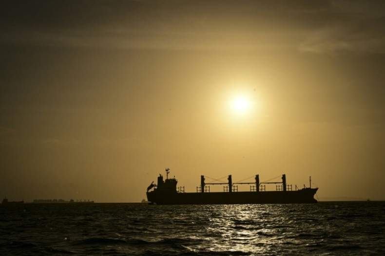
The Panama Canal Authority announced that from September 3 the number of vessels allowed through the canal each day will be reduced from 36 ships currently to 34, falling further to 32 from September 15. [1] The reductions stem from a lack of rain caused by the El Nino weather phenomenon. [1] The canal operator cited lower-than-forecast rainfall in the canal's watershed and said the measures aim to bolster the long-term sustainability of the waterway. [1] The Panama Canal handles five percent of global maritime trade and around 40 percent of US container traffic. [1] It is fed by rainwater that collects in two artificial lakes, and the authority has already implemented other water conservation measures such as lowering the maximum draft for the largest ships. [1]
Contrasting Weekend Outlook for New Zealand
The North Island is set to experience spring-like conditions and temperatures of 20C and higher this weekend. [4] MetService head of weather news Heather Keats said the North Island is probably the best spot to be over the weekend. [4] In contrast, the South Island faces a fresh bout of severe weather with warnings issued over 120 km/h winds. [4]
Broader El Nino Context
Central America is in the throes of a severe drought driven by El Nino, a weather pattern that warms surface temperatures in the central and eastern equatorial Pacific Ocean and triggers worldwide changes in winds, atmospheric pressure, and rainfall. [1] On Wednesday the government of Honduras placed 80 percent of that Central American country on drought alert. [1] El Nino occurs on average every two to seven years, and this year's event is shaping up as one of the strongest on record. [1]
What to watch next: The Panama Canal Authority will lower daily transits to 34 on 3 September and to 32 on 15 September while the South Island of New Zealand contends with severe weather and 120 km/h winds this week