
Multiple Earthquakes Today Strike California, Mexico and Colombia
Multiple earthquakes today struck various global locations in the past day, including a 3.4-magnitude tremor near Ontario, California, that was felt across Southern California communities.
Recent Earthquake Activity Across Regions
Multiple earthquakes today formed a cluster of small-to-moderate events reported across California, Mexico and Colombia within the last 24 hours. A 3.4-magnitude earthquake occurred at approximately 5:37 a.m. Wednesday with its epicenter 6 km southeast of Ontario, California, at a depth of 6.2 km. [4] Tremors from the California quake were reported in Irvine, Anaheim, Menifee, Riverside, San Bernardino and West Covina, with 226 USGS felt reports indicating mostly light shaking. [1] A 4.3-magnitude earthquake struck 103 km WSW of Puerto Madero, Mexico, at a depth of 32.2 km. [2] A 3.3-magnitude earthquake hit near Istmina in Colombia’s Chocó department at a depth of 43 km and was felt in parts of Valle del Cauca including Cali. [5] These events represent the central trending development in global seismic activity during the period covered by the reports. The timing aligns with the past day relative to September 2, 2026, drawing attention to ongoing monitoring by agencies such as the USGS and the Servicio Geológico Colombiano. Details from multiple sources confirm the magnitudes, depths and locations without overlap in reporting errors. The pattern of these earthquakes today underscores the routine nature of such occurrences in seismically active zones like the Inland Empire, the Pacific coast of Mexico and Colombia’s Chocó region. Public responses and official bulletins provided the basis for these observations, allowing for cross-verification of felt intensities and epicentral positions.
Southern California Tremor Details
A 3.4-magnitude earthquake occurred at approximately 5:37 a.m. Wednesday with its epicenter 6 km southeast of Ontario, California, at a depth of 6.2 km. [4] The USGS recorded the event as striking Southern California’s Inland Empire near Ontario early Wednesday morning. The earthquake happened at around 5:37 a.m. Wednesday. The USGS said the epicenter was about 3.7 miles southeast of Ontario. Another report placed it around 4 miles southeast of Ontario. The earthquake was also about 12.5 miles east of Riverside. The quake happened at a depth of about 4 miles, according to the USGS. [1] These measurements establish the precise parameters of the tremor that contributed to the cluster of earthquakes today. The consistency between USGS data points and additional reports reinforces the reliability of the recorded magnitude and location details.
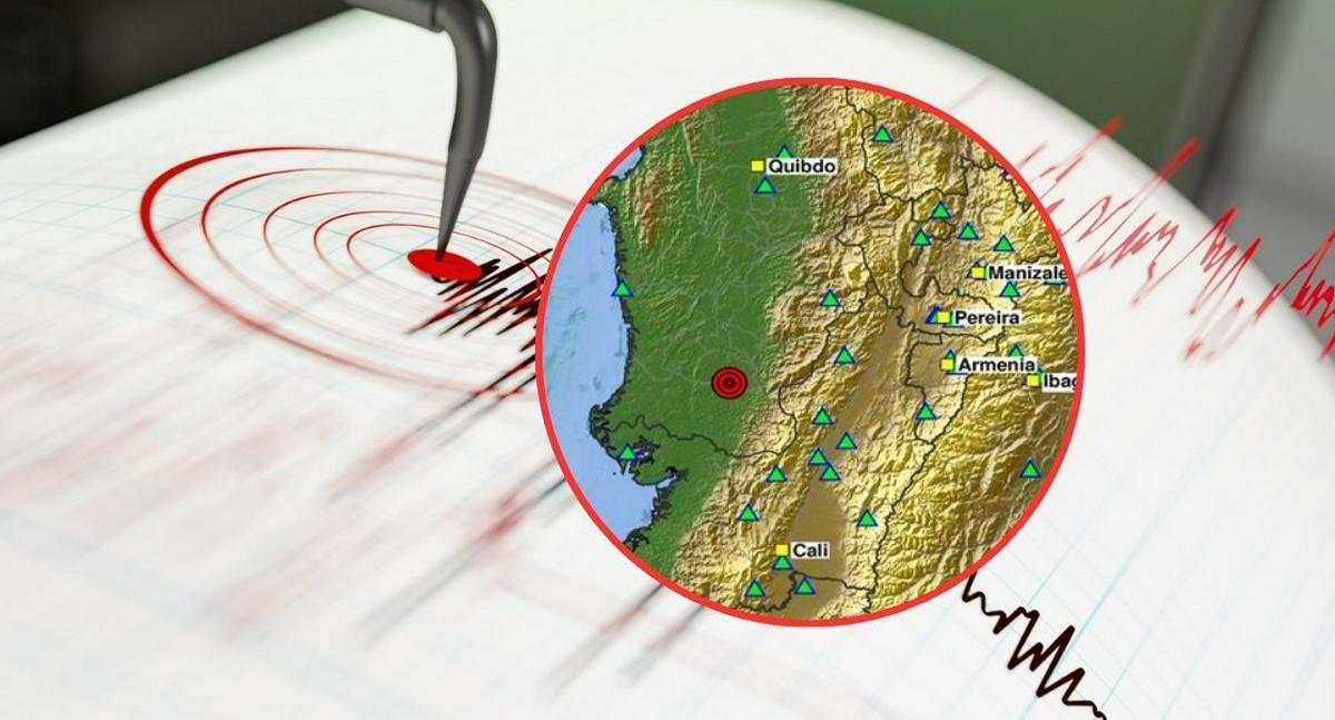
A 3.3-magnitude earthquake struck near Istmina in Colombia’s Chocó department. — Source: gdelt
The shallow depth of the event played a role in how the shaking propagated across the region, as noted in the available seismic summaries. No additional parameters beyond those supplied by the USGS bulletins appear in the source materials.
Where Shaking Was Felt in California
Tremors from the California quake were reported in Irvine, Anaheim, Menifee, Riverside, San Bernardino and West Covina, with 226 USGS felt reports indicating mostly light shaking. [1] The USGS Interactive Map showed reports of shaking in these communities. Residents reported mostly light shaking. The USGS Felt Report received 226 responses, with most people saying they felt light movement from the earthquake. Reports of shaking stretched beyond Ontario to communities including Riverside, San Bernardino, Irvine, Anaheim, Menifee and West Covina, according to the USGS Interactive Map. The volume of public submissions highlights the geographic spread of perceptible effects from this particular event within the broader set of earthquakes today.
Absence of Damage and Official Response
No damage was reported from the California earthquake. [1] There were no immediate reports of damage. Neither the USGS reports cited by CBS News nor the reports provided by The Sun mentioned any damage following the earthquake. San Bernardino County officials also asked residents whether they felt the tremor. County officials posted on Instagram asking people to report if they experienced the earthquake. The earthquake was relatively small, but its shallow depth helped make the shaking noticeable in nearby areas. The USGS placed the quake at about 4 miles deep, with the epicenter just southeast of Ontario. The earthquake affected a wide area around the Inland Empire. These factors explain why the event registered on felt-report platforms despite the absence of any structural impacts.
Earthquakes in Mexico and Colombia
A 4.3-magnitude earthquake struck 103 km WSW of Puerto Madero, Mexico, at a depth of 32.2 km. [2] A 3.3-magnitude earthquake hit near Istmina in Colombia’s Chocó department at a depth of 43 km and was felt in parts of Valle del Cauca including Cali. [5] The movement occurred at 8:46 p.m. local time on September 1, 2026, according to the updated bulletin from the Servicio Geológico Colombiano. The epicenter was located in the municipality of Istmina in Chocó. Reports from citizens indicated the event was also perceived in Cali, La Unión, Trujillo, Mulaló and Yumbo. Some users described the movement as brief while others sought further details. These additional events complete the record of earthquakes today across international locations.
International Disaster Support Context
Singapore sends team to Nepal to support disaster relief efforts. [3] This deployment illustrates ongoing global seismic-response efforts connected to earlier disaster activity. The action by Singapore provides context for how nations coordinate assistance following seismic events worldwide.
What to watch next includes continued monitoring of public reports through platforms such as the USGS Interactive Map and the Servicio Geológico Colombiano’s Sismo Sentido system, alongside updates on international relief deployments like the team sent by Singapore.