
Magnitude 7.2 Earthquake Strikes Ayacucho Region in Peru
A magnitude 7.2 earthquake struck 35 km north of Coracora in Peru's Ayacucho region on August 20, 2026, as part of heightened seismic activity across multiple countries including the Philippines, Colombia, Alaska and Venezuela.
Major Quake Hits Peru's Ayacucho Region
Peru's Instituto Geofísico del Perú recorded a M7.2 quake near Coracora on August 20 followed by additional M4.2 and M4.0 events in the same area that day, plus numerous smaller quakes ranging from M3.4 to M4.8 across regions including Lima, Arequipa, Junín and others over the preceding week. [2] The M7.2 event took place at 13:00:16 on August 20, 2026, with its epicenter 35 km north of Coracora in the Parinacochas province of Ayacucho. [2] Later the same day, a magnitude 4.2 quake occurred at 16:30:31, located 28 km north of Coracora, and a magnitude 4.0 quake followed at 20:24:18, 26 km north of Coracora. [2] Earlier in the week, on August 19, a magnitude 4.8 quake struck 42 km southwest of Lurín in Lima, while a magnitude 3.6 event was recorded 38 km west of Ocoña in Arequipa on August 20. [2] Additional events included a magnitude 3.4 quake on August 19 in Huancavelica, a magnitude 3.5 quake on August 17 in Junín, and a magnitude 4.2 quake on August 17 in Amazonas. [2] The Instituto Geofísico del Perú continued monitoring all events and issued updates to keep the public informed through official channels. [2]
Ongoing Swarm in Colombia's Chocó Department
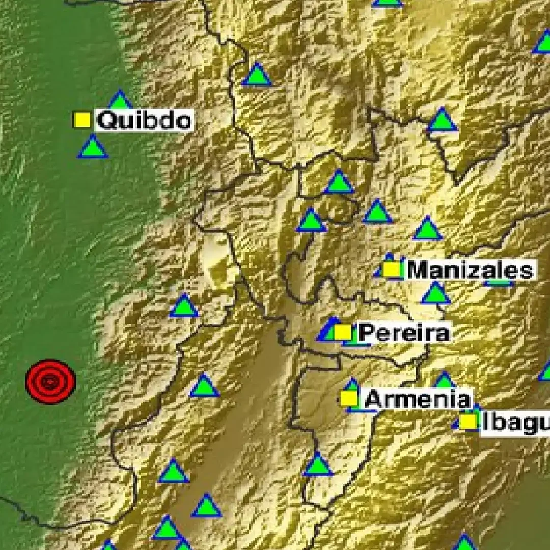
Six earthquakes ranging from M2.4 to M3.5 struck Colombia's Chocó department in under seven hours on August 21, 2026, mainly near Istmina and Sipí, days after a stronger quake on August 10. [4] The first tremor occurred at 12:41 a.m. in Sipí with magnitude 2.4 and shallow depth. [4] At 3:28 a.m., a magnitude 2.8 event was recorded in Istmina, also at shallow depth. [4] Nine minutes later at 3:37 a.m., another quake of magnitude 3.3 struck Istmina at 74 km depth. [4] Activity resumed at 5:46 a.m. with a magnitude 3.1 quake at 41 km depth near Istmina. [4] At 6:10 a.m., a magnitude 2.9 event again centered on Istmina. [4] The largest of the sequence reached magnitude 3.5 at 6:59 a.m. in Sipí with shallow depth. [4] Nearby municipalities such as Nóvita, El Dovio and Trujillo felt some of the events, though no significant damage was reported. [4] The Servicio Geológico Colombiano noted that the sequence followed the stronger August 10 earthquake and emphasized that Colombia remains seismically active. [4]

Map shows Venezuela's earthquake response efforts from August 18 to 20 2026. — Source: reliefweb
Additional Earthquakes Reported in Philippines and Alaska
The USGS reported a M5.0 earthquake at a depth of 10 km located 6 km south of Kitcharao in the Philippines. [1] The event was recorded with a precise magnitude of 5.0 and occurred at the stated shallow depth of 10.0 km. [1] Separately, a M3.0 earthquake occurred at a depth of 24.5 km, 238 km ESE of Attu Station in Alaska according to the USGS. [3] That quake registered exactly magnitude 3.0 at the reported depth of 24.5 km. [3] Both events were documented through standard USGS monitoring and released as discrete reports without linkage to other regional sequences. [1][3]
Humanitarian Response Continues in Venezuela
Venezuela continued its response to earlier earthquakes from June 24, 2026, with the International Organization for Migration distributing 348 collapsible jerrycans, 340 plastic tarps, 271 tool kits, 338 hygiene kits and 66 kitchen sets between August 18-20. [5] The distributions formed part of the ongoing assistance detailed in the organization's Situation Report No. 24 covering the period from August 18 to 20, 2026. [5] The items supplied included 348 collapsible jerrycans, 340 plastic tarps, 271 tool kits, 338 hygiene kits and 66 kitchen sets, all delivered in the days immediately preceding the report's coverage window. [5] These distributions supported communities affected by the June 24 earthquakes and were tracked as part of the sustained relief effort. [5]
Geological Context of Frequent Activity in Peru
The Perú se encuentra dentro del Cinturón de Fuego del Pacífico, una extensa franja que concentra cerca del 85 % de la actividad sísmica mundial. [2] Esta condición convierte al país en una de las zonas con mayor frecuencia de movimientos telúricos. [2] El principal origen de los temblores y terremotos es el proceso de subducción, mediante el cual la Placa de Nazca se desplaza por debajo de la Placa Sudamericana. [2] Como consecuencia, se acumula energía en el subsuelo que, al liberarse, produce ondas sísmicas de distinta intensidad. [2] Este mismo proceso geológico también ha sido determinante en la formación y evolución de la Cordillera de los Andes. [2] La interacción constante entre la Placa de Nazca y la Placa Sudamericana provoca una acumulación progresiva de energía bajo el territorio peruano. [2] Cuando la presión supera la resistencia de las rocas, esa energía se libera en forma de ondas sísmicas, dando origen a terremotos que pueden sentirse a cientos de kilómetros del epicentro. [2] La evolución geológica de la Cordillera de los Andes también contribuye a la generación de movimientos sísmicos. [2]
Official Recommendations and Emergency Contacts
La preparación sigue siendo una de las medidas más eficaces para reducir riesgos ante un movimiento telúrico. [2] El Instituto Geofísico del Perú recomienda mantener actualizado el plan familiar de emergencia, identificar previamente las rutas de evacuación, contar con una mochila de emergencia equipada, participar en los simulacros nacionales y consultar información únicamente a través de fuentes oficiales. [2] Estas acciones permiten responder con mayor rapidez y organización frente a una eventual emergencia. [2] Ante cualquier situación de emergencia, las autoridades recomiendan comunicarse con los siguientes servicios: Bomberos al 116, Policía Nacional del Perú al 105, SAMU al 106 e INDECI mediante las autoridades locales y regionales. [2] Tener estos números disponibles puede facilitar una atención oportuna cuando ocurre un sismo o cualquier otra emergencia. [2]
What to watch next: The Instituto Geofísico del Perú will continue issuing updates on the latest recorded events in regions such as Huánuco, Junín, Pasco, Arequipa and Lima, while the Servicio Geológico Colombiano maintains monitoring of activity in Chocó following the August 10 event.