Indonesia Volcano Mount Sinabung Erupts With 3,500-Meter Ash Column
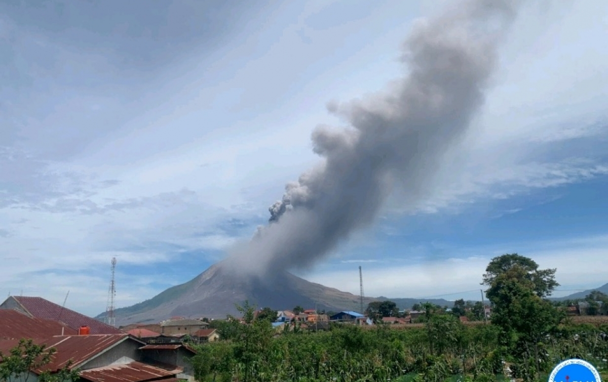
Mount Sinabung in Indonesia's North Sumatra erupted on August 31, 2026, at 10:17 a.m. local time, producing a 3,500-meter ash column and prompting the Geological Agency to raise its alert level from II to III. [1] The Indonesia volcano sent thick black ash leaning east and southeast, with the column reaching 3,500 meters above the summit or 5,960 meters above sea level. [2]
Eruption Details
The eruption column reached 3,500 meters above the summit, or 5,960 meters above sea level, with thick black ash leaning east and southeast. [1] It was recorded with a maximum seismogram amplitude of 120 millimeters. [2] The eruption at the Indonesia volcano began at 10:17 a.m. local time and lasted at least one hour. [4] Visual observations confirmed the ash column height and direction immediately after the event. [3]
Pre-Eruption Activity
Prior to the eruption, the agency recorded 85 volcanic earthquakes, one gust earthquake, and one harmonic tremor. [1] Monitoring from August 1-30 showed white and gray smoke emissions up to 1,000 meters and yellowing vegetation on eastern slopes. [2] These signs indicated rising activity at the Indonesia volcano ahead of the main event. [1]
:quality(30):format(webp):focal(0.5x0.5:0.5x0.5)/medan/foto/bank/originals/Pegawai-Dinsos-Provinsi-Sumut-UPTD-Tuna-Sulila-dan-Tuna-Laras-Berastagi1.jpg)
Mount Sinabung erupts thick black ash column 3500 meters high over Berastagi in North Sumatra. — Source: gdelt
Alert Level Increase
The Geological Agency raised Mount Sinabung's activity level from Level II to Level III (Alert) effective August 31, 2026, at 12:30 p.m. [1] The volcano had been at Level II since May 17, 2023. [2] At Level III, activities are prohibited in relocated villages, within a 3 km radius of the summit, and a 6 km sectoral radius to the south-southeast. [1] Residents near rivers originating from the volcano must watch for lahar floods. [2]
Local Impacts in Berastagi
Thick ash fell on Berastagi district to the east and southeast, covering offices, settlements, and main roads, reducing visibility and disrupting outdoor activities. [3] Ash began falling around 10:40 a.m. local time and quickly covered areas including the UPTD Dinas Sosial office in Desa Raya. [3] Masks were distributed to prevent respiratory issues for those in rehabilitation facilities where outdoor training was halted. [3]
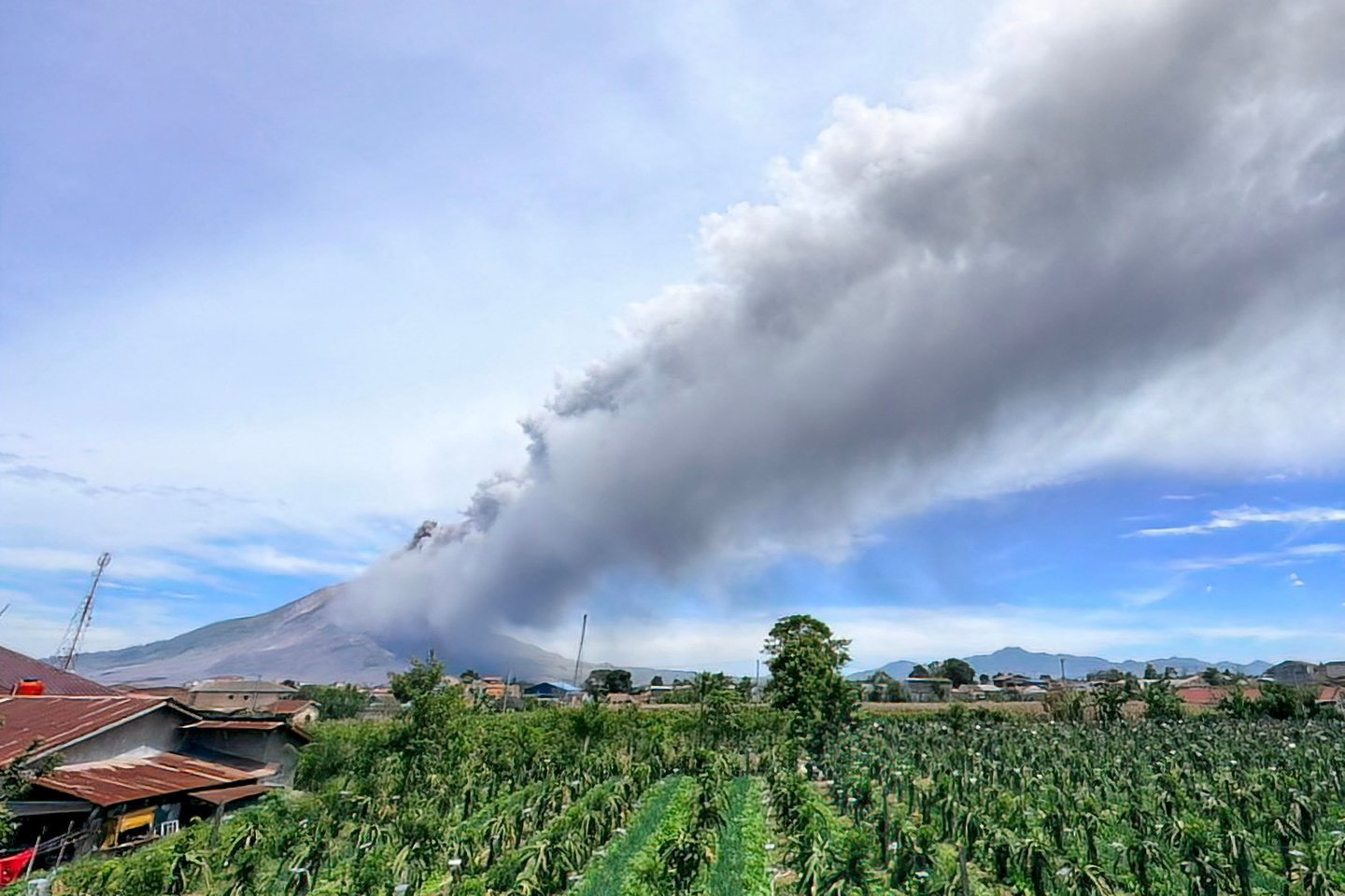
Mount Sinabung erupts in Indonesia sending a 3500-meter ash column east and southeast. — Source: gdelt
Official Guidance and Monitoring
The Geological Agency urged the public to remain calm, increase vigilance, and follow the directions of the North Sumatra Provincial Disaster Mitigation Agency and the Karo District Disaster Mitigation Agency. [1] Local government was urged to maintain coordination with the Sinabung Volcano Observation Post in Ndokum Siroga Village. [2] Updates on volcanic activity are available through the Geological Agency’s official PVMBG app and channels as well as the MAGMA Indonesia application. [1]
Volcano Context
The eruption lasted at least one hour with no reported casualties. [4] Sinabung, at 2,460 meters elevation, is one of Indonesia's most active volcanoes in the Pacific Ring of Fire. [4] Indonesia’s archipelago lies in the Ring of Fire with approximately 120 active volcanoes. [4] Sinabung had been largely dormant for centuries before reactivating in 2010. [4]
What to watch next: The Geological Agency predicted a possible larger eruption and will keep Mount Sinabung under close monitoring with status reassessed regularly whenever significant changes are detected. [1]