
Hurricane Tracker Shows Typhoon Champi Enveloping Taiwan With 155 kph Winds
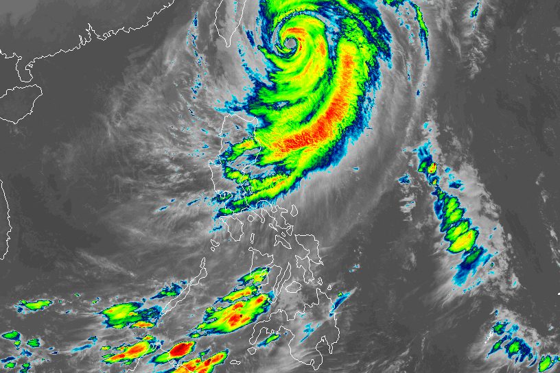
The hurricane tracker indicates that Typhoon Champi’s storm circle has enveloped Taiwan proper, bringing sustained winds near its center of 155 kph. [4] The typhoon was located about 260 km southeast of Yilan County at 11 a.m., moving northwest to north-northeast at between 11 kph and 15 kph. [4] It is not expected to make landfall but will linger until late tomorrow before weakening into a tropical storm. [4]
Typhoon Champi Envelops Taiwan
The hurricane tracker data showed the typhoon’s radius of level 7 winds at 320 km and the radius of level 10 winds at 120 km. [4] Central Weather Administration Weather Forecast Center Deputy Director Wu Wan-hua said the storm is expected to slow down when it moves into waters off the northeastern coast this afternoon and evening, potentially exhibiting erratic movement, although the chance of a landfall is low. [4] Average wind speeds across Taiwan are expected to exceed level 9 through tomorrow morning, with gusts reaching or exceeding level 11, while coastal areas could experience strong gusts of level 12 to 13. [4] Wind speeds are expected to gradually weaken after noon tomorrow. [4]
Heavy Rainfall and Flood Risks in Taiwan
Cumulative rainfall in the mountainous areas of Yilan County reached 329 mm as of 11:20 a.m., meeting the criteria for heavy rain, with precipitation expected to escalate to extremely heavy rain. [4] Cumulative rainfall had reached 184.5 mm in Hualien County, 178 mm in Taichung, 153.5 mm in Taipei and 138.5 mm in Hsinchu County. [4] Localized heavy rain is forecast across northern, northeastern, central and eastern Taiwan today, as well as in the mountainous areas of the south, with northern and northeastern mountain areas bracing for the heaviest rainfall, reaching or exceeding extremely heavy levels. [4] Heavy rain or higher levels of precipitation are expected over the next 24 hours in areas north of Miaoli County, as well as in the mountainous areas of Taichung, Nantou County, Yunlin County, Chiayi County and Kaohsiung, alongside Yilan and Hualien counties. [4] Localized extremely heavy rain is forecast for the mountainous regions of Taipei, New Taipei City and Taoyuan, as well as Hsinchu and Miaoli counties. [4]
Hurricane Tracker Tracks Dangerous Sea Conditions and Strong Gusts
Rough seas are anticipated across all surrounding waters today, with wave heights exceeding 3 m. [4] Extremely large waves exceeding 6 m are likely along the east coast, including Orchid Island and Green Island, as well as along the north coast in Keelung and the Hengchun Peninsula in the south. [4] Wave heights along the southeastern coast and Orchid Island have already surpassed 8 m, while waves of more than 6 m are expected along the central coastal areas and in Penghu County tonight. [4] A weather station on Orchid Island recorded a peak gust of level 15 on the Beaufort scale, while Dongji Island and Hualien registered level 12 gusts. [4] Chenggong Township in Taitung County and Pengjia Islet off Keelung recorded level 11 gusts, while Penghu County and Taoyuan's Sinwu District saw level 10 gusts. [4] As eastern Taiwan is on the leeward side of the typhoon, foehn winds could bring localized temperatures of more than 36°C to Taitung County today and tomorrow, as well as to Hualien County from tonight through tomorrow. [4]
Precautionary Closures in New Taipei City
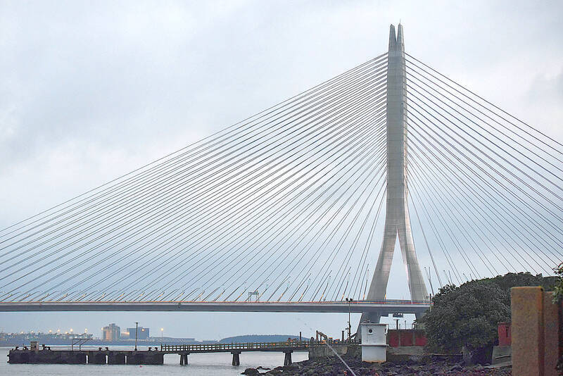
New Taipei City's Danjiang Bridge is to be closed to all traffic from 3 p.m. today as a precaution against Typhoon Champi. [1] Three MRT lines in the city would also suspend service from the same time. [1] The bridge at the mouth of the Tamsui River is particularly vulnerable to strong winds and sudden gusts. [1] While the bridge is closed, motorists traveling between Tamsui and Bali districts should use Guandu Bridge instead. [1] Strong winds could also affect Provincial Highways 61, 62, 64 and 65, where highway authorities are to impose traffic controls as conditions warrant. [1] Forecasts indicated that gusts in suburban parts of New Taipei City could reach levels 9 to 12 on the Beaufort scale this afternoon. [1] As some sections of the Danhai and Ankeng light rail lines and the Metro Sanying line run through open areas or on elevated tracks that are more exposed to strong gusts, the metro decided to suspend service on the three lines from 3 p.m. as a precaution. [1] Service could be suspended earlier if wind and rain worsen sooner than expected. [1]
What to watch next: The heaviest rainfall is expected from now through tomorrow morning, with the typhoon projected to weaken into a tropical storm by late tomorrow. [4]