Two New Islands Emerge Near Indonesia's Mount Anak Krakatau After September Eruptions Amid Natural Disasters
Two new islands have formed northwest and southeast of Mount Anak Krakatau in Indonesia's Sunda Strait following continuous eruptions in early September 2026, prompting updated hazard zones and restrictions after the volcano's alert level was downgraded to Level II amid natural disasters. The Geological Agency confirmed the islands' existence at 760 meters northwest and 495 meters southeast of Anak Krakatau's coast through mariner reports, volunteer accounts, and Sentinel satellite imagery analyzed as of Sept. 23, 2026. [1]
Formation of New Islands Near Mount Anak Krakatau
The Geological Agency of the Ministry of Energy and Mineral Resources has detected two new islands northwest and southeast of Mount Anak Krakatau in the Sunda Strait. Acting Head of the Geological Agency Lana Saria said the existence of the two new islands was confirmed through reports from mariners and volunteers, as well as an analysis of Sentinel satellite imagery as of Sept. 23. "New islands were detected 760 meters from the coast of Anak Krakatau in the northwest sector and 495 meters from the coast in the southeast sector. If connected by a straight line, they form a northwest-southeast alignment, with the main crater located between them," she said. [1]
Link to Recent Eruptive Activity
According to Lana, the formation of the new islands is believed to be closely linked to the continuous eruptions of Mount Anak Krakatau from Sept. 4 to 6, 2026. The 25-hour eruption during that period triggered a heavy lava flow that expanded the volcanic edifice by 32.8 hectares. [1] The islands formed in alignment with the main crater between them after the eruption produced heavy lava flows.

Two new islands formed northwest and southeast of Mount Anak Krakatau after September 2026 eruptions. — Source: gdelt
Geological Assessment by Experts
Anggota Ikatan Ahli Bencana Indonesia (IABI) Daryono stated that the new land consists of accumulated volcanic material such as ash, rocks, and lava rather than an independent new volcano. The process of accumulation occurs gradually with increased volcanic activity until the deposits surface above the water. Formation between Mount Anak Krakatau and Pulau Sertung is influenced by geological and oceanographic factors, including the shallow seabed in the ancient caldera from the 1883 eruption, which allows eruptive material to accumulate faster. Pyroclastic ejections and lava flows during eruptions are predominantly directed toward that sector. Ocean currents and waves in the Sunda Strait also play a role in moving light erosion sediment to calmer water points where it settles permanently. [2] Whether the land can enlarge or disappear depends on the balance between ongoing volcanic activity and natural erosion. Continued eruptions would supply new material to expand the land, and its durability would strengthen if coated with liquid lava that hardens into rock. If eruptions stop, wave impact and abrasion could erode the loose sand deposits until they submerge again. Submarine landslides or large explosive eruptions could also destroy the young structure quickly. For the land to qualify as a new independent volcano, three main geological conditions must be met: it must have an independent magma channel connected directly to the magma chamber through a new fracture separate from the parent crater; it must produce its own magmatic eruption activity by expelling magma or gas from its crater rather than merely receiving ejecta from the neighboring mountain; and it must have its own geological structure and deformation, including local volcanic earthquake activity or ground swelling centered directly beneath the new land. [2]
Updated Hazard Zones and Public Advisories
Following the downgrade of Mount Anak Krakatau's activity status from Level III to Level II effective Sept. 21, the Geological Agency issued updated hazard zones. The public and tourists are prohibited from entering within two kilometers of the main crater and within one kilometer of the two new islands. "We urge residents along the Banten and Lampung coasts to remain calm, ignore tsunami rumors, and follow safety instructions from the local Disaster Mitigation Agency (BPBD)," Lana added. [1] Residents in Banten and Lampung are urged to ignore tsunami rumors.
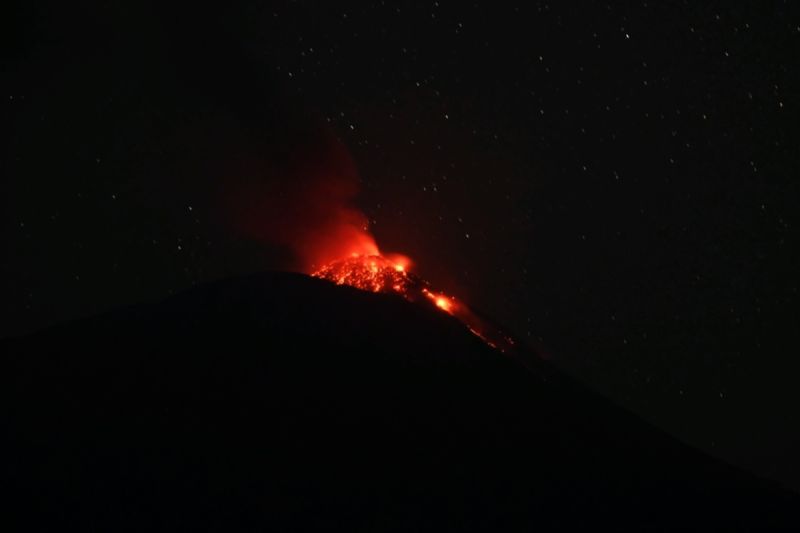
Government restricts tourism activities around Mount Ile Lewotolok in Lembata Regency. — Source: gdelt
Restrictions at Mount Ile Lewotolok
Authorities in Lembata Regency have restricted tourism, cultural events, farming, and other activities around Mount Ile Lewotolok, which remains at Level II, with a two-to-three kilometer exclusion zone in place. The Lembata Regency Government limited tourist and community activities in the Mount Ile Lewotolok area following increased volcanic activity. "Traditional and cultural activities involving mass gatherings in disaster-prone areas, tourism, including the Pesta Kacang, are temporarily postponed until further notice from the local government based on recommendations from PPGA-PVMBG," said Kanisius in a circular issued in Lewoleba. The restrictions were implemented as a mitigation step to protect the community from potential eruption hazards, hot clouds, material ejection, toxic gases, and rain lahars. Based on observations by the Ile Lewotolok Volcano Observation Post-Pusat Vulkanologi dan Mitigasi Bencana Geologi (PPGA-PVMBG) on 15 September 2026, the activity level of Mount Ile Lewotolok is at Level II or Alert. In addition to traditional and cultural activities, the local government also prohibits climbing, camping, and other activities within a two-kilometer and three-kilometer radius from the crater peak. Tourism managers were asked to temporarily close climbing routes and install prohibition signs to prevent people and tourists from entering areas potentially affected by volcanic activity. The government also prohibits farming, field cultivation, grass collection, and other economic activities within the designated danger zone. Kanisius asked sub-district heads and village heads in Ile Ape and Ile Ape Timur sub-districts to immediately socialize the circular to the community, traditional leaders, and tourism groups. Sub-district and village heads were also asked to conduct daily monitoring and reporting to the Pusat Pengendalian Operasi (Pusdalops) BPBD of Lembata Regency and prepare evacuation routes and gathering points if the volcano's status increases. "The public is asked to remain calm, not be provoked by issues, follow officers' directions, and immediately report to the village head or sub-district head if they see signs of increased volcanic activity," he said. The circular applies from the date of issuance until revoked based on the latest evaluation and recommendations from PPGA-PVMBG. [3]
Ongoing Monitoring and Recommendations
Although the emergence of the islands has been confirmed, the Geological Agency team still requires further data and analysis to determine whether they represent new eruption vents or accumulations of secondary eruptive material. [1] The community is advised not to be easily provoked by speculative issues circulating on social media. The emergence of new land is a common volcanic sedimentation process in active volcanic areas. The wisest step is to always filter information through official sources such as Pusat Vulkanologi dan Mitigasi Bencana Geologi (PVMBG). [2] Sub-district and village heads were asked to conduct monitoring and daily reporting to Pusdalops BPBD of Lembata Regency. [3]
What to watch next: Further data and analysis are still needed by the Geological Agency team, while communities should continue following recommendations from PVMBG and local BPBD offices.