Two New Islands Appear in Waters Around Indonesia’s Anak Krakatau After September Eruption Amid Natural Disasters
Two new islands have formed in the waters surrounding Indonesia’s Anak Krakatau volcano following its major 25-hour eruption in September that blanketed cities in ash, grounded flights and left more than 300,000 passengers stranded amid natural disasters. [1]
New Islands Emerge After Anak Krakatau Eruption in Natural Disasters
The new islands were identified in Sentinel satellite imagery, one located about 760 meters northwest and the other 495 meters southwest of Anak Krakatau in the Sunda Strait between Java and Sumatra. [1] It remains unclear whether the formations are emerging from the caldera base like Anak Krakatau itself or are simply deposits of volcanic material; they may erode and disappear over time as earlier landmasses did after 1927. [1] The islands were spotted in satellite images of the water-filled caldera in which Anak Krakatau stands, according to Rita Susilawati of the PVMBG Centre for Volcanology and Geological Hazard Mitigation. [1] “Based on an evaluation of Sentinel satellite imagery, two formations resembling small islands can be seen around Mount Anak Krakatau” in the Sunda Strait between the islands of Java and Sumatra, she added. [1] Sentinel is a fleet of Earth observation spacecraft developed by the European Space Agency. [1] Rita said it was too early to refer to the islands as “children” of Mount Anak Krakatau. [1] Further research was needed to determine if the new islands were emerging from the base of the caldera in a similar way than Anak Krakatau did, or whether they were formed by deposits of volcanic material. [1] In the case of Anak Krakatau, several landmasses briefly emerged starting in 1927 and then disappeared due to erosion before an enduring island formed in 1930. [1] The two new islands may similarly be eroded away over time. [1]
Context of Anak Krakatau’s September Eruption
Mount Anak Krakatau erupted for 25 hours nonstop in September, blanketing cities in volcanic ash and prompting multiple airports to close. [1] More than 300,000 passengers were left stranded. [1] Rita said Anak Krakatau was at alert Level 2, the second lowest out of four danger categories. [1] People are advised not to approach within 3 km of the eruption center. [1] Five journalists on a mission to cover the September eruption were declared presumed dead, along with three boat crewmembers, nearly two weeks after the vessel they were traveling in disappeared without a trace. [1]
Two new islands formed in waters near Anak Krakatau after its September eruption. — Source: gdelt
Geological Background of the Krakatau Caldera
Rita said it was too early to refer to the islands as “children” of Mount Anak Krakatau — which itself was formed by an underwater eruption in the caldera or depression left behind after the massive 1883 blowout of the original Krakatau volcano. [1] “Anak” means child in Bahasa Indonesia. [1] In the case of Anak Krakatau, several landmasses briefly emerged starting in 1927 and then disappeared due to erosion before an enduring island formed in 1930, she added. [1]
Latest Eruption at Gunung Marapi
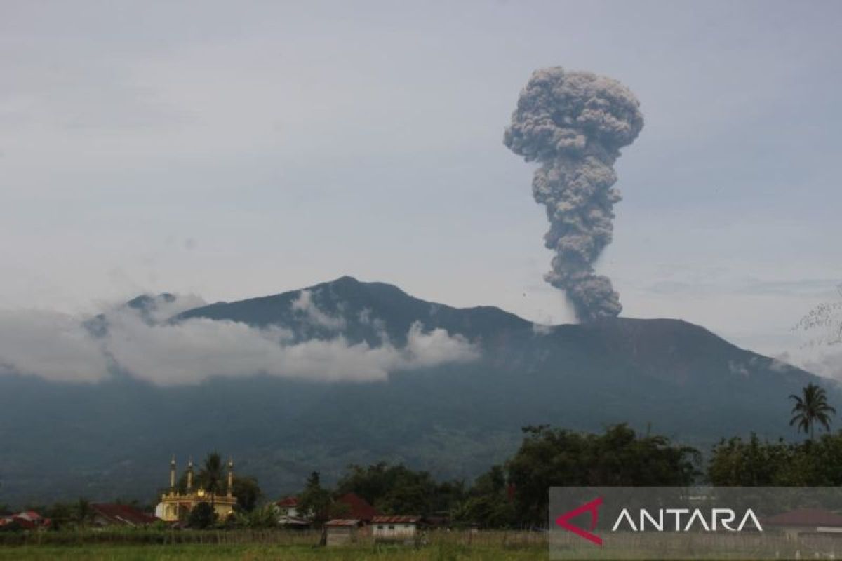
Gunung Marapi in West Sumatra erupted on 1 October 2026 at 10:00 WIB, its 63rd eruption of the year, with seismic recordings showing an amplitude of 19.5 mm and duration of 27 seconds although the ash column was obscured by clouds. [2] The eruption was recorded on a seismograph even though the ash column could not be observed visually due to cloud cover at the summit. [2] The seismic recording showed maximum amplitude of 19.5 millimeters with the duration of the eruption earthquake around 27 seconds. [2] The distribution of volcanic ash was observed heading toward the southern part of Gunung Marapi, namely the areas of Padang Panjang City and Tanah Datar Regency. [2] PGA Marapi recorded the eruption as the 63rd eruption event throughout 2026. [2] Gunung Marapi remains at Level II (Waspada) status. [2]
Ongoing Hazard Management and Public Advisories
Both volcanoes remain at alert Level II (Waspada); authorities prohibit approach within 3 km of each crater and warn residents downstream of lahar risk during rainfall as well as the need to wear masks and protect against ashfall. [1][2] People are advised not to approach within 3 km of the eruption center at Anak Krakatau. [1] Residents, climbers, visitors, and tourists are prohibited from entering or carrying out activities within a three-kilometer radius of Kawah Verbeek, the center of the eruption at Gunung Marapi. [2] Communities and tourists are asked to continue to pay attention to safety provisions that apply in the Gunung Marapi area and avoid areas around the center of volcanic activity. [2] People living around valleys, flow paths, and river banks originating from the peak of Gunung Marapi are asked to increase vigilance against potential lahar, especially when it rains in the peak area. [2] Residents are urged to use masks to protect the nose and mouth from exposure to volcanic ash that can trigger respiratory problems, and to use eye and skin protection if ash rain occurs. [2] In addition, people are asked to secure clean water supplies and clean volcanic ash that accumulates on house roofs to reduce the risk of building damage. [2] People are advised not to spread unverified information and to follow official information and directions from the local government. [2]
Indonesia’s Position on the Ring of Fire
Indonesia sits on the Ring of Fire, where the meeting of continental plates causes high volcanic and seismic activity. [1]
What to watch next: Further research on whether the new islands are emerging from the caldera base or are deposits of volcanic material, along with continued monitoring of both volcanoes at Level II alert with the 3 km exclusion zones in place.






/wz.lviv.ua/images/news/_cover/559377/img4437.webp)