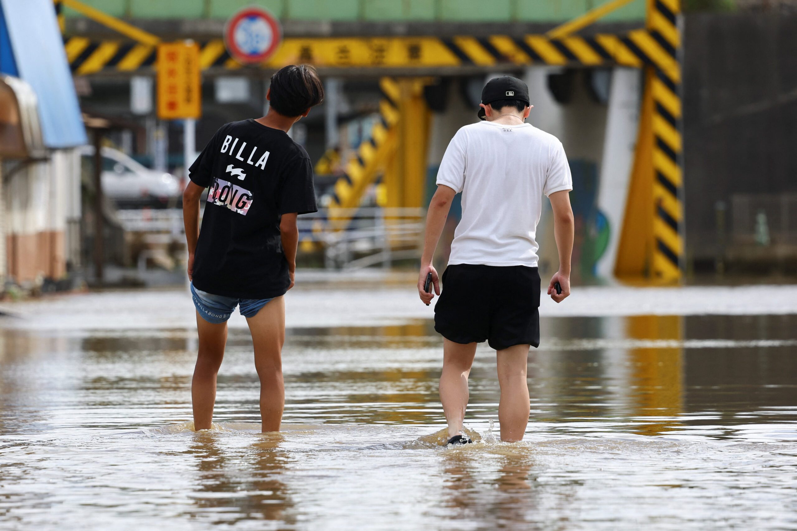

Record Japan Rains Kill Eight and Strand 7,000 at Narita Airport
Record rainfall in Japan killed eight people, stranded thousands at Narita airport and caused widespread flooding and power outages in Chiba, while severe thunderstorms and heatwaves struck parts of the US, Europe and the Netherlands.
Deadly Record Rains Hit Japan
More than 360 mm of rain fell in 24 hours in parts of Chiba adjoining Tokyo, the highest since October 2013, leading to floods, power outages for 20,000 homes, gas cuts to nearly 13,000 and eight deaths including one in a submerged vehicle. [2] The eight dead included one person trapped in a submerged vehicle, public broadcaster NHK said, citing Chiba authorities and police. [2] Record rainfall stranded thousands of travellers at Tokyo’s Narita airport on Friday, bringing floods to the surrounding area that disrupted transport, knocked out power to 20,000 homes and killed eight. [2] During one of Japan’s busiest holiday weeks, more than 360 mm of rain fell in 24 hours in parts of the Chiba area adjoining Tokyo, inundating roads and railways, with soldiers sent to help with rescue efforts. [2] “This case was an extremely unusual situation,” Chiba Governor Toshihito Kumagai told reporters. “I have responded to many disasters in the past, but I have never experienced a case like this.” [2] In Chiba city, one of the worst-hit spots, hundreds of people spent the night under foil blankets at makeshift evacuation centers in government buildings. [2] Some major highways in Chiba were shut, forcing drivers to take alternative routes that clogged traffic, said highway operator NEXCO East. [2] Several rail services were also suspended on Friday, though some services from Narita to Tokyo resumed, easing congestion at the international transport hub. [2] Weather authorities said the 367 mm of rain over a 24-hour period in Chiba exceeded the previous record of 309 mm set in October 2013. [2]
Narita Airport Chaos
At Narita airport, about 7,000 passengers were stranded overnight with staff distributing sleeping bags, water and snacks; most flights were expected to operate normally the next day. [2] Passengers queued to enter the train station after train lines and public transportation services were suspended due to heavy rain at the Narita International Airport. [2] At Narita, airport staff distributed sleeping bags, water and snacks to hundreds of passengers, many of whom had bedded down on Thursday after transport disruptions stranded about 7,000 people, causing widespread chaos. [2] “I queued for a taxi, but the wait was four hours,” said Minoru Yamasaki, a 48-year-old Chiba resident returning from holiday, who had booked a hotel only to be told it could not put him up. [2] With nowhere else to go, he returned to the airport. [2] An airport spokesperson said most flights were expected to operate normally on Friday. [2] More than 20,000 homes were without power in the early hours of Friday, after rain flooded a power substation, utility Tokyo Electric Power said, while gas supply to nearly 13,000 was temporarily cut. [2] Local residents walked in a flooded area after heavy rain in Oamishirasato, Chiba Prefecture. [2]
Severe Thunderstorms Strike US Midwest
Severe thunderstorm warnings were issued for Hancock County, Illinois, with 60 mph wind gusts moving east at 15 mph from Plymouth, threatening damage to roofs, siding and trees in Augusta and Bowen. [1] At 1238 AM CDT, a severe thunderstorm was located over Plymouth, or 13 miles southeast of Carthage, moving east at 15 mph. [1] Hazard included 60 mph wind gusts with radar indicated as the source. [1] Impact expected damage to roofs, siding, and trees. [1] Locations impacted include Augusta and Bowen. [1] A separate severe thunderstorm warning covered northwestern Leavenworth County, Kansas, with 60 mph gusts moving east at 20 mph from Oskaloosa, threatening similar damage in Leavenworth, Easton and Jarbalo. [4] The National Weather Service in Pleasant Hill issued a Severe Thunderstorm Warning for northwestern Leavenworth County in northeastern Kansas until 1245 AM CDT. [4] At 1213 AM CDT, a severe thunderstorm was located over Oskaloosa, moving east at 20 mph. [4] Hazard included 60 mph wind gusts with radar indicated as the source. [4] Impact expected damage to roofs, siding, and trees. [4] Locations impacted include Leavenworth, Easton, and Jarbalo. [4]
Europe's Heatwaves Visible From Space
Western Europe experienced its hottest June-to-July on record with satellite imagery showing shrunken Alpine glaciers, scorched wildfire areas, arid fields and low river levels on the Danube and Rhine. [3] Satellite images examined by BBC Verify show shrunken glaciers, scorched areas left by wildfires, green fields turned arid and lower river levels. [3] The EU's climate monitoring service, Copernicus, has confirmed that western Europe experienced its hottest June-to-July period on record. [3] The waters of the Danube, Europe's second-longest river, have dropped to their lowest levels for 30 years in several countries. [3] This has led to unusual discoveries on the river bed, including the bones of a mammoth in Bulgaria and a sunken WW2 warship in Serbia. [3] On the Rhine, some cargo vessels have been left stranded and river cruises have been cancelled. [3] Ongoing measurements suggest this summer could become one of the worst ever recorded for melting Alpine glaciers, with more than a month of the season still to go. [3] Satellite imagery suggests much of the front of Rhône Glacier in Switzerland has retreated by 50m or more since the same time last year. [3] More than 90,000 hectares has burned in France, already its worst year on record according to the European Forest Fire Information System. [3] The largest fire in Gironde region burnt about 42,000 hectares of land. [3] The Normalised Difference Vegetation Index this summer came in below a five-year benchmark of 2021 to 2025 across about 70% of France. [3] Close to half the UK and roughly 40% of western Germany showed the same. [3] In the worst-affected areas, soil moisture is lower than on about 98% of comparable dates in the historical record. [3]
Fifth Heatwave Grips Netherlands
The Netherlands issued a yellow heat warning as temperatures hit 35C, marking the fifth heatwave this year, with people cooling off in outdoor pools. [5] The Royal Netherlands Meteorological Institute issued a yellow heat warning on Aug. 14, 2026, as temperatures reached 35 degrees Celsius, marking the fifth heatwave in the Netherlands this year. [5] People cooled off in an outdoor swimming pool in Delden. [5] A man jumps into an outdoor swimming pool in Delden. [5] A woman jumps into an outdoor swimming pool in Delden. [5]
Broader Context of Extreme Weather
The immediate cause of the heatwaves has been persistent high-pressure weather systems bringing clear, sunny skies and allowing temperatures to build, according to the Met Office. [3] But climate change, mainly due to the burning of fossil fuels, has been raising average temperatures for decades and making hot spells much more likely and intense. [3] Dr Lander van Tricht said in recent years climate change has led to much less snow in winter and much more melt in summer. [3] Dr Douglas Kelley tells us extreme wildfires are becoming more and more frequent as climate change is creating ideal conditions, with higher temperatures drying out vegetation and soils faster. [3] Prof Andrew Challinor said the images were consistent with widespread water stress, which does not bode well given much of Europe's land is covered by crops. [3] Prof Luis Samaniego warns even if rain returns, some of the agricultural damage may already have been done. [3]
What to watch next: Most flights at Narita were expected to operate normally the next day while the severe thunderstorm warnings in Illinois and Kansas remained active with 60 mph wind gusts.






