
Puracé Volcano Swarm of 58 Earthquakes Triggers Colombian Monitoring Alert Amid Natural Disasters
Multiple volcanoes around the world exhibited increased seismic activity or eruptions in late August 2026 amid natural disasters, including earthquake swarms at Colombia's Puracé volcano, ash emissions at Indonesia's Lewotobi Laki-laki and ongoing activity at Merapi, while researchers continued monitoring potential signs of unrest at Germany's Laacher See and discovered metal-rich fluid zones beneath the Caribbean's Soufrière Hills.
Overview of Recent Volcanic Activity
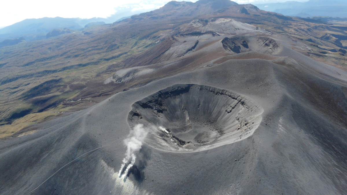
Colombia's Servicio Geológico Colombiano recorded a swarm of 58 volcano-tectonic earthquakes at Puracé, the largest measuring magnitude 4.1 at 9.4 km depth, caused by rock fracturing inside the volcanic edifice with no changes in other monitoring parameters. [1] Indonesia's Mount Lewotobi Laki-laki erupted on 28 August 2026 at 7:35 a.m. local time, producing a 1 km ash column for over six minutes; it remains at Alert level with a 5 km exclusion zone. [3] Indonesia's Mount Merapi recorded 16 lava avalanches and 19 hybrid earthquakes in a six-hour period on 30 August 2026, with white gas plumes rising 25 m; it stays at Level III with defined hazard zones for pyroclastic flows and lahars. [4] Germany's Laacher See showed over 500 micro-earthquakes between September 2022 and August 2023 plus a 92-event swarm in October 2025 at 12-14 km depth, interpreted as deep low-frequency events indicating magmatic fluid movement, though no imminent eruption is expected. [2] Seismic imaging at the Caribbean's Soufrière Hills volcano revealed a 1-1.5 km wide zone of metal-rich magmatic brine approximately 2 km beneath the surface. [5]
Seismic Swarm at Puracé Volcano in Colombia
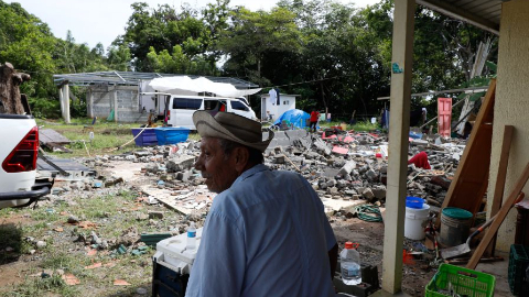
The sector of the San Rafael valley and its surroundings in the department of Cauca experienced a day of seismic alert after an increase in tremors in the area of influence of the Puracé volcano. [1] The phenomenon, which is part of the Los Coconucos volcanic chain, activated the monitoring protocols of environmental authorities and risk management in the southwest of the country. [1] The Servicio Geológico Colombiano confirmed that the seismicity responds to volcano-tectonic events, a physical process that originates internally due to the fracturing of rock within the volcanic edifice. [1] The movements generated fear and uncertainty among residents of the area adjacent to the volcano and were even felt in Popayán and nearby towns. [1] Monitoring stations detected a total of 58 seismic events located mainly 11 kilometers northeast of the main crater, with an average depth of 9 kilometers. [1] The official report detailed the magnitude of the most representative earthquakes recorded during this episode, including a main event that reached a magnitude of 4.1 at 06:18 p.m., located at 9.4 kilometers depth in the San Rafael valley sector. [1] Additional events included one of magnitude 3.9, one of magnitude 3.1, one of magnitude 2.8, another of magnitude 3.1 and one of magnitude 2.8. [1] Residents of the municipalities of Puracé, Totoró and the city of Popayán reported having felt several of these tremors. [1] The technical entity specified in its extraordinary bulletin that at the moment no changes have been detected in the other volcanic monitoring parameters. [1] The SGC will continue to monitor any change and will inform in a timely manner. [1] The entity emphasized the importance of remaining calm and turning exclusively to institutional sources to avoid the spread of rumors. [1] It recommended that citizens closely follow the daily and extraordinary bulletins published on its official channels and urged strict compliance with instructions issued by local, departmental authorities and the Unidad Nacional para la Gestión del Riesgo de Desastres. [1]
Eruption of Lewotobi Laki-laki in Indonesia
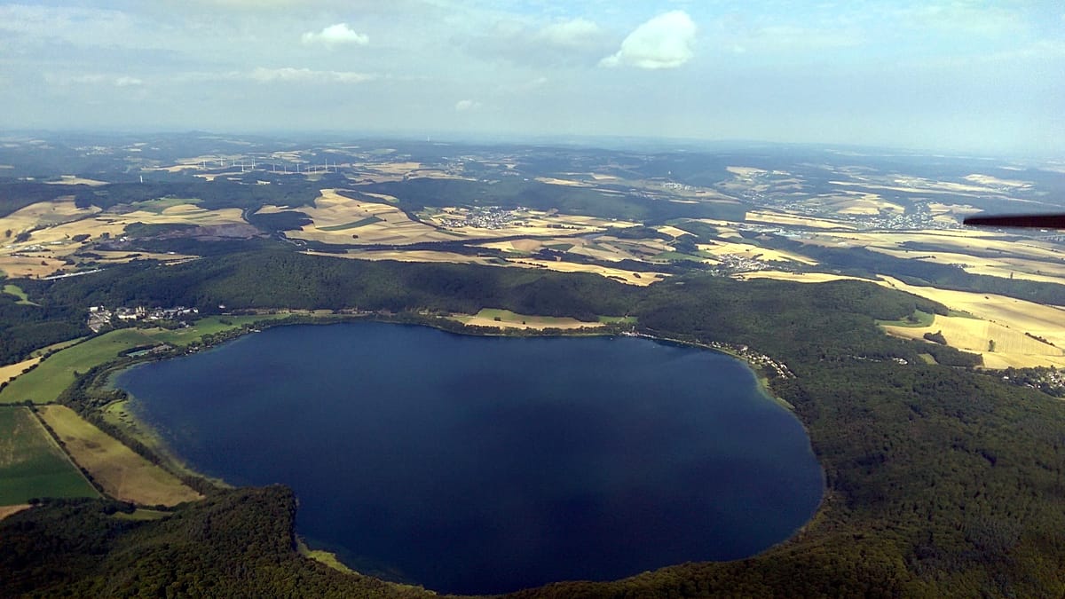
German researchers monitor Laacher See volcano for potential future eruption. — Source: gdelt
Mount Lewotobi Laki-laki in East Flores, East Nusa Tenggara, erupted on Friday morning, sending an ash column about 1 km above its peak during an eruption lasting six minutes. [3] Lana Saria, head of the Geological Agency at the Energy and Mineral Resources Ministry, said the eruption occurred at 7:35 a.m. local time, sending thick ash southwest and west. [3] The eruption was recorded on a seismogram with a maximum amplitude of 14.8 mm and lasted about six minutes and four seconds. [3] Lewotobi Laki-laki is currently at Level III, or Alert, and residents and tourists are prohibited from conducting activities within five km of the eruption center. [3] The Geological Agency urged residents near the volcano to wear masks or cover their noses and mouths to protect against the respiratory hazards posed by volcanic ash. [3] Residents were also urged to watch for rain-triggered lahars along rivers originating from the summit during heavy rain, particularly around Dulipali, Padang Pasir, Nobo, Nurabelen, Klatanlo, Hokeng Jaya, Boru and Nawakote. [3] The agency urged residents to remain calm, avoid unverified information and follow instructions from local authorities and the Lewotobi Laki-laki monitoring post in East Flores. [3] The Center for Volcanology and Geological Hazard Mitigation will coordinate with the East Nusa Tenggara disaster agency and local authorities to provide information on Lewotobi Laki-laki's activity. [3]
Ongoing Activity at Merapi Volcano
Gunung Merapi experienced 16 lava avalanches with amplitudes of 2-13 mm and durations of 35.98-178.82 seconds. [4] In addition, 19 hybrid earthquakes with amplitudes of 2-26 mm, S-P of 0.3-0.4 seconds and durations of 21.11-51.82 seconds were recorded. [4] This is based on the latest report from BPPTKG Yogyakarta during the observation period until this morning on 30 August 2026, from 00:00-06:00 WIB. [4] The Balai Penyelidikan Pengembangan Teknologi Kebencanaan Geologi continues to set Level III for the active volcano on the border between DIY and Central Java. [4] Visually, the volcano was clearly visible with white smoke from the main crater of thin intensity rising about 25 meters from the peak. [4] Weather was observed clear, wind weak to the east, air temperature around 15.7-17°C, humidity 87.6-90 percent and air pressure 874.5-918 mmHg. [4] Recommendations include potential hazards of lava avalanches and pyroclastic flows in the south-southwest sector covering the Boyong River up to a maximum of 5 km, Bedog, Krasak, Bebeng rivers up to a maximum of 7 km, and in the southeast sector covering the Woro River up to a maximum of 3 km and Gendol River 5 km. [4] Ejection of volcanic material in the event of an explosive eruption could reach a radius of 3 km from the peak. [4] Monitoring data shows that magma supply is still ongoing which can trigger pyroclastic flows within the hazard area. [4] The public is advised not to carry out any activities in the hazard area and to be alert to the danger of lahars and pyroclastic flows especially when it rains around Mount Merapi. [4] The public is also urged to anticipate disturbances due to volcanic ash from the eruption of Mount Merapi. [4] If there is a significant change in activity, the activity level of Mount Merapi will be reviewed immediately. [4]
Monitoring and Research at Laacher See in Germany
Between September 2022 and August 2023 researchers recorded over 500 micro-earthquakes with several measuring stations. [2] In October 2025 another slight increase in earthquake activity was noted in the East Eifel area with a swarm of around 92 small micro-earthquakes within twelve hours in the night to 10 October 2025. [2] The strongest quake reached just 0.9 on the earthquake scale. [2] These movements are called Deep-Low-Frequency events and are seen as an indication that magmatic fluids are moving at great depth. [2] In about 12 to 14 kilometers depth magmatic fluids are said to accumulate according to the study. [2] These fluids can be water, oxygen, sulfur compounds or halogens that escape from a rock melt. [2] They control how explosively a volcano erupts and trigger earthquakes in the subsurface. [2] Four spatially limited groups of such DLF earthquakes have been detected in the East Eifel in the past five years. [2] Current volcanic activity is not expected by the researchers. [2] Datings of the magmas ejected in the last eruption 12,900 years ago show that the filling of the upper magma chamber under the Laacher See could have taken about 30,000 years before the eruption occurred. [2] The ascent of magma into the shallow earth's crust is usually accompanied by high-frequency earthquake swarms, an activity that has not been observed in the East Eifel so far. [2] There are also no indications of uplift of the earth's surface that would have to be clearly detectable in the case of massive magma ascent. [2] In addition to the small quakes there are further indications of ongoing CO2 degassing from the mantle. [2] In 2024 the GFZ carried out RMT measurements at two locations in the vicinity of the Laacher See where the escape of CO2 gases of magmatic origin could be detected. [2]
Scientific Discovery at Soufrière Hills Volcano
Under the active Soufrière Hills volcano in the Caribbean, scientists detected a zone of fluids saturated with metals. [5] A team from the University of Oxford described in Geophysical Research Letters that the discovery could be of great importance for future raw material extraction and for research into geothermal energy. [5] Researchers identified an underground area containing hot, saline magmatic fluids that can transport important metals used in modern technologies. [5] The team used seismic data from earthquakes recorded in the same area between 1996 and 2007 by 23 monitoring stations. [5] On this basis they reconstructed a three-dimensional image of the interior of the volcano. [5] Faster P waves and slower S waves were key because both types of waves pass differently through rocks, liquids and molten magma. [5] This allowed researchers to distinguish areas built of solid rock from those filled with fluid. [5] The resulting map showed not only the arrangement of magma under the volcano but also a solid volcanic core, areas with circulating and heated geothermal fluids and a shallower layer of clay altered by these fluids. [5] The most interesting result concerns a zone located about 2 km below the surface with a diameter of 1 to 1.5 km containing fluid rich in metals in the form of strongly saline magmatic brine. [5] Such a subsurface reservoir could represent the beginning of a new deposit. [5] The researchers emphasized that such subvolcanic brines have great economic importance because they can transport critical metals. [5] At this stage it is still necessary to determine which elements are present in this zone and in what concentration. [5] The result is also important because it shows a new method for searching for potential resources without drilling, using analysis of seismic waves. [5] The three-dimensional model of the interior of the volcano agrees with previous models, which strengthens the credibility of this technique. [5] Scientists pointed out that volcanoes are not only a source of geothermal energy but can also supply metals needed for modern technologies and the transformation towards a low-emission economy. [5]
What to watch next: The Center for Volcanology and Geological Hazard Mitigation will coordinate with the East Nusa Tenggara disaster agency and local authorities to provide information on Lewotobi Laki-laki's activity while the SGC will continue to monitor any change at Puracé and inform in a timely manner.