
Peru Earthquake Injures Three and Damages Dozens of Buildings
A magnitude 6.7 earthquake struck near Aniso in Peru's southern Ayacucho region on Thursday, injuring at least three people, damaging dozens of homes and schools, and causing power outages across thousands of properties. [1]
Overview of the Earthquake
The Peru earthquake struck at around 13:00 local time at a depth of approximately 100 km, 31 km northwest of Aniso, with tremors felt as far as Lima 482 km away. [1] The US Geological Survey recorded the event as magnitude 6.7, while the Geophysical Institute of Peru initially recorded the quake as magnitude 7.2. [5] Data from the USGS showed the epicenter in a relatively remote part of the Andes mountain range. [1] The head of the Geophysical Institute of Peru noted that the depth of the quake prevented major damage. [5] Tremors reached an intensity of III-IV on the modified Mercalli scale in the Coracora area according to reports from the National Seismological Center. [2]
Reported Damage and Injuries
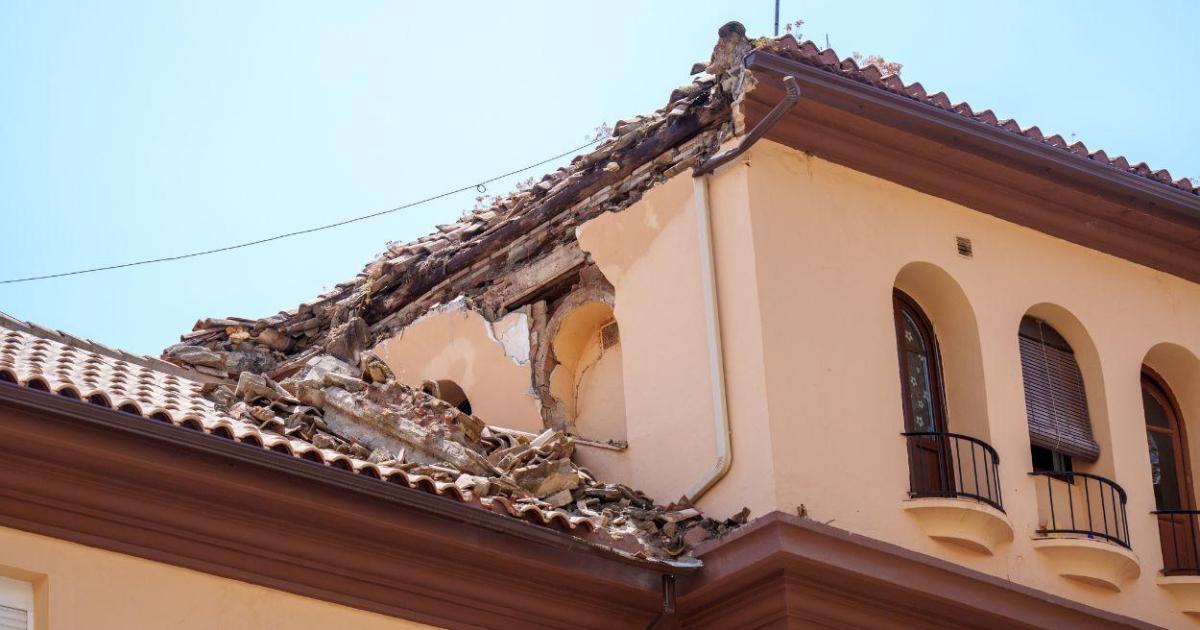
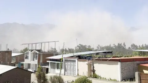
Peru's defence minister reported 22 homes and six schools damaged, while the National Institute of Civil Defence noted damage to 10 healthcare facilities in Ayacucho and two in Cusco, all of which remained operational. [1] Around 9,000 properties lost power; three people were injured but did not suffer serious injuries. [1] The defence minister stated that the three injured individuals did not require serious medical attention following the Peru earthquake. [1] Nine educational facilities were also listed among the damaged structures in the official count. [1] Dust filled the air in Pausa, a settlement about 74 km from the epicenter, as residents assessed the immediate effects. [1]

A magnitude 7.2 earthquake struck southern Peru near Aniso in the Ayacucho region. — Source: gdelt
Seismic Context and Regional Activity
Peru lies at the boundary of the Nazca and South American tectonic plates, making it prone to seismic activity; the event follows recent strong quakes in Colombia and Venezuela. [1] The country experiences high seismic activity primarily due to the interaction of the Nazca and South American plates. [2] A magnitude 7.4 earthquake struck Colombia on 10 August, prompting a state of emergency, with the death toll exceeding 300 people according to local authorities. [1] Venezuela was hit by twin earthquakes on 24 June, with magnitudes of 7.2 and 7.5 recorded just 39 seconds apart, resulting in more than 6,000 deaths according to local officials. [1] The South American country sits in the Pacific Ring of Fire, where approximately 85 percent of the world's seismic activity occurs. [5]
Official Response and Assessments
Peru's defence minister Rafael Belaunde coordinated the emergency response and confirmed the limited injuries from the Peru earthquake. [1] The head of the Geophysical Institute of Peru, Hernando Tavera, told local radio that the population went out to the streets out of concern but there is no impact. [5] The National Institute of Civil Defence confirmed that all damaged healthcare facilities remained operational despite the reported issues. [1] Experts attributed the limited damage to the quake's depth, which reduced the intensity felt at the surface. [5] The defence minister noted that services at affected sites continued without interruption. [1]

A magnitude 6.7 earthquake struck near Aniso in Peru's Ayacucho region injuring three people and damaging dozens of buildings. — Source: cyprusmail
Aftershocks and Ongoing Monitoring
The report of this event follows other movements registered during the latest hours in the country, including a magnitude 3.6 earthquake at 08:29:59 local time west of Ocoña in Camaná, Arequipa. [2] The Geophysical Institute of Peru recommends maintaining a culture of prevention and having a family emergency plan due to the nation's seismic setting. [2] Magnitude and intensity are distinct parameters, with magnitude quantifying the energy released and intensity describing the effects and perception of movement at a specific location. [2] A magnitude 4.4 earthquake was recorded at a depth of 86 km, 17 km south-southwest of Tambo, Peru, as part of ongoing seismic monitoring. [4]
Expert Analysis on Limited Impact
The depth of approximately 100 km helped limit surface effects during the Peru earthquake, according to assessments from the Geophysical Institute of Peru. [5] Officials emphasized that the remote location of the epicenter contributed to fewer widespread impacts than might occur in more populated zones. [1] The initial magnitude reading of 7.2 from the Geophysical Institute of Peru was later aligned with the 6.7 figure from international measurements, highlighting differences in reporting methods. [5] No major structural collapses were reported, consistent with the depth and the resulting lower intensity in affected communities. [1]