
Magnitude 4.9 Quake Strikes Near Union in the Philippines During Earthquakes Today
Multiple earthquakes ranging from magnitude 3.0 to 4.9 struck several regions worldwide on August 30, 2026, including areas south of the Fiji Islands, the Philippines, Chile/Peru border, and Venezuela, while aid distribution continued for victims of a prior major quake in Indonesia's East Nusa Tenggara. [1] [2] [3] [4] [5] Earthquakes today produced a series of moderate events that drew attention from monitoring agencies and local residents across distant locations.
Recent Earthquakes Reported Across Multiple Regions
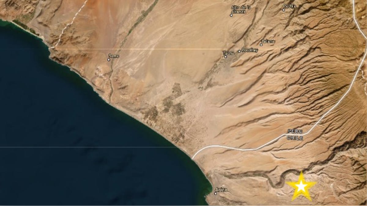
A magnitude 4.5 earthquake occurred south of the Fiji Islands at a depth of 508.3 km. [1] A magnitude 4.9 earthquake struck 13 km SSE of Union in the Philippines at a depth of 83.9 km. [2] A magnitude 4.7 earthquake with epicenter in Chile was felt in Tacna, Peru, at a depth of 108 km and intensity II-III on the Mercalli scale. [3] A magnitude 3.0 earthquake hit 4 km west of La Guaira, Venezuela, at a depth of 12.3 km; some residents felt it or received phone alerts, with no reported damage. [4] These events unfolded on the same day that aid efforts advanced in Indonesia following an earlier disaster. [5] The spread of activity across the Pacific and Caribbean regions highlighted ongoing seismic monitoring by agencies such as the USGS and national geophysical institutes. [1] [2] [3] [4] Each quake varied in depth and felt intensity, yet none produced immediate reports of widespread structural harm in the initial assessments from the sources.
Details of the Tacna-Peru / Chile Border Quake
The magnitude 4.7 event registered at 11:04 in the morning with its epicenter located in Chile, 50 km southeast of Tacna. [3] The quake reached a depth of 108 km and produced an intensity of II-III on the Mercalli scale in Tacna, allowing some people inside buildings to notice the shaking. [3] Authorities from the Instituto Geofísico del Perú noted the motion could be perceived by residents in homes. [3] The Instituto de Defensa Civil recommended keeping an emergency backpack ready, staying calm, moving away from windows and objects that might fall, and sheltering beside structural columns or walls if evacuation is not possible. [3] Public response included residents following these guidelines while the event remained moderate enough that no major damage reports emerged from the affected area. [3] The timing during daylight hours contributed to the limited but noticeable perception among those indoors at the time. [3]
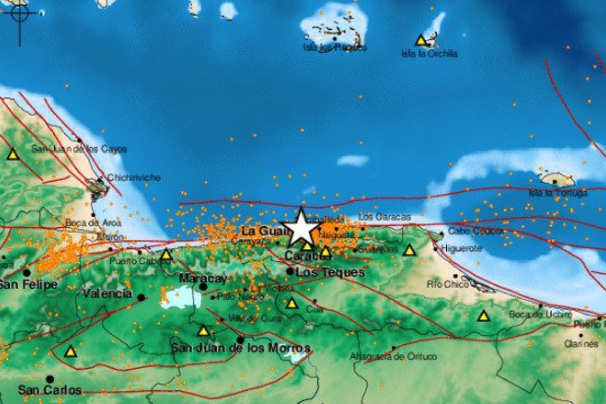
Funvisis reported a magnitude 3.0 earthquake 4 km west of La Guaira, Venezuela. — Source: gdelt
Venezuela Tremor and Ongoing Seismic Activity
A magnitude 3.0 earthquake occurred at 3:44 in the afternoon with its epicenter 4 km west of La Guaira and 14 km northwest of Caracas. [4] The event registered at a depth of 12.3 km according to Funvisis. [4] Some social media users reported feeling the tremor in zones of La Guaira, Caracas, and Miranda, while others noted only the sound or received alerts through Android systems and related applications without sensing motion. [4] No damage or injuries were reported from this event. [4] Context from prior activity included a double earthquake on June 24 that became the deadliest of 2026 worldwide with more than 6,500 fatalities, followed by more than 1,700 aftershocks as the crust readjusted. [4] Experts described these aftershocks as occurring in the same general region with reduced force. [4] The latest tremor added to the sequence of smaller movements that kept residents attentive to alerts amid afternoon rainfall in the capital area. [4]
Aid Distribution Progress in Indonesia
A total of 1,954 tons of aid had been delivered to communities affected by the earthquake in East Nusa Tenggara. [5] The National Disaster Mitigation Agency recorded 1,953,849 kilograms received between August 15 and 30, 2026, with distribution reaching 98.39 percent through centers in Maumere and Labuan Bajo. [5] Breakdown of the logistics showed 565 tons distributed by air by the Indonesian Air Force, 1,065 tons from the Ready-to-Use Fund, 179 tons by ship, and 145 tons by land or truck. [5] An additional 21 tons left Halim Perdanakusuma National Logistics Support Post on Sunday morning bound for Labuan Bajo, arriving at 8:57 a.m. Western Indonesia Time and containing basic food packages, medicines, instant noodles, mineral water, rice, toiletries, baby kits, clothing, and stationery. [5] The number of evacuees stood at 188,161 as of August 30, down 4,142 from the previous day. [5] The death toll from the magnitude 7.7 earthquake on Flores Island remained at 111 as of August 28. [5]
Evacuee Numbers and hardest-Hit Districts
The largest concentrations of evacuees were recorded in Manggarai District with 50,556 people and Nagekeo District with 50,574 people. [5] Additional districts with sizable numbers included East Manggarai, West Manggarai, Ngada, Sikka, and Ende. [5] Manggarai District reported the highest number of fatalities at 45, followed by East Manggarai with 38 and Nagekeo with 13, accounting for the total of 111 deaths. [5] Thousands of aftershocks continued to affect the region. [5] The reduction in evacuee numbers reflected ongoing movement of supplies and coordination through the distribution centers. [5]
What to watch next: Continued aftershocks in East Nusa Tenggara and further aid shipments through Maumere and Labuan Bajo remain under monitoring by the National Disaster Mitigation Agency.