
Hurricane Tracker Updates Show Severe Thunderstorms and Flash Floods Hit US States
The hurricane tracker is following multiple severe thunderstorm warnings and a flash flood warning issued across parts of the United States amid a broader pattern of extreme weather including heatwaves, drought and wildfires affecting Britain.
hurricane tracker Active Severe Weather Warnings in the US
A severe thunderstorm with 60 mph wind gusts and quarter-size hail was located near Doland, South Dakota, moving east at 20 mph, threatening hail damage to vehicles and wind damage to roofs, siding and trees. [1] A separate severe thunderstorm with 60 mph wind gusts and quarter-size hail was located near Maxwell, Nebraska, moving east at 25 mph, with a 57 mph gust previously reported. [2] A flash flood warning was issued for western Cobb County and northeastern Douglas County in Georgia due to thunderstorms producing 2-4 inches of rain with an additional 1-2 inches possible. [4] These alerts form part of the hurricane tracker coverage of active conditions that also encompass broader extreme weather patterns reported in Britain.
South Dakota Thunderstorm Threat
A severe thunderstorm warning covers West Central Clark County in northeastern South Dakota and Southeastern Spink County in northeastern South Dakota until 100 AM CDT. [5] At 1213 AM CDT a severe thunderstorm was located over Glendale Colony, or 15 miles east of Redfield, moving northeast at 25 mph. [5] Hazard details include 60 mph wind gusts and half dollar size hail according to radar indications. [5] Expected impacts cover hail damage to vehicles along with wind damage to roofs, siding and trees. [5] The storm was earlier noted near Doland or 19 miles east of Redfield moving east at 20 mph with 60 mph wind gusts and quarter size hail. [1] Radar sources indicated the threat would reach Camrose Colony around 1240 AM CDT, Hillside Colony around 1245 AM CDT, Doland around 1250 AM CDT, and Clark Colony and Raymond around 1255 AM CDT. [1]
Nebraska Storm Details
A severe thunderstorm warning applies to locations including Brady, Maxwell, Keith, and Cottonwood Canyon State Wildlife Management Area. [2] At 1238 AM CDT a severe thunderstorm was located near Maxwell or 12 miles east of North Platte moving east at 25 mph. [2] The hazard consists of 60 mph wind gusts and quarter size hail based on radar data. [2] A 57 mph gust was reported at 1216 AM CDT 6 miles west northwest of Maxwell. [2] Impacts are expected to include hail damage to vehicles and wind damage to roofs, siding and trees. [2]
Flash Flooding in Georgia
The National Weather Service in Peachtree City issued a flash flood warning for western Cobb County in north central Georgia and northeastern Douglas County in north central Georgia until 715 AM EDT. [4] At 119 AM EDT Doppler radar indicated thunderstorms producing heavy rain across the warned area. [4] Between 2 and 4 inches of rain have fallen with additional rainfall amounts of 1 to 2 inches possible in the warned area. [4] Flash flooding is ongoing or expected to begin shortly. [4]
Britain's Extreme Heat and Drought
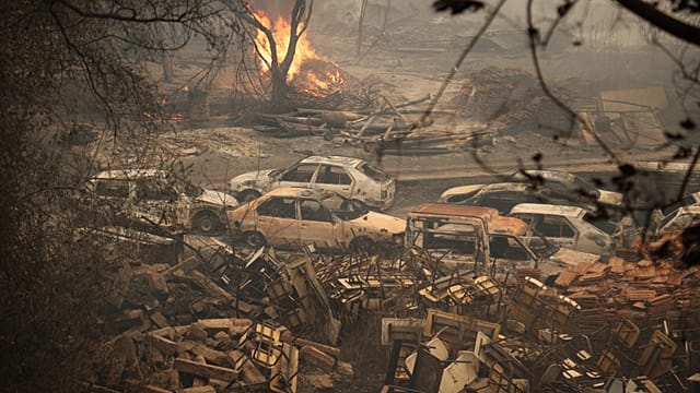
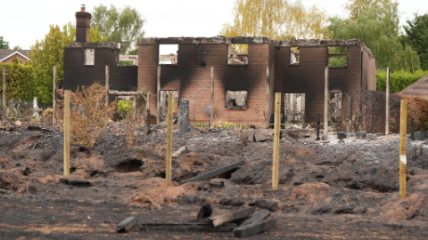
Britain has experienced five heatwaves in 2026 so far with its driest July on record featuring only 6.5 mm of rain. [3] This has resulted in about 20 percent economic losses for some farms along with over 2,000 heat-related deaths and multiple wildfires including one that destroyed 19 homes in Stourbridge. [3] Farmer William Oliver described the drought as unusual while noting that harvesting began three weeks earlier than normal to minimize damage. [3] In July England received just 6.5 millimeters of rainfall representing 10 percent of the long-term meteorological average and marking the driest July on record. [3] Oliver estimated an economic loss close to 20 percent on the approximately 2,000-acre family farm. [3] On Aug. 14 an emergency warning stated the risk of wildfires nationwide was very high and banned activities that could start a fire. [3] The day before a serious fire in Stourbridge destroyed 19 homes under hot and dry conditions described as apocalyptic. [3]
Longer-Term Challenges for the UK
British farmers report early harvests, low yields, increased fire risk and insufficient irrigation infrastructure while hosepipe bans have been introduced in many areas. [3] William Oliver stated the farm lacks a professional and efficient irrigation system leaving production dependent on rainfall and that government support for infrastructure remains insufficient. [3] Rob Ford a farmer in Cheshire noted that if hot and dry weather continues farming methods may need to change. [3] British Prime Minister Andy Burnham said this has probably been the hardest summer for British farming in a generation. [3] In London parks the usual summer crowds have thinned and lawns have turned yellow and brown while residents gathered along the River Thames to cool off. [3] Hosepipe bans prohibit using hoses to water plants and wash cars with fines up to 1,000 pounds for violations. [3]
What to watch next includes continued monitoring of thunderstorm movement in South Dakota and Nebraska along with ongoing flash flood conditions in Georgia and further reports on infrastructure needs in Britain amid persistent heat and drought effects.