
Hurricane Tracker Shows Tropical Storm Edouard Nearing Texas Landfall With Flood Threat
The hurricane tracker shows Tropical Storm Edouard moving toward Texas and Louisiana with risks of heavy rain and flash flooding.
Storm Overview and Current Status
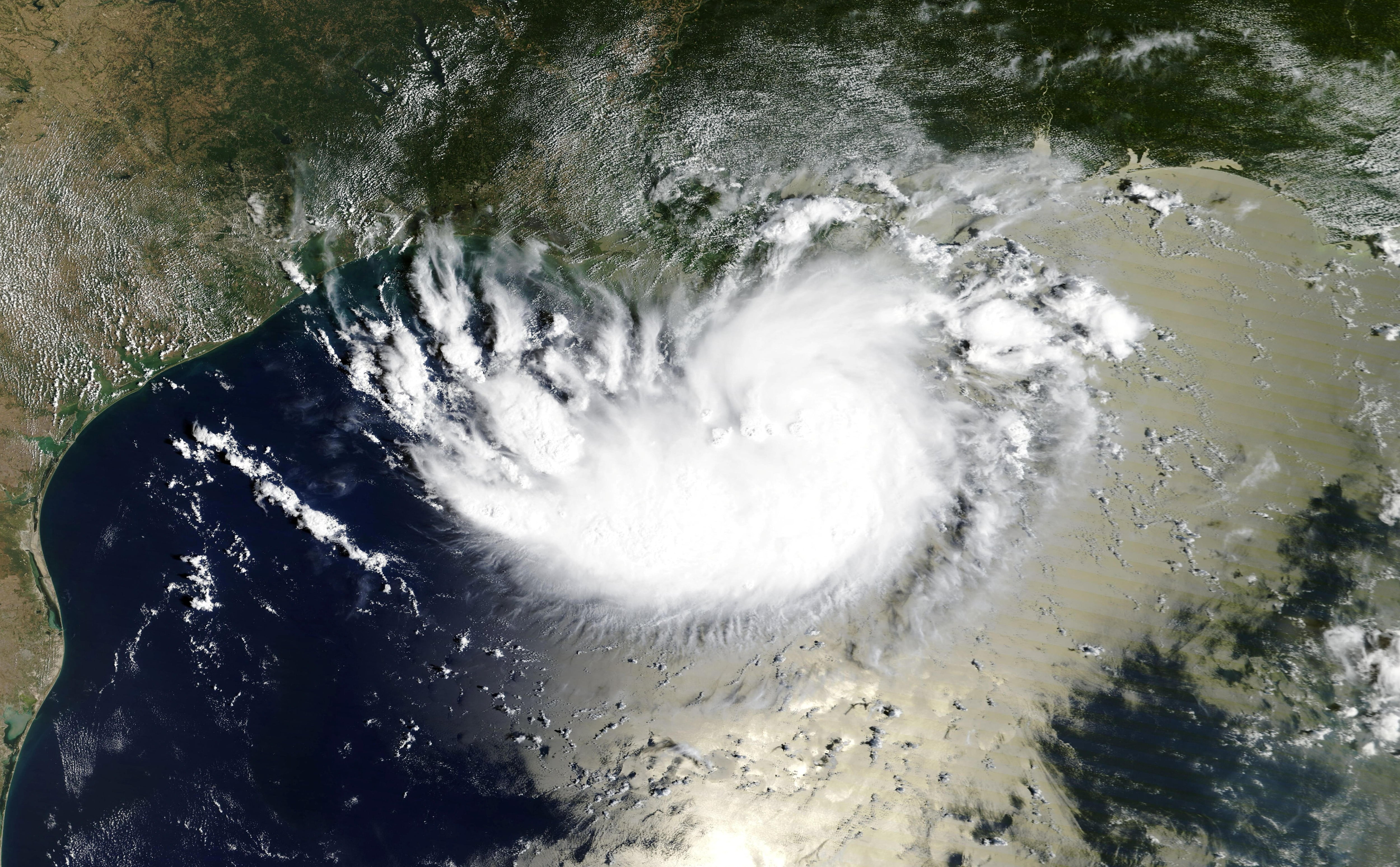
Tropical Storm Edouard intensified from a tropical depression to a tropical storm with maximum sustained winds of 40 mph while located near the Texas-Louisiana border and moving west-northwest at 8 mph. [2] The system reached this intensity after upgrading Monday night and by Tuesday morning sat near the Texas-Louisiana border with maximum sustained winds of 40 mph while traveling west-northwest at 8 mph. [2] Forecasts indicate Edouard could reach hurricane strength before landfall in Texas but will weaken inland with the primary threat being torrential rains and flooding rather than winds. [2] The hurricane tracker continues to follow the storm as it approaches the western Gulf Coast with expectations that it may strengthen significantly before making landfall yet begin weakening once inland. [2]
Rainfall and Flooding Risks
Rainfall totals of 3 to 6 inches are expected across the Texas coast and central-eastern regions with isolated amounts up to 9 inches. [2] The heaviest rain bands could produce 3 to 4 inches per hour increasing flash flood risk in low-lying and urban areas. [2] The Texas coast and parts of the state’s central-eastern region could receive between 3 and 6 inches of rain while some areas could see up to 9 inches. [2] Lower amounts are expected in southwestern Louisiana. [2] The risk of flash flooding is increasing due to the intensity of the expected rainfall with the heaviest rain bands capable of producing 3 to 4 inches per hour particularly affecting low-lying and urban areas. [2] In the southeast the Houston and Bryan areas could see between 3 and 6 inches with isolated amounts of up to 9 inches. [2] South and east of Dallas-Fort Worth towns such as Mexia and Fairfield could see up to 3 inches of rain while the Dallas-Fort Worth metropolitan area generally expects less than 1 inch. [2]
{IMAGE_2}
Official Warnings and Advisories
The National Hurricane Center has issued tropical storm warnings hurricane watches storm surge advisories and flood alerts for parts of the western Gulf Coast. [2] A Tropical Storm Warning covers Southern Calcasieu including locations such as Lake Charles Carlyss Bell City Hayes and Iowa with peak wind forecasts of 15-25 mph and gusts to 35 mph. [4] Another Tropical Storm Warning applies to West Cameron including Johnson Bayou Holly Beach and Hackberry with peak wind forecasts of 30-40 mph and gusts to 50 mph. [5] The National Weather Service has issued these alerts as the storm nears the coast with plans in place for hazardous wind of equivalent tropical storm force. [4] [5]
Local Severe Weather Alerts
A separate Tornado Warning was issued for south central Rapides Parish in central Louisiana until 1230 PM CDT due to a severe thunderstorm with radar-indicated rotation capable of producing a tornado. [1] The National Weather Service in Lake Charles issued the Tornado Warning for south central Rapides Parish until 1230 PM CDT. [1] At 1215 PM CDT a severe thunderstorm capable of producing a tornado was located over Glenmora moving northwest at 30 mph. [1] The hazard includes a tornado with radar indicated rotation and impacts such as flying debris that will be dangerous to those caught without shelter along with potential damage to mobile homes roofs windows and vehicles. [1]
Impacts on Texas Communities and Response
The threat of heavy rain led several school districts in Southeast Texas to cancel classes on Tuesday to prevent students staff and families from having to travel during the worst of the weather. [2] Texas Governor Greg Abbott noted that flooding is the biggest problem expected from the storm and urged residents to prioritize their safety and stay away from rising waters. [2] Edouard is hitting a region that has been experiencing exceptionally dry conditions and extreme temperatures for several weeks with much of North Texas having gone 47 days without measurable rain. [2] Last month tied for the second-driest August on record in the area following a month that included 27 days with temperatures above 100 degrees Fahrenheit and 11 consecutive days of triple-digit heat. [2] The arrival of moisture and rain will break that streak and bring temperatures down to around 90 degrees Fahrenheit on Wednesday and Thursday with scattered showers and isolated thunderstorms also expected. [2] The storm will have a mixed effect on the wildfires affecting the region as the increase in humidity will help emergency crews over the next few days but gusts of up to 20 mph forecast for Wednesday could complicate containment efforts. [2]
What to watch next: Edouard is expected to continue moving inland after potential landfall with weakening winds but ongoing risks from remaining rain bands and localized flooding in affected Texas and Louisiana areas.