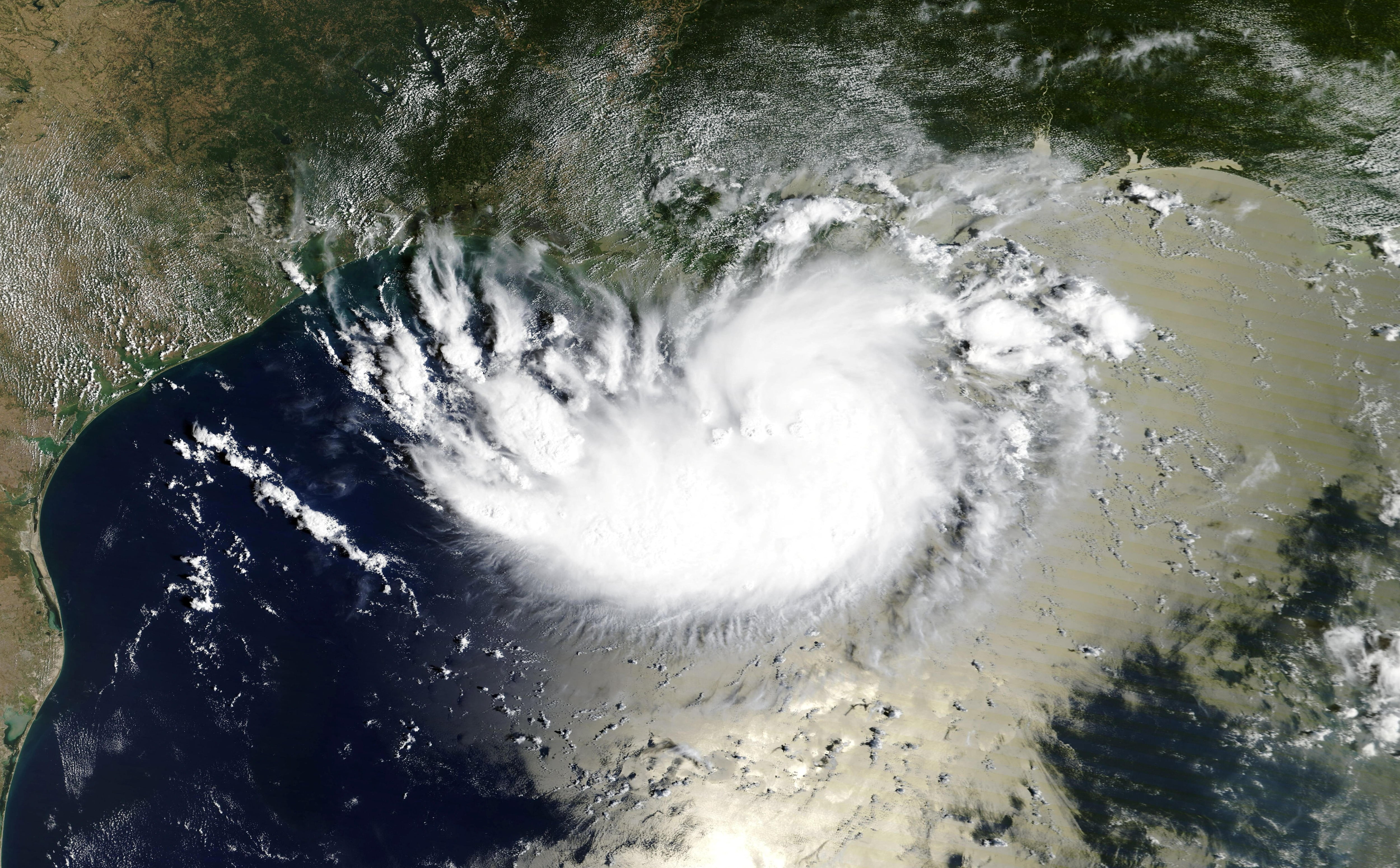
Hurricane Tracker Shows Tropical Storm Edouard Makes Landfall Near Johnson Bayou
Hurricane tracker updates confirm that Tropical Storm Edouard made landfall near Johnson Bayou, Louisiana, on the Texas-Louisiana border, bringing heavy rain, flooding risks, and tropical-storm-force winds to parts of the Gulf Coast.
Landfall Details
Tropical Storm Edouard came ashore near Johnson Bayou, Louisiana, around 2:20 p.m. CDT with maximum sustained winds of 60 mph. [5] The storm was located about 15 miles south-southeast of Port Arthur, Texas, at landfall. [5] Hurricane tracker reports placed the center of the system at that position as it pushed inland from the northwestern Gulf Coast. [4] The National Hurricane Center noted that tropical storm conditions had already begun affecting parts of the Upper Texas and southwestern Louisiana coasts before the center crossed the shoreline. [5]
Rainfall and Flood Risk
Heavy rain has spread across portions of Texas and Louisiana, raising flooding concerns with 3 to 6 inches expected and isolated totals up to 9 inches. [5] The Hurricane Center forecast that Edouard would bring those rainfall amounts from the Texas coast into east-central Texas, while southwestern Louisiana was expected to receive comparatively lighter rainfall. [5] A flash flood warning was issued for Jefferson County in the Golden Triangle, remaining in effect through early evening. [5] The first flash flood warning of the day was issued at 3 p.m. and covered Jefferson County. [5]
Observed Conditions
A National Ocean Service station at Port Arthur, Texas, recently reported a sustained wind of 40 mph and a wind gust to 49 mph. [5] Residents in areas affected by Tropical Storm Edouard took to social media to share videos showing the heavy rain and conditions they experienced as the storm moved through. [5] One user driving along Highway 82 on the Louisiana coast posted footage showing intense downpours, with windshield wipers rapidly sweeping across the vehicle’s windshield to maintain visibility. [5] The post was timestamped around 1:30 p.m. and described conditions through the core of the storm along the Louisiana coast. [5]
Severe Thunderstorm Warnings
Separate severe thunderstorm warnings were issued for Columbia County and parts of Lycoming and Sullivan counties in Pennsylvania with 60 mph winds and half-dollar-size hail, and for Boyd County, Nebraska, with 60 mph winds and quarter-size hail. [1] [2] The National Weather Service in State College PA issued a Severe Thunderstorm Warning for Columbia County in central Pennsylvania, east central Lycoming County in north central Pennsylvania, and southeastern Sullivan County in north central Pennsylvania until 830 PM EDT. [1] At 746 PM EDT, a severe thunderstorm was located over Central, moving southeast at 35 mph, with hazards including 60 mph wind gusts and half dollar size hail indicated by radar. [1] In Nebraska, at 645 PM CDT, severe thunderstorms were located along a line extending from near Gross to 12 miles south of Spencer to near Atkinson, moving east at 30 mph, with hazards of 60 mph wind gusts and quarter size hail. [2]
Impacts and Locations Affected
Hail damage to vehicles is expected from the storms in Pennsylvania and Nebraska, along with wind damage to roofs, siding, and trees. [1] [2] Locations impacted in Nebraska include O'Neill, Spencer, Atkinson, Lynch, Gross, Bristow, Emmet, Monowi, Scottville, Redbird State Wildlife Management Area, Opportunity, and Spencer. [2] The flash flood warning for Jefferson County in the Golden Triangle remained in effect through the early evening amid the rainfall from Edouard. [5] Heavy rain spread across portions of Texas and Louisiana as Edouard approached the Gulf Coast, raising concerns over possible flooding. [5]
What to watch next: Additional flash flood warnings may be issued as the storm continues to push inland, with the National Hurricane Center providing its next full forecast at 4 PM CDT.