
Hurricane Tracker Shows Storm Boelo Bringing Orange Flood Warnings to Eastern Norway
The hurricane tracker shows Storm Boelo bringing heavy rain, strong winds, and orange-level flood and landslide warnings to eastern Norway this weekend. Storm Boelo is expected to arrive from the UK, reaching Norway on Saturday evening and hitting hardest in areas east of the mountains, particularly from eastern Agder northwest toward regions west of the Oslofjord and Mjøsa.
Storm Boelo Approaches Norway
Storm Boelo is forecast to strike Britain first before moving into Norway on Saturday evening. The areas expected to feel the effects most are those east of the mountains, especially from eastern Agder and continuing northwest to zones west of the Oslofjord and Mjøsa. Much rain is anticipated during the night to Sunday, along with strong winds that could topple trees. [3] Persistent conditions are set to produce a combination of wind and precipitation impacts starting Saturday afternoon. [3]
Weather Warnings in Place

Storm Boelo brings heavy rain and strong winds to eastern Norway. — Source: vg Norwegian authorities have issued orange warnings for flood and landslide risk in parts of Østlandet, while the meteorological institute has issued yellow warnings for rain and wind. [1] [3] Expected rainfall is 30-40 mm in 12 hours, with locally strong wind gusts of 27-37 m/s. [1] [3] Full storm is forecast on the coast of Rogaland and Hordaland. [3] Orange alerts for flood cover large parts of Østlandet west of Oslo, running from night to Sunday and easing Sunday evening. [3] Yellow warnings for heavy wind gusts apply to Rogaland, Trøndelag, Hordaland, parts of Agder, parts of southern Norway and parts of Østlandet. [3] Orange warnings for landslide risk cover parts of Akershus around Oslo, Oslo, Vestfold, Telemark and Buskerud. [3]
Hurricane Tracker Comparison to Last Year's Amy Storm
For almost exactly one year ago, extreme weather Amy struck southern Norway with great force. [1] Forecasters state it is less intense than last year's extreme weather Amy. [1] This low pressure system has a similar wind direction coming in from the southeast, but it is less powerful than Amy was. [1] When warnings were issued for Amy, there were orange and red levels both for precipitation and wind. [1] The meteorological institute is limiting itself to yellow warnings for precipitation on Østlandet, with amounts expected around 30 to 40 mm in 12 hours. [1] Based on current forecasts, yellow level is expected to continue through the entire event. [1]
Preparations and Impacts
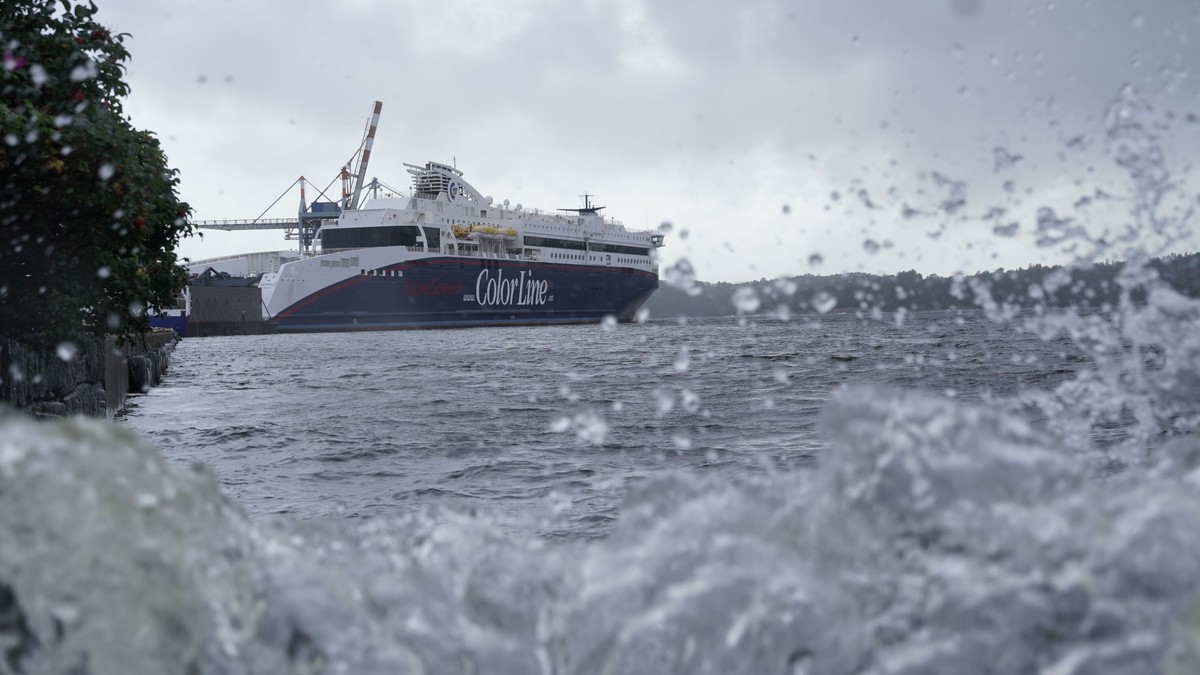
Ferry services including Fjord Line and Color Line routes between Norway, Denmark, and within Norway have been cancelled due to the storm. [3] Fjord Line has cancelled several departures Sunday, including the Kristiansand-Stavanger route at 23:15, the Stavanger-Bergen route at 07:30 and the Bergen-Stavanger route at 14:00. [3] The Stavangerfjord route from Kristiansand at 23:15 Saturday toward Bergen is also cancelled. [3] Color Line is cancelling Superspeed departures between Kristiansand and Hirtshals, specifically from Hirtshals at 20:40 Saturday and from Kristiansand at 08:00 Sunday. [3] Local authorities in Tønsberg have implemented preventive measures based on experience from last year's Amy storm, which caused significant damage including blowing the roof off a block. [1] In Tønsberg the municipality has started preventive measures at Revetal to be as prepared as possible. [1] NVE warns that this is a serious situation and people should be prepared for heavy rain increasing flood risk. [1] [3] Hold drains, ditches and pipes free of twigs and leaves so water can run away, as blocked waterways can cause water to dam up and trigger landslides. [1] [3] Consequences of wind typically include power outages due to fallen trees, loose roof tiles, trampolines flying away, aquaplaning on roads with standing water, landslides over roadways, roads standing under water, floating piers affected and boats coming loose. [3] Local authorities in Tønsberg note that experiences from Amy last autumn have given valuable knowledge about which areas may be vulnerable, so they are focused on being early with preventive measures if the weather develops as forecast. [1] The goal is to reduce risk and limit consequences as much as possible if challenges arise. [1]
What to watch next is continued monitoring of yellow and orange warnings as they may be adjusted, along with further ferry cancellations if conditions worsen.