
Hurricane Tracker Shows Nor'easter Driving Flooding and 100,000 Power Outages Along US East Coast
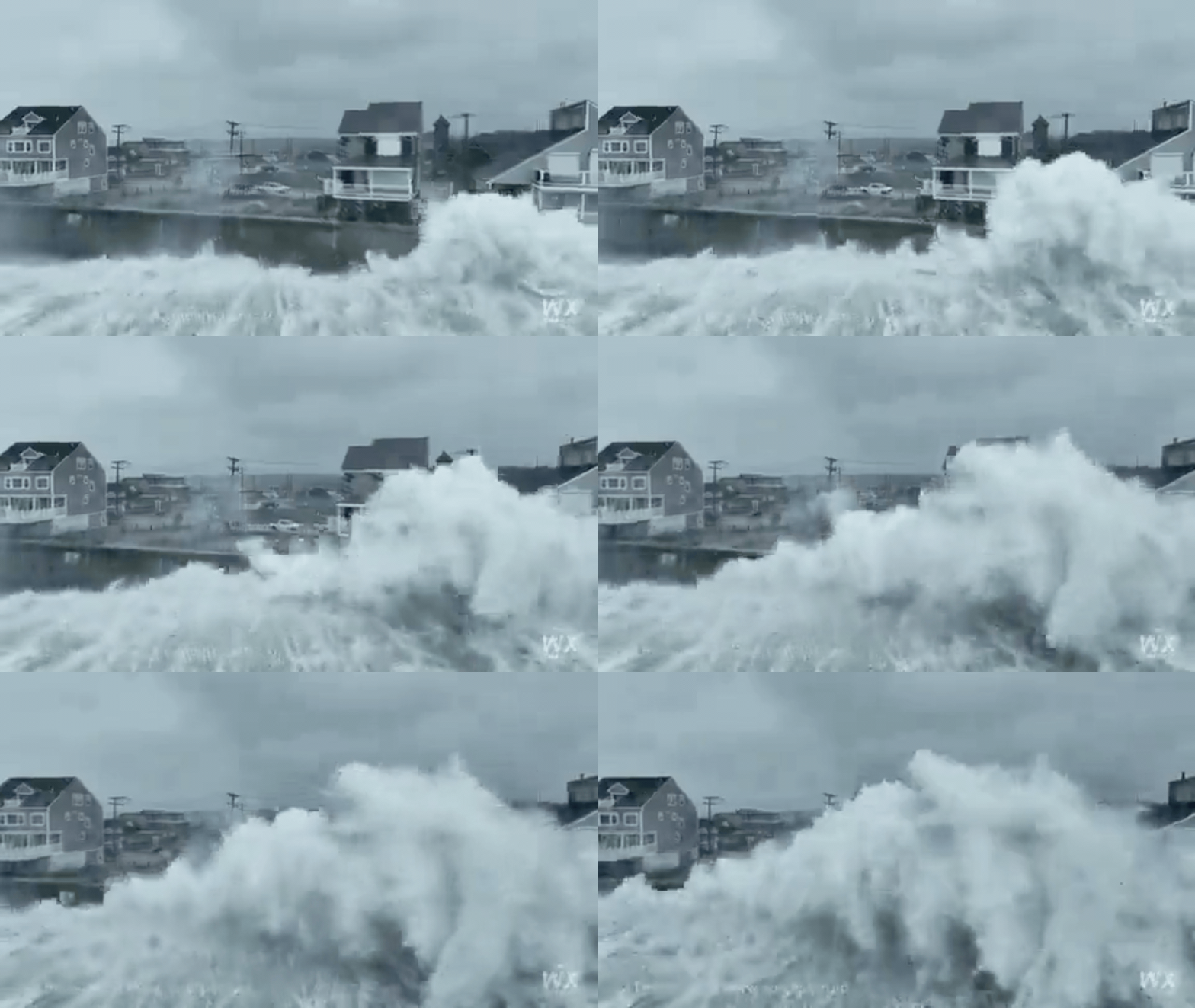
A powerful nor'easter is battering the US East Coast with heavy rain, strong winds, coastal flooding, and waves up to 20 feet, causing power outages for more than 100,000 customers, flight disruptions, and at least one death. Hurricane tracker updates highlight how the slow-moving system continues to threaten coastal areas from the Mid-Atlantic to New England.
Nor'easter Pounds East Coast With Flooding and High Winds
The slow-moving storm has knocked down trees and power lines, leaving more than 88,000 customers without electricity in New Jersey, Connecticut, New York and Pennsylvania as of Saturday afternoon. [2] A person was killed by a fallen tree in Brooklyn as the storm pelted the city with rain and strong winds. [3] Emergency crews in mid-Atlantic and New England states raced to restore power after downed trees contributed to outages for about 100,000 customers in the region. [3] The storm has also disrupted travel, with around 425 flights cancelled and more than 1,300 delayed across US airports. [2]
Widespread Power Outages and Travel Chaos
The disruption extended well beyond homes and roads. [2] Hundreds of flights were canceled at Boston Logan International Airport, as were the vast majority of flights at Martha's Vineyard and Nantucket. [3] The Boston Red Sox and the Chicago Cubs shuffled the schedule for their three-game series, playing a doubleheader Friday in Boston to try to avoid the storm, then rescheduling their Sunday finale to Florida. [3] Ed Sheeran canceled his high-profile concerts Friday and Saturday at Gillette Stadium in Foxborough, Massachusetts. [3] Also canceled were an Ironman triathlon in New York and the three-day Oceans Calling Festival in Ocean City, Maryland. [3] A flooding-related highway closure on North Carolina’s Hatteras Island scrambled wedding plans for a Virginia couple whose guests were stranded. [3]
Coastal Communities Face Record Tides and Erosion
In New Jersey and New York, flooded streets became so deep that some residents took to kayaks. [2] Along the coast, powerful waves battered beaches, eroded dunes and damaged property. [2] In Surf City, New Jersey, water is rising inside houses as people’s belongings also get displaced by the strong forces of wind and rain. [2] In Ocean City, Maryland, heavy surf eroded beaches and washed away dune fencing. [2] In Norfolk, Virginia, flooding left vehicles struggling through waterlogged roads. [2] In the coastal New Jersey borough of Surf City, one marina owner watched surveillance cameras showing water rising inside the building, a rare event last seen during Hurricane Sandy in 2012. [3] Farther south in Norfolk, Virginia, one resident watched passing vehicles leave wakes through isolated flooding that persisted all week. [3]
What Is a Nor'easter and Why Is This One So Dangerous
A nor’easter is a powerful storm that develops along or near the US East Coast, typically moving northeastward while drawing energy from the contrast between cold air to the north and warmer, moist air to the south and over the Atlantic. [2] The storms get their name from the northeasterly winds that can batter the coast as the system strengthens. [2] They can bring a dangerous combination of heavy rain, powerful winds, coastal flooding and huge waves. [2] Heavy rainfall can overwhelm drainage systems and worsen inland flooding, while strong gusts can bring down trees, damage buildings and snap power lines. [2] High tides, combined with storm-driven water, can push seawater onto roads and into coastal communities. [2] This storm is particularly threatening because it is slow-moving, meaning coastal areas can remain exposed to strong winds, waves and high water for a prolonged period. [2] Nor’easters are not unusual as New England moves into the fall, but this might be a little earlier than average for a big storm. [3]
El Niño Influence on East Coast Storm Patterns
The immediate ingredients are the storm’s atmospheric setup, strong winds, moisture and the temperature contrasts that help nor’easters intensify. [2] There is a bigger climate pattern in the background: El Niño. [2] El Niño is a natural cycle in the tropical Pacific in which unusually warm ocean temperatures alter atmospheric circulation far beyond the Pacific. [2] This year’s El Niño is particularly strong. [2] For the Northeast, El Niño can shift the Pacific jet stream southward, helping provide energy and moisture for storms forming off the southeastern US before they move north along the East Coast. [2] Nor’easters also appear to occur more frequently during El Niño years. [2] El Niño is also expected to influence other weather patterns through the coming months. [2]
Forecast and Official Warnings
The National Weather Service warned that the storm could continue bringing coastal flooding, rip currents, strong wind gusts and heavy rain through Monday. [2] The highest tides were expected north of Atlantic City from Saturday night into Sunday, raising the risk of widespread flooding in coastal and bayside communities. [2] There will be a lot of high winds, a lot of high tides and heavy rain possibility over the next few days for the northeastern US. [3] Anyone who goes in or near the water this weekend is literally gambling with their life. [3] State officials along the East Coast urged people to use caution. [3] Coastal flooding was the biggest threat, but heavy rains, powerful winds and waves as high as 6 meters were also expected. [3]
What to watch next: The highest tides were likely to occur north of Atlantic City, New Jersey, from Saturday night into Sunday, creating the potential for widespread road flooding in coastal and bayside communities. [3] Tens of millions of people remained in the storm’s path, while emergency agencies prepared for further outages and flooding. [2]