
Hurricane Tracker Shows Isaias Forecast to Hit U.S. Gulf Coast After Forming Off Mexico
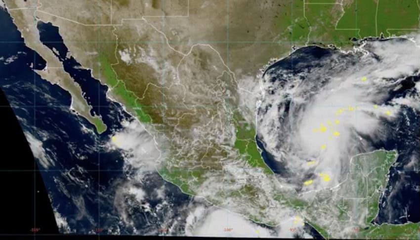
A hurricane tracker update indicates Tropical Storm Isaias formed early Wednesday in warm waters off eastern Mexico and is expected to strengthen into the first hurricane of the Atlantic season before hitting the U.S. Gulf Coast later in the week. [4] National Weather Service alerts detail active Tropical Storm and Hurricane Warnings for portions of the Florida Gulf Coast as the system intensifies. [1] [2]
Current Warnings for Florida Gulf Coast Waters
A Tropical Storm Warning remains in effect for Apalachee Bay and coastal waters from Keaton Beach to Ochlockonee River FL out to 20 NM. [1] Northeast winds of 30 to 40 kt with gusts up to 55 kt and seas of 12 to 17 ft are forecast in that zone. [1] Tropical storm force winds are possible from Friday in the warned area. [1] The warning also covers additional coastal waters from Mexico Beach to Apalachicola FL out 20 NM, coastal waters from Ochlockonee River to Apalachicola FL out to 20 NM, coastal waters from Suwannee River to Keaton Beach FL out 20 NM, and waters from Suwannee River to Apalachicola FL from 20 to 60 NM. [1]
A separate Hurricane Warning is in effect for St. Andrews Bay Waterways and associated coastal and offshore waters. [2] Northeast winds of 35 to 45 kt with gusts up to 65 kt and seas of 13 to 18 ft are expected in that zone. [2] Hurricane force winds are possible from Friday morning until early Saturday morning in the warned area. [2] The warning extends to coastal waters from Mexico Beach to Okaloosa Walton County Line FL out 20 NM, waters from Mexico Beach to Okaloosa Walton County Line FL from 20 to 60 NM, and waters from Apalachicola to Mexico Beach FL from 20 to 60 NM. [2]
Forecast Track and Strengthening of Isaias
Tropical Storm Isaias formed early Wednesday in the warm waters off eastern Mexico. [4] Forecasters stated the system is expected to strengthen into the first hurricane of the Atlantic season before hitting the U.S. Gulf Coast later in the week. [5] The hurricane tracker shows the storm centered about 285 miles from the coast at formation. [4] Warm waters off eastern Mexico supported initial development of the tropical storm. [5]
{IMAGE_2}
Expected Impacts from Strong Winds and Seas
Extremely strong winds will cause hazardous seas in the warned areas. [2] Mariners and coastal interests face northeast winds reaching 35 to 45 kt with gusts up to 65 kt under the Hurricane Warning. [2] Seas are projected to reach 13 to 18 ft in those zones. [2] Under the Tropical Storm Warning, northeast winds of 30 to 40 kt with gusts up to 55 kt and seas of 12 to 17 ft are anticipated. [1] These conditions are expected to create dangerous marine environments from Friday onward in the affected Florida Gulf Coast waters. [1] [2]
Longer-Term Coastal Changes in North Carolina
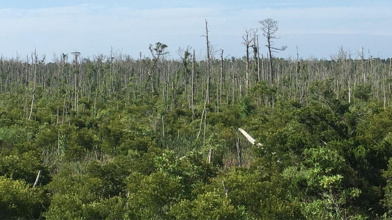
North Carolina lost 21% of its coastal forests between 1985 and 2021. [3] Forest cover in the Albemarle Peninsula declined from about 304,729 hectares in 1985 to 269,970 hectares in 2021, representing a net decline of 21.1% or approximately 64,220 hectares. [3] Loss accelerated after 2010, with about 23,876 hectares converted to marsh, shrubs or ghost forest between 2010 and 2021, which is 1.5 times the 16,968 hectares that transitioned in the earlier period from 1985 to 2010. [3] Ghost forest area increased by about 7,561 hectares between 2010 and 2021 compared with 3,087 hectares during 1985 to 2010, showing a rate roughly 2.5 times higher in the later period. [3] Rising seas push saltwater farther inland and raise coastal water tables, exposing tree roots to conditions they cannot tolerate. [3] Saturated soils become oxygen-poor and add stress to trees. [3] Areas that experienced severe drought between 2007 and 2011 as well as Hurricane Irene in 2011 failed to fully recover afterward. [3] More than 30,000 hectares of the forest loss was converted to cultivated land, while other areas became shrubland, marsh, water or ghost forest. [3] Of the 64,220 hectares of net forest loss, about 33,884 hectares transitioned into natural coastal vegetation and water categories. [3]
Monitoring Tools and Resources
Researchers combined satellite imagery with an artificial intelligence model designed to classify different types of land cover to reconstruct decades of change. [3] They compared Landsat imagery with higher-resolution Sentinel-2 data. [3] Sentinel-2 performed better when both systems were tested against the same 2021 landscape, but Landsat provided a much longer historical record essential for tracing coastal landscape changes from 1985 onward. [3] Combining seasonal and topographic information improved the ability of the model to distinguish ghost forests from other vegetation. [3] The results help identify coastal areas most vulnerable to continued forest retreat. [3] Earlier work showed that ghost forests serve as an early warning sign of saltwater intrusion and rising seas. [3]
What to watch next: Continued monitoring of Tropical Storm Isaias as it strengthens and approaches the Gulf Coast, alongside ongoing satellite tracking of coastal forest transitions in North Carolina.