
Hurricane Tracker Shows El Niño Strengthening Into Potential Record Event With Global Weather Impacts
Hurricane tracker observations align with forecasts showing El Niño strengthening into one of the strongest on record, driving severe drought in Sri Lanka and anticipated heavy rainfall and flooding risks in Kenya while localized severe thunderstorms and flash flooding are occurring in parts of the United States.
El Niño Forecast to Become One of Strongest on Record
The UN's World Meteorological Organization warned that this year's El Niño could be the strongest since records began four decades ago, peaking by year-end with impacts continuing into 2027 and placing the world in a danger zone for extreme weather. [4] El Niño is forecast to be the strongest since comparable records began four decades ago, the United Nations' climate agency warned, with the UN chief saying the world was in the "danger zone of extreme weather". [4] The weather phenomenon is set to become "very strong" in the months ahead and is near certain to persist through to February, the World Meteorological Organization said. [4] "If this trajectory continues, it may be stronger than anything since our monitoring began," WMO chief Celeste Saulo told reporters in Geneva. [4] El Niño will peak towards the end of this year — though its knock-on impacts for the climate will continue well into 2027, said the WMO. [4] This year is likely to be marked by a “super” El Nino, which could become the strongest on record, weather forecasters have said. [3] El Niño warms surface temperatures in the central and eastern equatorial Pacific Ocean, bringing worldwide changes in winds, pressure and rainfall. [4]
Sri Lanka Drought Leaves Wells Dry and Farmers Without Income
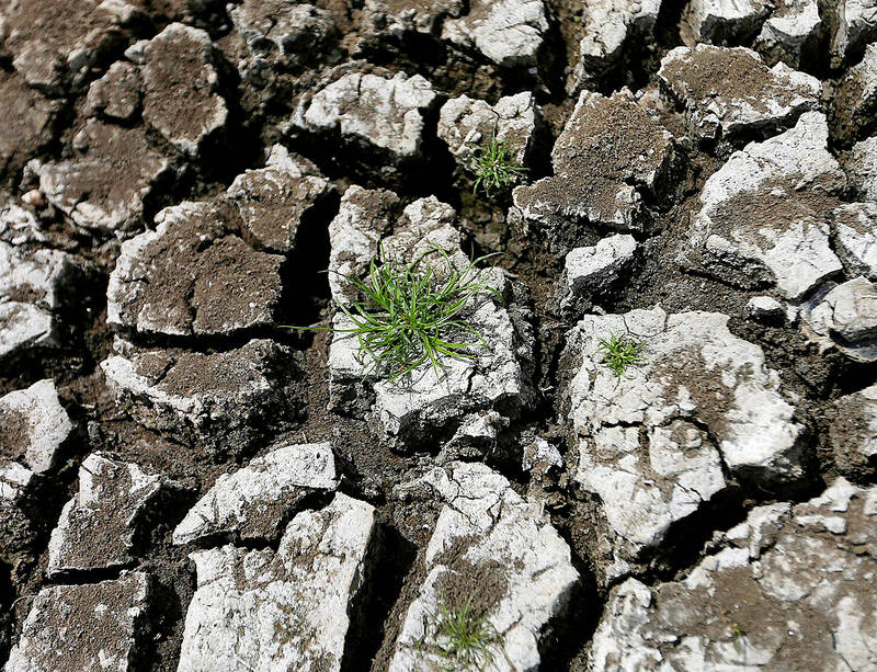
Sri Lanka is experiencing one of its worst El Niño-driven droughts in more than three decades, with rainfall deficits of 85-100% in key farming districts, causing wells, tanks, rivers and lakes to run dry and forcing water deliveries to tens of thousands of residents. [3] For the first time in more than three decades, Sri Lankan farmer AM Pathmasena says, his well is running so dry that it barely provides enough water for his family and two cows. [3] Sri Lanka is among the South Asian countries hardest hit by weather disruption this year, with some key farming districts recording rainfall deficits of 85 percent to 100 percent below long-term averages. [3] The government has arranged for water to be delivered to tens of thousands of people. [3] “The drought has been intensifying. The amount of water seeping into the well is barely enough,” Pathmasena, 48, said while sitting in his hut in Galwela Yaya, a small village in one of the worst-hit districts, Ampara. [3] “We dig a small hole and wait for the water to seep in to bathe.” [3] Soaring temperatures have already left large swathes of Sri Lanka’s north, east and southern regions parched, with small tanks, rivers and lakes that usually feed crops and provide drinking water drying out. [3] The Sri Lankan government has said the impact this year could be the worst in decades and that water levels at hundreds of such tanks in the country have dropped to about 10 percent. [3] Many houses on the main roads and those that are easily accessible get drinking water trucked in every three to five days, while some in remote areas wait for as many as 23 days, according to government officials and interviews with residents. [3] Farmers’ incomes, as expected, are taking a big hit, making it difficult to repay loans and even manage proper meals daily. [3] Before the drought, Pathmasena said he earned about 20,000 Sri Lanka rupees (US$60) a month growing cowpeas, but the crisis means he has lost it all, forcing him to become a daily-wage laborer to survive. [3] His son shuttered his chicken farm weeks ago due to the heat and water shortages. [3] On a recent evening, Pathmasena asked his wife to first give water in tin vessels to their cows, before they sat to consume their meal. [3] “On some days, when we have nothing, we skip meals,” he said. [3] “We supplement the water deliveries by gathering the last bit of the water in our well for washing and bathing but even then we sometimes run out,” said Konara Mudiyanselage Sumanawathie, 49, who lives in one of the worst-affected areas, Monaragala, about 160km from Colombo. [3]
Kenya Prepares for Heavy Rains and Potential Mass Displacement
In Kenya, above-normal rains are expected between October and December, with up to 1.5 million people possibly affected by heavy rainfall and 500,000 at risk of displacement as authorities prepare for a worst-case scenario. [4] In Kenya, weather experts said the phenomenon could cause above-normal rains between October and December. [4] The National Disaster Operation Centre said it was preparing for a “worst-case scenario”. [4] The body said up to 1.5 million people may be directly affected by heavy rainfall, and 500,000 people could be displaced. [4] Authorities are working to identify which areas and infrastructure are the most at risk, to enhance response capabilities and raise awareness among populations. [4] The Kenyan government is especially concerned with water supplies, electricity networks and communication systems, the Daily Nation reported. [4]
Active Severe Thunderstorm Warnings Issued in Carolinas
Active severe weather in the US includes a Severe Thunderstorm Warning for Anson County, North Carolina with 60 mph winds and quarter-size hail, a Severe Thunderstorm Warning for Laurens County, South Carolina with 60 mph winds. [1] [5] At 347 PM EDT, a severe thunderstorm was located 13 miles south of Biscoe, or 14 miles south of Troy, moving southeast at 45 mph. [1] HAZARD...60 mph wind gusts and quarter size hail. [1] IMPACT...Hail damage to vehicles is expected. Expect wind damage to roofs, siding, and trees. [1] Locations impacted include Rockingham, Wadesboro, Pinehurst, Hamlet, Biscoe, Ansonville, Hoffman, Polkton, Mount Gilead, and Robbins. [1] At 343 PM EDT, a severe thunderstorm was located 15 miles northeast of Laurens, or 8 miles southeast of Woodruff, moving southeast at 30 mph. [5] HAZARD...60 mph wind gusts. [5] IMPACT...Expect damage to trees and power lines. [5] Locations impacted include Laurens, Union, Clinton, Woodruff, Monarch Mill, Joanna, Buffalo, Gray Court, Jonesville, and Carlisle. [5]
Flash Flooding Already Occurring in Southwestern Louisiana
A Flash Flood Warning for parts of Beauregard and Vernon Parishes in Louisiana where 2-3 inches of rain have already fallen. [2] The National Weather Service in Lake Charles has issued a Flash Flood Warning for Northeastern Beauregard Parish in southwestern Louisiana and South Central Vernon Parish in west central Louisiana until 545 PM CDT. [2] At 243 PM CDT, local law enforcement reported thunderstorms producing heavy rain in DeRidder. Between 2 and 3 inches of rain have fallen. Additional rainfall amounts of 1 to 2 inches are possible in the warned area. Flash flooding is already occurring. [2]
What to watch next: El Niño will peak towards the end of this year though its knock-on impacts for the climate will continue well into 2027.







