
Flash Flooding Hits Eastern New York as Deventer Shuts Harbour Over Low River Levels
Widespread severe weather is producing flash flooding across parts of New York state while drought conditions are forcing the indefinite closure of Deventer's harbour in the Netherlands and triggering a Red Flag Warning for lightning-induced fires in Idaho.
Flash Flood Warnings Issued Across Eastern New York
The National Weather Service in Albany has issued a Flash Flood Warning for southwestern Saratoga County, northeastern Schenectady County, southeastern Fulton County and east central Montgomery County in east central New York until 2:45 PM EDT Wednesday. [3] At 8:52 AM EDT, Doppler radar indicated heavy rain across the warned area with between 2 and 4 inches of rain having already fallen. [3] Additional rainfall amounts of 1 to 2 inches are possible in the warned area. [3] The National Weather Service in Albany has also issued a Flash Flood Warning for north central Ulster County in east central New York until 2:45 PM EDT Wednesday. [4] At 8:40 AM EDT, Doppler radar indicated heavy rain across that warned area with between 2 and 3 inches of rain having already fallen. [4] Additional rainfall amounts up to 1 inch are possible in the warned area. [4] Flash flooding is ongoing or expected to begin shortly in the Ulster County area. [4] The hazard consists of flash flooding caused by heavy rain according to the radar source. [4]
Minor Flooding Underway on Esopus Creek
Minor flooding is occurring and minor flooding is forecast on Esopus Creek at Cold Brook. [5] The Flood Warning covers the period from this morning to late this evening. [5] At flood stage of 11.0 feet, water begins to overflow banks above Ashokan Reservoir with little damage. [5] At 8:15 AM EDT Wednesday the stage was 11.0 feet. [5] The river is expected to rise to a crest of 12.6 feet this afternoon. [5] It will then fall below flood stage late this afternoon. [5] The impacts remain limited to minor overflow with little damage expected at these levels. [5]
Deventer Harbour Closed Indefinitely Due to Low River Levels
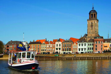
Deventer is closing its harbour to ships from this weekend after the summer drought caused the water level in the river IJssel to drop to exceptionally low levels. [2] The municipal council said on its website that the sluice gates would close to prevent damage to water barriers, problems for ships and risks for houseboats. [2] The rules state that the sluice gates must be closed if the level of the river outside the harbour falls below 45 cm above Normaal Amsterdams Peil. [2] That level is expected to be reached on Saturday. [2] Ships will be allowed to enter the harbour until Thursday but will have to leave by Friday evening. [2] The last time Deventer’s harbour was closed due to low water levels was in 2018 when it was able to reopen after two weeks. [2] The Twentekanaal which runs between Almelo Hengelo and Enschede has been closed since last Saturday because the water level is too low. [2] The canal will reopen once the water level rises to 9.10 metres above NAP. [2] The regional liaison group Twente Board has written to infrastructure minister Vincent Karremans asking for financial support for affected businesses. [2] Koninklijke Binnenvaart Nederland said the closure would cost the local economy between €125,000 and €500,000 a day. [2]
Red Flag Warning for Lightning in Southern Idaho
The National Weather Service in Boise has issued a Red Flag Warning for lightning which is in effect from 2 PM this afternoon to 9 PM MDT this evening. [1] The affected area is Fire Weather Zone 426 Southern Highlands in Idaho. [1] Ongoing isolated storms this morning will redevelop in the afternoon with scattered coverage and abundant lightning possible. [1] Storms will also be capable of producing outflow gusts up to 50 mph. [1] Scattered thunderstorms capable of producing outflow gusts up to 50 mph and abundant lightning are expected to redevelop in the afternoon. [1]
Global Pattern of Extreme Weather Continues
Flash Flood Warnings remain active across multiple counties in eastern New York with rainfall totals already measured between 2 and 4 inches in some areas and additional rain still possible. [3][4] Minor flooding continues on Esopus Creek at Cold Brook where the river reached 11.0 feet at 8:15 AM EDT Wednesday and is forecast to crest at 12.6 feet later in the day. [5] At the same time Deventer is preparing to close its harbour indefinitely once the River IJssel drops below 45 cm above NAP with the Twentekanaal already shut since last Saturday at an estimated daily economic cost of €125,000 to €500,000. [2] In Idaho the National Weather Service has placed Fire Weather Zone 426 under a Red Flag Warning from 2 PM to 9 PM MDT due to scattered thunderstorms expected to produce abundant lightning and outflow gusts up to 50 mph. [1] These simultaneous conditions reflect the alerts issued by the National Weather Service offices in Albany and Boise along with local reporting from the Netherlands on the same day.
What to watch next: Observers will monitor whether the River IJssel reaches the 45 cm above NAP threshold on Saturday to trigger the Deventer harbour closure and whether the Twentekanaal water level climbs back to 9.10 metres above NAP for reopening while tracking any additional rainfall in the New York warned counties through 2:45 PM EDT Wednesday and the redevelopment of thunderstorms in southern Idaho between 2 PM and 9 PM MDT.







