
Guatemala Volcano Triggers Orange Alert and Evacuation of 1,400 Residents
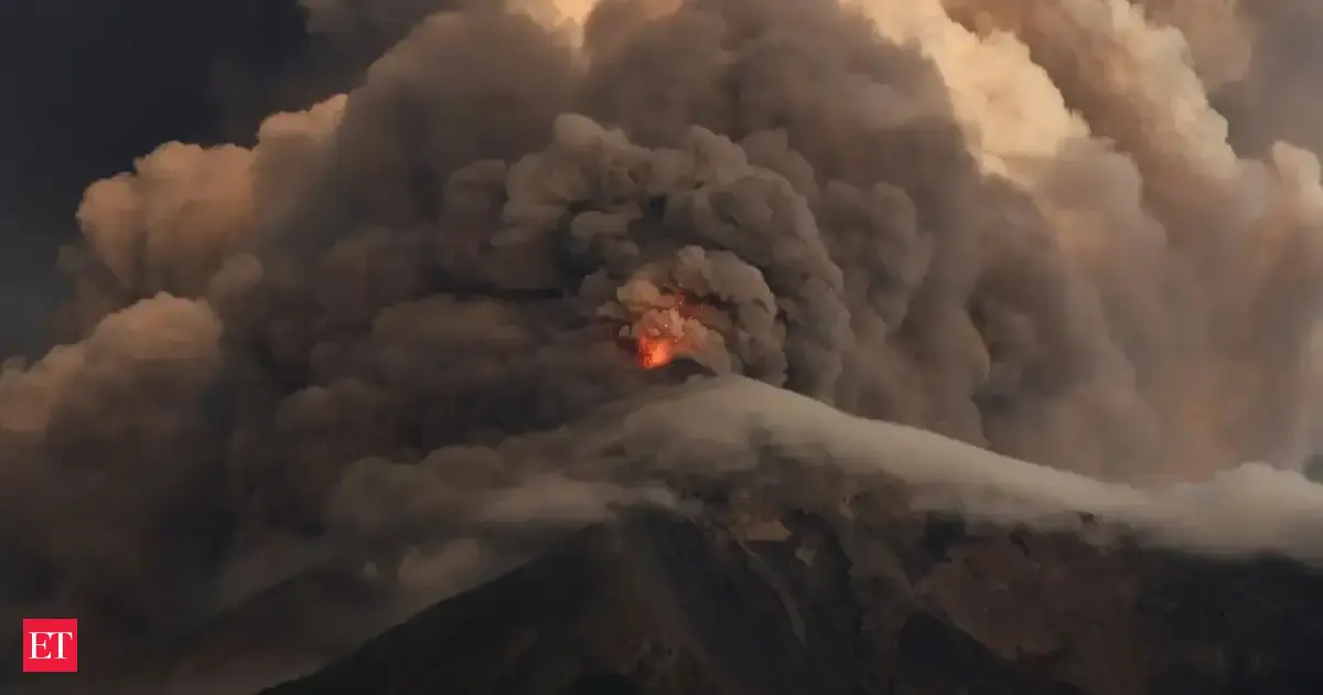
Guatemalan authorities declared a nationwide orange alert and ordered preventive evacuations after the Guatemala volcano intensified its eruption on August 4 2026, sending pyroclastic flows down multiple ravines and producing ash plumes rising 6 km. [1][2]
Eruption Intensifies Into Paroxysmal Phase
The eruption began on Monday morning but intensified significantly as the day progressed. [1] Guatemala's Institute of Volcanology said monitoring data indicates that Fuego is transitioning into a more explosive stage. [1] INSIVUMEH detected mounting activity at the 3,763-meter stratovolcano at approximately 8:30 a.m. local time on Monday, August 3. [5] By 4:00 p.m. local time, INSIVUMEH had logged nine higher-amplitude seismic events and confirmed pyroclastic density currents descending toward the Seca ravine. [5] By late Monday night, a lava fountain reaching between 200 and 300 meters above the crater developed during the paroxysmal phase. [5] Ash and gas columns climbed to between 5,000 and 6,000 meters above sea level. [5] INSIVUMEH director Edwin Rojas stated that the heightened paroxysmal activity could last between 24 and 72 hours. [5]
Pyroclastic Flows Reach Six Ravines
The eruption sent pyroclastic flows down five ravines, disaster management officials said. [2] By 8:00 p.m. local time Monday, pyroclastic density currents were confirmed descending both the Seca and Ceniza ravines on the southwestern flank. [5] Beginning at 1:15 a.m. ET on Tuesday, August 4, INSIVUMEH confirmed pyroclastic density currents descending through Las Lajas and Honda ravines on the southeastern flank in addition to continuing flows in the Seca, Taniluyá, and Ceniza ravines. [5] The total count of affected ravines had risen to six. [5] Pyroclastic density currents are fast-moving mixtures of volcanic gas, ash and rock. [2] The activation of Las Lajas on the southeastern flank is the specific development that transforms this eruption from a hazardous event into one demanding comparison with 2018. [5]
Evacuations and Orange Alert Declared
Authorities on Tuesday declared an “orange alert” and stepped up monitoring of the volcano. [2] The evacuations were ordered in the areas of El Porvenir and Las Lajitas, both in the municipality of San Juan Alotenango. [2] Around 1,000 people were evacuated, with approximately 900 individuals including some 125 families moved to safety from El Porvenir. [5] More than 1,400 people were moved to safety. [4] Claudinne Ogaldes, executive secretary of Guatemala's National Coordinator for Disaster Reduction, confirmed the eruption had begun that morning and intensified throughout the day. [5] Officials on Tuesday warned the flows could travel further if activity intensifies. [2]
Infrastructure Closures and Ash Impact
As a precaution, the government suspended in-person classes in communities across two municipalities near the volcano. [1] Guatemala's General Directorate of Road Protection and Safety closed National Route 14 in both directions between km 83 and km 103. [5] The Ministry of Education suspended in-person classes on August 4 in El Porvenir, the municipality of Escuintla, and the municipality of Yepocapa. [5] Ash cloud dispersal could affect areas up to 100 km west and northwest of the volcano. [2] The ash clouds extend about 120 kilometers in western and northwestern directions. [4] INSIVUMEH advised civil aviation authorities to take precautions in airspace between 60 and 100 km west of Fuego and at altitudes between 4,450 and 6,000 meters. [5]
History of Deadly Eruptions at Fuego
A major eruption in 2018 of the Fuego volcano buried an entire community and killed more than 200 people. [2] The 2018 eruption killed 215 people and left about the same number missing. [1] More than 500 people were moved to safety during an eruption last year, while another event in 2023 forced around 1,200 residents to leave their homes. [1] The volcano is one of Central America's most active volcanoes and has erupted repeatedly in recent years. [1] The volcano lies on the Pacific Ring of Fire. [4]
Ongoing Monitoring and Public Warnings
Conred urged people living in high-risk areas to leave immediately if evacuation orders were issued. [1] The Guatemalan Tourism Institute prohibited visitors from climbing both Volcán de Fuego and neighboring Acatenango. [5] Conred called on the population not to approach the volcano or the ravines on its southeastern flank. [4] INSIVUMEH advised that precautions should be taken for places within a 10-kilometer radius. [4]
What to watch next: INSIVUMEH warned the volcano has entered a paroxysmal phase that could last 24-72 hours with heightened risk on the western and southern flanks while CONRED maintains the nationwide orange alert and continues monitoring for further escalation.