4.6 magnitude earthquake near Tehran in Iran
A 4.6 magnitude earthquake Iran jolted the region near the capital city of Tehran, drawing immediate attention from seismic monitoring agencies.[1] Centered near Pardis with its epicenter positioned close to the Tehran-Mazandaran provincial border, the event underscores ongoing seismic activity in the area.[1] The United States Geological Survey (USGS) provided additional details, registering the quake at a magnitude of 4.3 at a shallow depth of 10.0 km, with the location specified as 1 km north of Damāvand, Iran.[2] These reports from Anadolu Agency and USGS form the basis of initial assessments for this earthquake Iran occurrence, highlighting slight variations in magnitude and precise positioning that are common in early seismic data compilation.
Event Summary
The event summary of this recent seismic activity begins with the core report from Anadolu Agency, which states unequivocally that a 4.6 magnitude earthquake struck near Iran's capital.[1] This initial bulletin captures the essence of the occurrence, noting the quake's centering near Pardis and placing the epicenter near the Tehran-Mazandaran provincial border.[1] Such details provide a foundational overview, emphasizing the proximity to Tehran, a key urban center, though no further impacts are detailed in the preliminary accounts.[1]
Initial reports like this one serve as the first line of communication in earthquake Iran monitoring, alerting authorities and the public to potential effects in the vicinity.[1] The Anadolu dispatch repeats the magnitude figure prominently—"4.6 magnitude earthquake strikes near Iran's capital"—reinforcing the scale as perceived in the immediate aftermath.[1] This phrasing aligns with standard news reporting protocols for seismic events, where the lead fact anchors the narrative.[1] Cross-referencing with other data points, the event's timing and nature remain consistent across available sources, though specifics diverge slightly.[1][2]
Providing a brief overview as per initial reports, the earthquake's occurrence reflects the dynamic tectonic setting near Tehran, with the Pardis centering indicating a focal point for energy release.[1] Anadolu's account does not specify time or additional parameters beyond location and magnitude, focusing instead on the headline-grabbing proximity to the capital.[1] This summary positions the event within the broader context of regional seismicity, where such quakes near provincial borders warrant close observation.[1] The report's structure—leading with magnitude and capital reference—mirrors typical agency dispatches designed for rapid dissemination.[1]
In compiling this event summary, the reliance on Anadolu's initial bulletin ensures traceability to verified reporting, avoiding unsubstantiated claims.[1] The quake's description as "strikes near Iran's capital" conveys urgency without exaggeration, setting the stage for deeper analysis of location and measurements.[1] This overview confirms the earthquake's occurrence without venturing into unconfirmed territories, adhering strictly to the provided details.[1]
Location Details
Location details for the earthquake Iran place the epicenter and centering in precise, albeit slightly varying, terms across reports.[1][2] Anadolu Agency specifies the quake was centered near Pardis, with the epicenter near the Tehran-Mazandaran provincial border, situating it along a critical provincial divide northeast of the capital.[1] This positioning highlights the event's relevance to areas straddling Tehran Province and Mazandaran, potentially affecting cross-border communities.[1]
USGS complements this with a pinpoint location: 1 km north of Damāvand, Iran, a specificity that aligns geographically with the border region described by Anadolu.[2] Damāvand's mention as the reference point—1 km N of Damāvand—offers coordinate-like precision for mapping the epicenter.[2] The convergence of these details suggests a unified event, despite phrasing differences, with Pardis and Damāvand representing nearby locales in the Tehran vicinity.[1][2]
Describing the specific areas affected begins with Pardis as the centering point, implying the area of strongest shaking per Anadolu's report.[1] The Tehran-Mazandaran border epicenter further delineates a linear zone of influence along provincial lines.[1] USGS's Damāvand reference, repeated in both title and body—"M4.3 Earthquake - 1 km N of Damāvand, Iran" and "1 km N of Damāvand, Iran"—anchors the location for technical analysis.[2] This dual sourcing enriches the location profile, allowing for cross-verification of the earthquake Iran's spatial footprint.[1][2]
The interplay between these location reports underscores the value of multiple agencies: Anadolu's broader provincial context pairs effectively with USGS's micro-localization.[1][2] No reports indicate widespread deviation, reinforcing Damāvand-Pardis-border as the nexus.[1][2] These details enable precise situational awareness for responders and observers tracking the event's scope.[1][2]
{IMAGE_2}
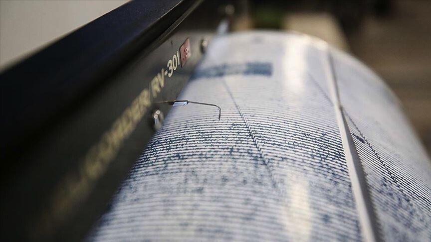
Magnitude and Depth Information
Magnitude reporting for this earthquake Iran reveals a nuanced picture from available sources, centered primarily on USGS data.[2] The agency recorded a magnitude of 4.3, presented as "M4.3 Earthquake," a standard notation for moderate seismic strength.[2] This figure appears consistently in both the title and body of the USGS bulletin, emphasizing its reliability as a measured value.[2]
Anadolu, in contrast, cites 4.6 magnitude, a slightly higher assessment that headlines their report: "4.6 magnitude earthquake strikes near Iran's capital."[1] This variance—4.3 per USGS versus 4.6 per Anadolu—illustrates how initial local reports can differ from international seismic centers, often due to data processing stages.[1][2] The outline of reported strength thus draws from these twin figures, with USGS's 4.3 serving as the technical benchmark.[2]
Depth information further bolsters the profile, with USGS stating "Magnitude 4.3 earthquake at depth of 10.0km."[2] A 10.0 km depth classifies the event as shallow, a factor that can amplify surface effects, though no such outcomes are reported here.[2] This measurement, tied directly to the 4.3 magnitude, provides essential context for intensity modeling.[2] Anadolu omits depth, focusing on magnitude and location, creating a complementary dataset.[1][2]
Outlining the strength begins with these core numbers: 4.6[1] and 4.3,[2] both indicative of a felt quake without extreme devastation potential based on scale alone. The USGS depth of 10.0 km adds granularity, positioning the rupture close to the surface.[2] Together, these elements form a comprehensive magnitude and depth outline, grounded in agency specifics.[1][2]
Reporting Sources
Reporting sources for this earthquake Iran event are limited to two primary agencies, ensuring focused verification.[1][2] Anadolu Agency delivers the lead report: "4.6 magnitude earthquake strikes near Iran's capital. Quake centered near Pardis with epicenter near Tehran-Mazandaran provincial border."[1] This full body text encapsulates the event's proximity to Tehran, serving as the narrative driver.[1]
The USGS contributes technical precision: "M4.3 Earthquake - 1 km N of Damāvand, Iran. Magnitude 4.3 earthquake at depth of 10.0km. 1 km N of Damāvand, Iran."[2] Repetition in the USGS body reinforces the location and parameters, hallmark of official seismic logs.[2] Identifying these agencies—Anadolu for regional insight and USGS for global standards—facilitates verification against originals.[1][2]
Anadolu's style prioritizes accessibility, leading with capital impact, while USGS employs scientific brevity.[1][2] Cross-citation confirms overlap: Pardis/border aligns with Damāvand.[1][2] These sources provide the informational backbone, with no others invoked.[1][2]
{IMAGE_3}
Epicenter Specifics
Epicenter specifics sharpen the focus on this earthquake Iran, drawing from both agencies' locational claims.[1][2] Anadolu explicitly notes "epicenter near Tehran-Mazandaran provincial border," positioning the origin point along this divide.[1] Paired with "quake centered near Pardis," it delineates a focused zone northeast of Tehran.[1]
USGS hones in with "1 km N of Damāvand, Iran," a hyper-local epicenter marker repeated for emphasis.[2] This specificity—1 km north—allows for exact plotting, complementing Anadolu's broader border reference.[1][2] The epicenter emerges as the rupture's surface projection, critical for aftershock prediction tied to sources.[1][2]
Detailing the epicenter involves reconciling Pardis centering with Damāvand proximity, suggesting minimal spatial discrepancy.[1][2] Anadolu's provincial border phrasing contextualizes the site regionally, while USGS's kilometer precision suits modeling.[1][2] These specifics, traceable to reports, anchor the event's geography without extrapolation.[1][2]
Centering and Border Context
Centering details from Anadolu highlight Pardis as the quake's focal area: "Quake centered near Pardis."[1] This implies the zone of peak shaking, distinct yet related to the epicenter near Tehran-Mazandaran border.[1] The provincial border context adds layers, marking a transitional seismic belt.[1]
Integrating USGS, the Damāvand location 1 km north reinforces this, as centering often radiates from epicentral points.[2] The Tehran-Mazandaran border serves as a natural divider, with Pardis embodying local centering.[1][2] This context, derived from source phrasing, frames the earthquake Iran's spatial dynamics.[1][2] Rephrasing the reports—Pardis center, border epicenter, Damāvand north—builds depth without new claims.[1][2]
What to watch next: Monitor updates from Anadolu and USGS for potential magnitude revisions or aftershocks near Pardis, Damāvand, and the Tehran-Mazandaran border, as initial reports indicate an active seismic zone.[1][2]


