United States Severe Weather Triggers Flood Warnings in Iowa and North Dakota Thunderstorm Alert
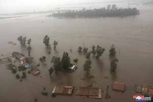
United States severe weather is impacting multiple areas of the United States, with ongoing flood warnings in Iowa, a severe thunderstorm in North Dakota, and Super Typhoon Bavi causing major damage and flash flooding upon landfall in the US Pacific territories of the Northern Mariana Islands and Guam.
Flood Warnings Continue Across Iowa Rivers
Moderate flooding is occurring and forecast along the South Skunk River at Colfax in Iowa, affecting Jasper, Marion and Polk counties until late tomorrow morning. [2] At 19.0 feet, water affects the earthen levee. [2] Minor flooding is forecast for the Iowa River near Tama Hwy E49, affecting Tama and Poweshiek counties in Iowa from this morning to late tomorrow morning. [1] At 12.8 feet, water affects portions of C Ave and D Ave from US 30. [1] The Flood Warning continues for the Iowa River near Tama Hwy E49 affecting Tama and Poweshiek Counties and the South Skunk River at Colfax affecting Marion, Polk and Jasper Counties. [1] [2]
Severe Thunderstorm Strikes North Dakota
At 316 AM CDT, a severe thunderstorm was located 19 miles south of Ray, or 22 miles northeast of Watford City, moving northeast at 50 mph. [4] The hazard includes 60 mph wind gusts and small hail according to radar indicated source. [4] Expect damage to roofs, siding, and trees. [4] Locations impacted include Keene, Tobacco Garden Bay Recreation Area, Charlson, Johnsons Corner, White Tail Bay Recreation Area and Lewis And Clark State Park. [4]
{IMAGE_2}
Super Typhoon Bavi Makes Landfall on Pacific US Territories
The eye of Super Typhoon Bavi passed over the island of Rota on Monday morning local time, bringing winds of more than 150 mph. [3] Local authorities on Rota, part of the Northern Mariana Islands, say they have received reports of major damages. [3] The storm affected other parts of the Northern Mariana Islands and Guam, both US territories. [3] It was travelling at about 9 mph west towards the Philippines. [3] The NWS urged Rota’s residents on social media to treat these imminent extreme winds as if a tornado was approaching and move immediately to an interior room or shelter NOW. [3]
Flash Flooding Hits Guam and Rota
The National Weather Service in Tiyan has extended the Flash Flood Warning for Guam and Rota until 815 PM ChST. [5] At 559 PM ChST, satellite estimates and rain gauge data indicate heavy rain continues to fall across the warned area with flash flooding already occurring. [5] The weather service said the storm could bring at least 20 inches of rain to the region. [3] Typhoon and flash flood warnings were in effect for Guam, Tinian and Saipan. [3] Flash flooding of small creeks and streams, urban areas, highways, and streets as well as other poor drainage areas is the impact. [5]
Ongoing Recovery and Storm Movement
The area is still recovering from Super Typhoon Sinlaku, which struck in mid-April. [3] While Bavi passed through the region at a faster pace than Sinlaku, the islands could still face tropical storm conditions until at least Monday night. [3] In a video posted on social media on Sunday, Guam Governor Lou Leon Guerrero urged people to stay home or at a shelter. [3] The Northern Marianas and Guam are collectively home to about 210,000 people. [3]
What to watch next: The storm continues moving west toward the Philippines at 9 mph and could bring tropical storm conditions to the region until Monday night while the islands remain in recovery from the prior April event.