Series of Minor Earthquakes Strike Cañete Region Near Lima, Peru, in Early 2026
Latest from X
Series of Minor Earthquakes Strike Cañete Region Near Lima, Peru, in Early 2026
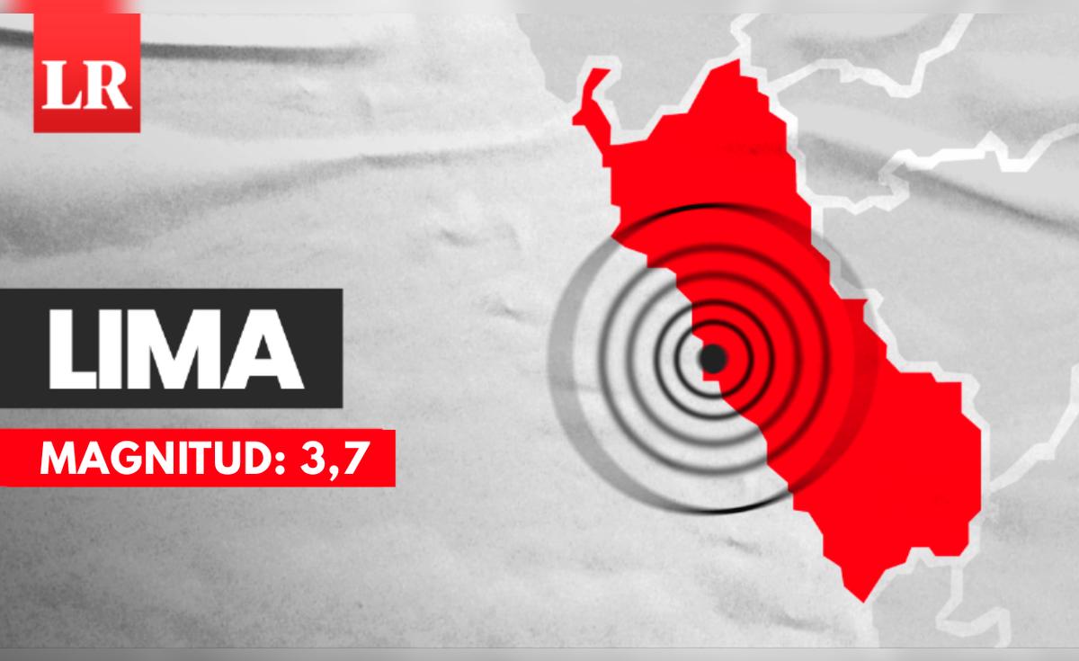
Lima, Peru – A magnitude 3.7 earthquake rattled the Cañete district south of Lima on January 5, 2026, marking the latest in a series of minor tremors in the seismically active region, according to reports from the Instituto Geofísico del Perú (IGP). No immediate reports of damage or injuries have emerged from the event, which was felt as light to moderate shaking in nearby areas.
The quake, which struck at 8:34 a.m. local time, was centered 13 kilometers southwest of Chilca in the Cañete province, at a depth of 51 kilometers. The IGP classified the intensity as III on the Mercalli scale in Chilca, indicating weak shaking where hanging objects swing and some people feel the tremor, but with no expected structural damage. Posts from the official IGP account on X detailed the event under report IGP/CENSIS/RS 2026-0013, highlighting its precise location at latitude -12.58 and longitude -76.84.
This tremor follows closely on the heels of another event just days earlier. On January 1, 2026, a slightly stronger magnitude 4.2 earthquake occurred at 11:28 a.m. local time, approximately 27 kilometers west of Chilca, with a depth of 68 kilometers and intensity III in the area (IGP/CENSIS/RS 2026-0002). Again, posts on X from IGP provided the coordinates (latitude -12.57, longitude -76.98), underscoring the proximity to populated coastal zones near Lima.
Reports also indicate a tremor in Peru on January 2, 2026, around 1:36 p.m. local time (18:36 UTC), classified as medium severity, though specific details on magnitude, depth, and epicenter remain under verification by authorities. The clustering of these events has heightened awareness among residents in the Cañete-Lima corridor, an area prone to frequent seismic activity.
Local media, including La Republica, reported on the January 5 quake under the headline "Temblor en Lima: sismo de magnitud 3.7 remeció Cañete según IGP," emphasizing its detectability in the capital but lack of significant impact. The article, published on January 5, aligns with IGP's real-time alerts, which are disseminated via social media to ensure public safety.
Seismic Context in Peru's Central Coast
Peru lies along the Pacific Ring of Fire, where the Nazca tectonic plate subducts beneath the South American plate at a rate of about 6-7 centimeters per year, generating thousands of earthquakes annually. The IGP records over 1,500 perceptible tremors each year nationwide, with the central coast, including Cañete and Chilca, experiencing recurrent low-magnitude events due to intermediate-depth quakes in the subduction zone.
Historical data from IGP shows similar activity in the region. For instance, posts on X from the institute reference past events such as a magnitude 3.6 quake on January 19, 2024 (37 km southwest of Chilca, depth 44 km, intensity II-III), and a magnitude 3.7 on November 6, 2024 (4 km north of Chilca, depth 58 km, intensity III). These patterns illustrate the area's ongoing tectonic stress, though magnitudes below 5.0 rarely cause damage in this depth range.
Experts note that such shallow-to-intermediate quakes (typically 30-70 km deep) are common precursors to larger events but do not necessarily predict them. The IGP's Center for Sismology (CENSIS) continuously monitors via a network of over 120 stations, issuing rapid reports to mitigate panic. Peru's National Civil Defense Institute (INDECI) advises residents to identify safe spots indoors, secure heavy furniture, and prepare emergency kits amid frequent activity.
No Damage Reported, Monitoring Continues
As of January 5, 2026, neither the IGP nor local authorities have reported casualties, structural damage, or disruptions from these recent quakes. The events' low intensities align with expectations for non-destructive shaking. Social media sentiment on X reflects mild concern among Lima residents, with many sharing personal accounts of feeling the ground move briefly during morning routines.
IGP officials have reiterated standard preparedness measures, including the "drop, cover, and hold on" protocol. The institute's real-time portal and social channels remain active for updates. While the cluster raises no immediate alarm, seismologists emphasize Peru's vulnerability—home to the 2007 Pisco earthquake (magnitude 8.0, over 500 deaths)—urging sustained vigilance.
In outlook, experts anticipate continued minor activity in the subduction zone through 2026, with IGP poised for enhanced forecasting via upgraded instrumentation funded by recent government initiatives. Residents in Cañete and surrounding areas are encouraged to stay informed via official channels as monitoring persists.
(Word count: 612)
Track this story live
Live World Map
Monitor global events in real time with a live activity map and hotspot summaries.
Earthquakes Today
Track recent quakes, magnitudes, and the most active seismic regions.
Earthquakes Near Me
Find earthquakes near your location with live seismic proximity tracking.
Tsunami Warnings
Check current tsunami warnings, alerts, and coastal threats from seismic activity worldwide.
Original Sources
- •Temblor en Lima : sismo de magnitud 3 , 7 remeció Cañete según IGP— La Republica (via GDELT)
Editorial process: This article was synthesized from the original sources cited above using The World Now's AI editorial system, with byline accountability from our editorial team. We grade every story for source grounding, factual coherence, and on-topic match before publication. Read more about our editorial standards and contributors. Spot something inaccurate? Let us know.
Last updated: March 7, 2026


