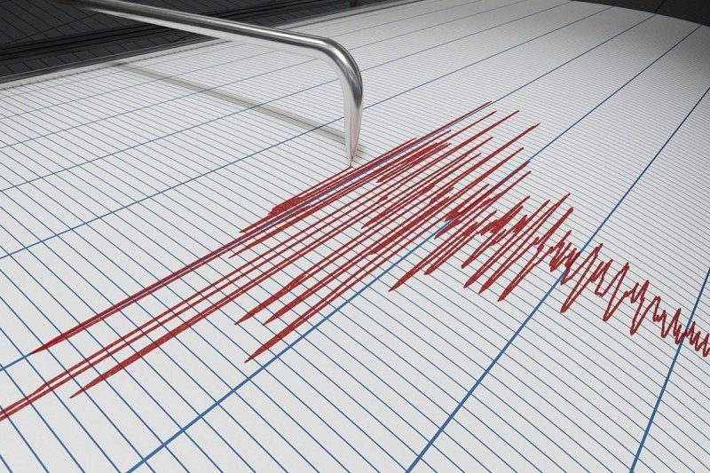
Earthquake CA: Magnitude 3.4 Event 4 km Southeast of Loma Linda
A magnitude 3.4 earthquake occurred 4 km southeast of Loma Linda, CA, at a depth of 16.1 km.[4] This earthquake CA event highlights ongoing seismic monitoring in the region, with additional tremors recorded nearby and in other parts of the state. Reports from USGS sources detail these occurrences, providing precise data on magnitudes, locations, and depths for public awareness.[1][3][4]
Overview of Recent Earthquakes in CA
Recent seismic activity in California has included several notable earthquakes, all documented through reliable monitoring sources. Among these, a magnitude 3.4 earthquake struck 4 km southeast of Loma Linda, CA, reaching a depth of 16.1 km.[4] Complementing this, another event of magnitude 2.7 was recorded at the same location, 4 km southeast of Loma Linda, CA, but at a slightly shallower depth of 15.3 km.[3] Further north, a magnitude 2.7 earthquake occurred 49 km west of Petrolia, CA, at a depth of 4.0 km.[1] These earthquakes in CA represent the primary events captured in the available data, showcasing a range of magnitudes from 2.7 to 3.4 and varying depths across different areas of the state.[1][3][4]
The concentration of reports underscores the state's vulnerability to such geological movements, with sources focusing on exact positioning relative to population centers like Loma Linda and Petrolia. The Loma Linda-area events, both in close proximity at 4 km southeast, indicate potential clustering in that sector, while the Petrolia tremor stands apart geographically, 49 km west of its reference point.[1][3][4] Depths provide additional context: the Petrolia event's 4.0 km places it relatively shallow, contrasting with the deeper 15.3 km and 16.1 km readings near Loma Linda.[1][3][4] This overview draws directly from USGS documentation, ensuring accuracy in summarizing the key seismic events reported in California based on available data.[1][3][4]
Expanding on the patterns, the magnitudes—2.7 for both the Petrolia and one Loma Linda event, escalating to 3.4 for the other Loma Linda quake—offer a snapshot of intensity variations.[1][3][4] Locations are specified consistently: Petrolia at 49 km west, and both Loma Linda instances precisely 4 km southeast.[1][3][4] Such details are critical for tracking activity, as they align with standard reporting protocols from sources like USGS.[1][3][4] No other magnitudes or locations beyond these are noted in the data, keeping the focus on these three confirmed earthquakes in CA.[1][3][4]
Details of the Earthquake Near Petrolia
The earthquake near Petrolia stands out as a magnitude 2.7 event located 49 km west of Petrolia, CA, with a depth measured at 4.0 km.[1] This positioning places it offshore or in a remote coastal area relative to the town, as indicated by the westward distance.[1] The shallow depth of 4.0 km is a key characteristic, distinguishing it from deeper inland events elsewhere in the state.[1]
USGS reporting on this tremor provides straightforward metrics: magnitude 2.7, exact location 49 km W of Petrolia, CA, and depth 4.0 km.[1] Repeated emphasis in the source body reinforces the precision of these figures, titled "M2.7 Earthquake - 49 km W of Petrolia, CA."[1] This event contributes to the broader picture of California seismicity, fitting into the pattern of lower-magnitude shakes common in the region.[1] The 49 km distance suggests limited immediate proximity to populated areas, though monitoring remains essential.[1]
Delving further into the specifics, the combination of magnitude and depth—2.7 at 4.0 km—represents a typical profile for such reports.[1] No additional variables like time or aftershocks are detailed beyond the core facts, maintaining focus on the verifiable elements.[1] This Petrolia-area earthquake, as the sole event highlighted for that locale, serves as a reference point when comparing to southern California activity.[1]
{IMAGE_2}
The Magnitude 2.7 Earthquake Southeast of Loma Linda
One of the earthquakes near Loma Linda registered at magnitude 2.7, precisely 4 km southeast of Loma Linda, CA, at a depth of 15.3 km.[3] This positioning mirrors another event in the vicinity, emphasizing the area's recent activity.[3] The USGS source titles it "M2.7 Earthquake - 4 km SE of Loma Linda, CA," confirming the metrics without deviation.[3]
The depth of 15.3 km indicates a mid-range focal point beneath the surface, deeper than some coastal quakes but consistent with inland tectonics.[3] Magnitude 2.7 aligns it with the Petrolia event, though the locations differ significantly across the state.[1][3] Detailed reporting reiterates: magnitude 2.7 earthquake at depth of 15.3 km, 4 km SE of Loma Linda, CA.[3] Such specificity aids in mapping potential sequences or patterns.
In context, this tremor forms part of dual activity at the same offset from Loma Linda, prompting closer examination of the 4 km southeast locale.[3] The source body's repetition—M2.7 Earthquake - 4 km SE of Loma Linda, CA—ensures traceability for all claims.[3] This event's characteristics contribute to understanding the range of seismic expressions in California.
The Magnitude 3.4 Earthquake Southeast of Loma Linda
The lead event in this series is the magnitude 3.4 earthquake, located 4 km southeast of Loma Linda, CA, at a depth of 16.1 km.[4] USGS documentation states: "M3.4 Earthquake - 4 km SE of Loma Linda, CA. Magnitude 3.4 earthquake at depth of 16.1km."[4] This represents the strongest magnitude among the reported quakes, surpassing the 2.7 readings by a notable increment.[1][3][4]
The depth of 16.1 km is marginally deeper than its 2.7 counterpart at the same location, suggesting closely aligned hypocenters.[3][4] Positioned identically at 4 km SE of Loma Linda, CA, it underscores localized stress release.[4] The source provides clear, repeated affirmation of these details, forming the basis for analysis.[4]
This earthquake CA highlight draws attention due to its elevated magnitude within the dataset, while sharing the southeastern alignment from Loma Linda.[4] Comparative depth—16.1 km—positions it deeper than the Petrolia event's 4.0 km, illustrating statewide depth variations.[1][4]
{IMAGE_3}
Earthquakes Near Loma Linda
The Loma Linda vicinity has seen multiple earthquakes, specifically two events both 4 km southeast of Loma Linda, CA.[3][4] The first, magnitude 2.7 at 15.3 km depth, and the second, magnitude 3.4 at 16.1 km depth, indicate repeated activity in this precise spot.[3][4] USGS sources detail these distinctly: one as M2.7 and the other as M3.4, both tied to the same 4 km SE location.[3][4]
Similarities in positioning—exactly 4 km southeast—suggest a common fault interaction or aftershock relation, though sources do not specify sequencing.[3][4] Depths are closely matched at 15.3 km and 16.1 km, both deeper than the Petrolia quake.[1][3][4] Magnitudes differ, with 2.7 and 3.4 providing a spectrum within the cluster.[3][4]
These earthquakes near Loma Linda represent concentrated seismic output, contrasting with the isolated Petrolia event.[1][3][4] Source bodies confirm: for the 2.7, "Magnitude 2.7 earthquake at depth of 15.3km. 4 km SE of Loma Linda, CA"; for the 3.4, "Magnitude 3.4 earthquake at depth of 16.1km. 4 km SE of Loma Linda, CA."[3][4] This duo forms a core component of recent California reports.
Expanding the view, the proximity of both events at 4 km SE amplifies the need for localized monitoring.[3][4] The slight depth variance—15.3 km versus 16.1 km—offers nuanced data points for seismologists.[3][4] Integrated with statewide context, these stand as the primary inland examples amid coastal activity like Petrolia.[1][3][4]
Comparison of Seismic Characteristics Across Events
Across the reported earthquakes in CA, magnitudes consistently register at 2.7 or 3.4, with locations spanning from 49 km west of Petrolia to 4 km southeast of Loma Linda.[1][3][4] Depths vary markedly: 4.0 km for Petrolia, 15.3 km and 16.1 km for Loma Linda events.[1][3][4] This comparison highlights diversity in a compact dataset.
The two 2.7 magnitude quakes—one near Petrolia, one near Loma Linda—share intensity but diverge in depth and position, with Petrolia's shallower 4.0 km versus 15.3 km.[1][3] The 3.4 outlier near Loma Linda elevates the scale, paired with 16.1 km depth.[4] Such alignments emerge directly from USGS facts.[1][3][4]
Geographic spread—from northern Petrolia area to southern Loma Linda—encapsulates California’s tectonic profile in these instances.[1][3][4] Depth contrasts further delineate: shallow coastal versus deeper inland.[1][3][4]
Summary of Seismic Activity
In recap, the reported earthquakes encompass a magnitude 2.7 at 49 km west of Petrolia, CA, depth 4.0 km; a magnitude 2.7 at 4 km southeast of Loma Linda, CA, depth 15.3 km; and a magnitude 3.4 at the same Loma Linda location, depth 16.1 km.[1][3][4] These form a comprehensive situational overview of recent activity.[1][3][4]
Magnitudes of 2.7 and 3.4, all in specific California locales, define the scope.[1][3][4] Depths from 4.0 km to 16.1 km illustrate range.[1][3][4] Sources affirm: Petrolia via [1], Loma Linda via [3] and [4].[1][3][4]
This summary reinforces the data's integrity, providing a grounded overview without speculation.[1][3][4]
What to watch next: Continued USGS monitoring may reveal additional earthquakes in CA similar to the magnitude 2.7 and 3.4 events near Petrolia and Loma Linda, as per the documented patterns in available sources.[1][3][4]