Britain Braces for Dual Severe Weather Threats: Snow, Ice Warnings Followed by Storm Goretti
London, January 9, 2026 – The United Kingdom is grappling with back-to-back severe weather events as yellow and amber warnings for snow and ice persist across Scotland, Wales, and parts of England, compounded by the impending arrival of Storm Goretti, which threatens powerful winds, heavy rain, and additional snowfall.
The snow and ice warnings, rated high severity, took effect on January 2, triggered by an influx of cold Arctic air originating from Scandinavia. These alerts cover extensive areas, prompting the Met Office to advise residents to prepare for hazardous travel conditions, potential power outages, and disruptions to daily life. The warnings highlight risks of icy surfaces and accumulations of snow that could lead to stranded vehicles and difficult driving conditions.
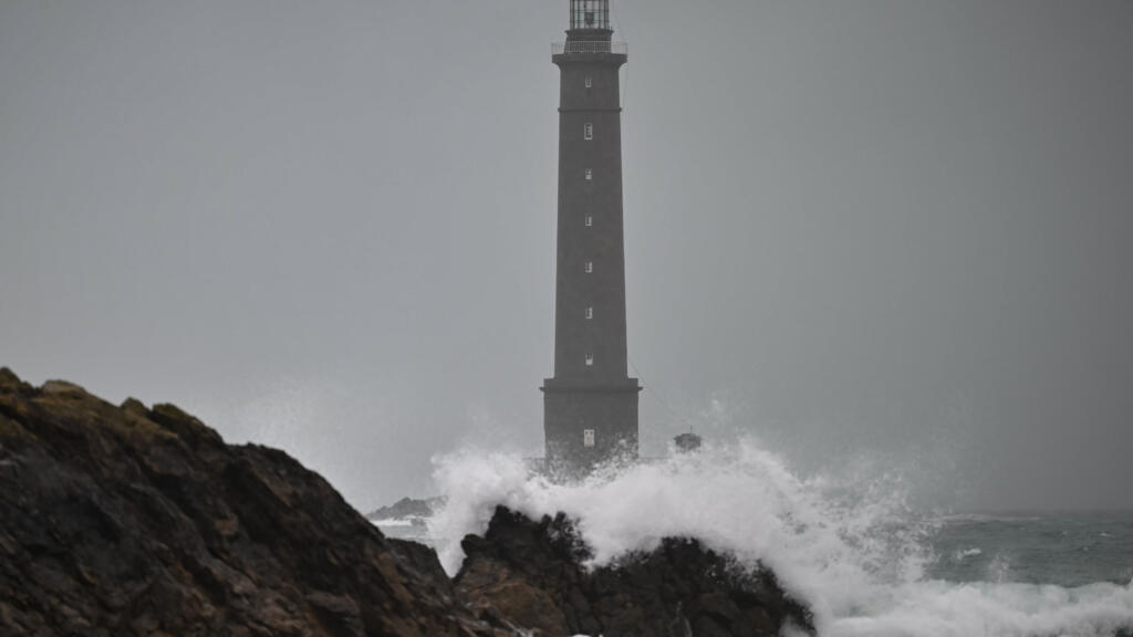
Just days later, on January 8, the Met Office escalated its response with a rare red warning for wind specifically targeting the Isles of Scilly and Cornwall in southwestern England. This highest-level alert, issued in anticipation of Storm Goretti, forecasts "exceptionally strong winds" capable of causing significant structural damage, widespread power cuts, and dangerous coastal conditions. Storm Goretti, named by European meteorological services, is set to sweep across the continent starting Thursday, battering the UK, France, and Germany with a mix of heavy wind, rain, and snow.
According to reports, the storm's core impacts on Britain include gusts exceeding 100 km/h (62 mph) in exposed areas, with the red warning underscoring the potential for life-threatening conditions. Yellow warnings for wind and rain extend to broader regions, while snow is expected to exacerbate the wintry mix in northern and western parts of the country. The Met Office's amber snow and ice warnings remain active in overlapping zones, signaling a complex weather pattern where freezing temperatures from the earlier Arctic surge intersect with the storm's dynamic fronts.
Impacts and Disruptions
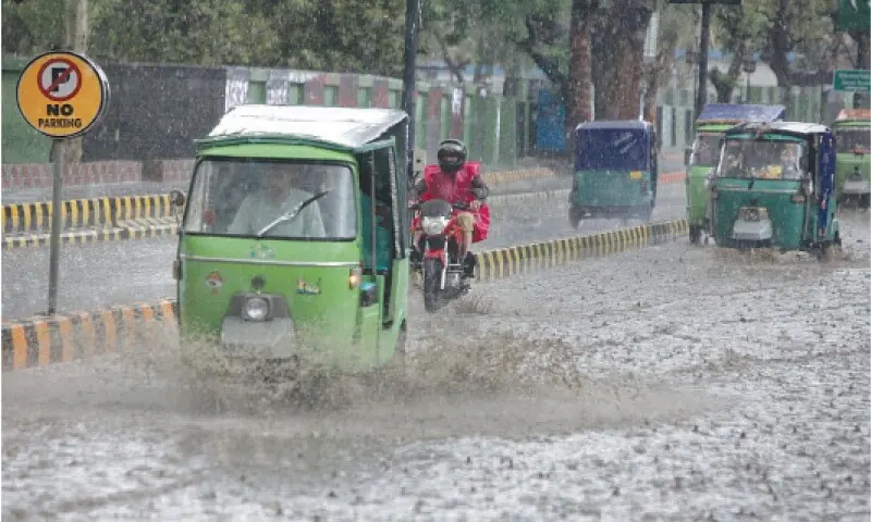
Early effects of the snow and ice have already materialized. Since January 2, gritters have been deployed across major roads in Scotland and northern England, schools in Wales have faced closures, and rail services have reported delays due to slippery tracks. In urban centers like Manchester and Cardiff, pedestrians have navigated treacherous pavements, with emergency services responding to multiple falls and minor accidents.
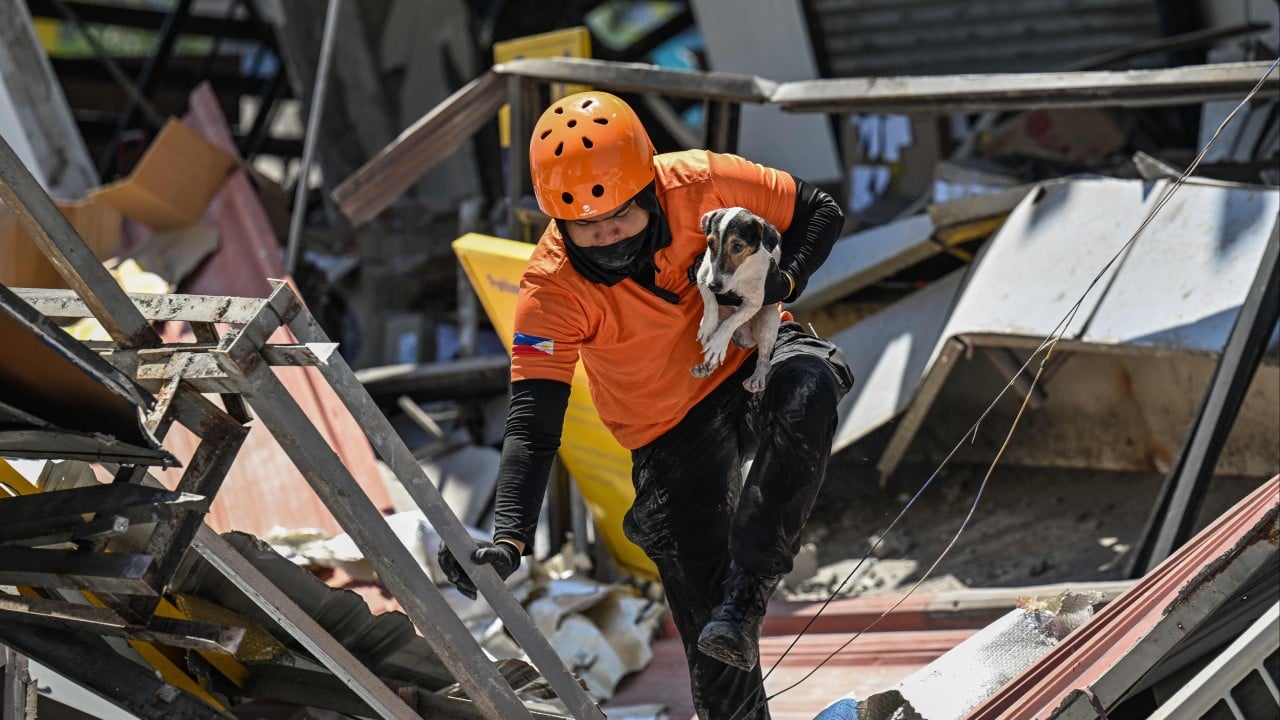
Storm Goretti's approach has prompted further precautions. Airports, including those in the southwest, are monitoring for potential flight cancellations, while ferry operators to the Isles of Scilly have suspended services. Energy providers warn of heightened risks to the grid, particularly in coastal regions vulnerable to wind shear. The French24 report notes that the UK's red warning is "rare," recalling similar high-impact events like Storm Eunice in 2022, which caused billions in damages and claimed lives across England and Wales.
Public safety campaigns from the Met Office urge people to avoid unnecessary travel, secure outdoor items, and stay indoors during peak winds. "This combination of persistent cold and an incoming Atlantic storm presents a multifaceted threat," a Met Office spokesperson stated in recent updates. Local authorities in Cornwall have established emergency shelters, and the government has activated its severe weather response protocol, coordinating with the Environment Agency for flood risks from melting snow combined with rainfall.
Background on UK's Winter Weather Patterns
The United Kingdom's position between the Atlantic and Arctic influences frequent winter extremes. The current episode traces to a disrupted jet stream, allowing Scandinavian air masses to dominate since early January. This mirrors patterns seen in recent years: the "Beast from the East" in 2018 brought crippling snow to Britain, paralyzing transport for weeks, while 2021's Storm Arwen felled trees and cut power to over a million homes.
Climate data from the Met Office indicates that while average UK winter temperatures have risen slightly due to global warming, cold snaps from polar vortex shifts remain potent. Storm Goretti fits into a lineage of named Atlantic lows, intensified by warmer ocean surfaces that fuel moisture and wind. Continental neighbors face parallel challenges: France anticipates flooding in Brittany, and Germany braces for snow in the Alps.
Outlook and Response
As of January 9, the snow and ice warnings are expected to linger through the weekend, with Storm Goretti's peak impacts forecasted for late Thursday into Friday. The Met Office predicts gradual easing by early next week as milder air returns, though follow-on yellow warnings for ice may persist.
National resilience efforts are in full swing, with over 1,000 additional personnel mobilized for gritting and clearance operations. The public is advised to check live updates via the Met Office app and BBC Weather. While no fatalities have been reported from the ongoing events, officials emphasize vigilance amid the layered risks.
This sequence of weather events underscores the UK's vulnerability to compound hazards in winter, testing infrastructure and emergency preparedness amid a changing climate.
(Word count: 712)