Magnitude 4.4 Earthquake Rattles Puerto Vallarta, Mexico, Prompting Seismic Alerts
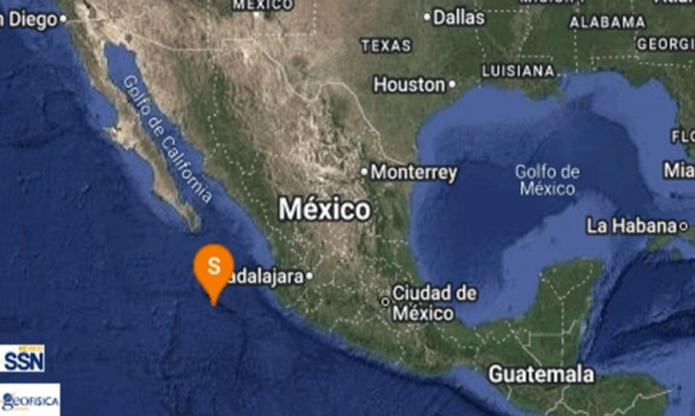
Puerto Vallarta, Jalisco – A magnitude 4.4 earthquake struck near Puerto Vallarta in the Mexican state of Jalisco on January 9, 2026, at approximately 18:09 UTC (12:09 PM local time), shaking the popular Pacific coast resort city and surrounding areas. The event, detected by national seismic monitoring networks, was classified as moderate but significant enough to trigger public alerts, though no immediate reports of damage or casualties have emerged.
The quake's epicenter was located in the vicinity of Puerto Vallarta, a bustling tourist hub known for its beaches, vibrant nightlife, and proximity to the Sierra Madre Occidental mountains. According to reports from local media, the tremor was felt widely across Jalisco, with residents describing a brief but noticeable jolt. Mexico's National Seismological Service (SSN), part of the National Autonomous University of Mexico (UNAM), confirmed the event shortly after it occurred, registering it at a depth typical for regional tectonics, though exact depth figures were not immediately detailed in initial dispatches.
In the immediate aftermath, social media and local news outlets buzzed with accounts from locals and visitors. Many reported hanging lights swaying and mild ground rumbling, but authorities quickly issued reassurances via the SASMEX early warning system, which provides seconds-to-minutes advance notice in high-risk zones. Puerto Vallarta's civil protection units activated standard protocols, including public advisories to "stay calm and seek shelter under sturdy furniture," but no evacuations were ordered.
Tectonic Context in a High-Seismic Zone
Mexico lies along the Pacific Ring of Fire, one of the world's most seismically active regions, where the Cocos Plate subducts beneath the North American Plate at rates of up to 7-10 cm per year. This subduction zone generates frequent earthquakes, particularly along the western coast from Guerrero to Jalisco. Puerto Vallarta sits near the Middle America Trench, making it prone to both shallow crustal quakes and deeper megathrust events.
Historically, Jalisco has experienced devastating quakes, including the 1932 Manzanillo earthquake (magnitude 6.9) and more recently, the 2022 magnitude 7.6 tremor in Michoacán that killed at least nine people and damaged infrastructure across western Mexico. The 1985 Mexico City earthquake (magnitude 8.0), though centered farther south, underscored the country's vulnerability, claiming over 10,000 lives due to amplified shaking in soft sedimentary basins. In contrast, the January 9 event's moderate magnitude—on the Richter scale, where anything above 4.0 can be felt but rarely causes serious harm—aligns with thousands of annual tremors monitored by SSN, which detects over 10,000 quakes yearly, most imperceptible.
Post-2020, Mexico has bolstered its seismic resilience through expanded sensor networks and public education campaigns. The SASMEX system, operational since 1991 and upgraded in recent years, now covers 90% of the population in key areas, providing critical lead time. Following the 2017 Puebla quake (magnitude 7.1, over 370 deaths), building codes were reinforced, emphasizing retrofitting in tourist-heavy zones like Puerto Vallarta.
Local Impact and Response
Puerto Vallarta, with a population exceeding 300,000 and millions of annual visitors, relies heavily on its tourism economy, including cruise ships and beach resorts. The quake occurred during peak season, but preliminary assessments indicated no disruptions to airports, ports, or major hotels. Jalisco's state governor's office and municipal authorities reported routine monitoring, with teams dispatched to inspect bridges, schools, and high-rises. As of January 10, when the primary report surfaced, no structural failures or injuries were confirmed.
This event adds to a string of recent activity in the region. Just weeks prior, smaller tremors (magnitudes 3.5-4.0) rattled Colima and Nayarit, precursors often linked to stress accumulation along the plate boundary. Seismologists note that aftershocks could follow for days, typically diminishing in intensity.
Broader Implications for Mexico's Seismic Preparedness
The January 9 quake serves as a reminder of Mexico's ongoing seismic vigilance. The country invests heavily in monitoring, with SSN operating over 150 stations nationwide. International collaborations, including with the USGS and Japan's JMA, enhance real-time data sharing. Public drills, like the annual September 19 Nacional Simulacro, have ingrained "drop, cover, and hold on" habits.
While this event caused no apparent harm, it underscores the unpredictability of the Ring of Fire. Larger quakes remain a risk; experts estimate a 50-70% probability of a magnitude 7+ event in Guerrero within decades. For Puerto Vallarta, resilient infrastructure and swift response mitigated potential panic, allowing normalcy to resume swiftly.
As monitoring continues, updates from SSN will clarify aftershock risks. Mexico's track record in managing such events reflects lessons from past tragedies, prioritizing lives and livelihoods in one of the world's most dynamic geological arenas.
(Word count: 612)


